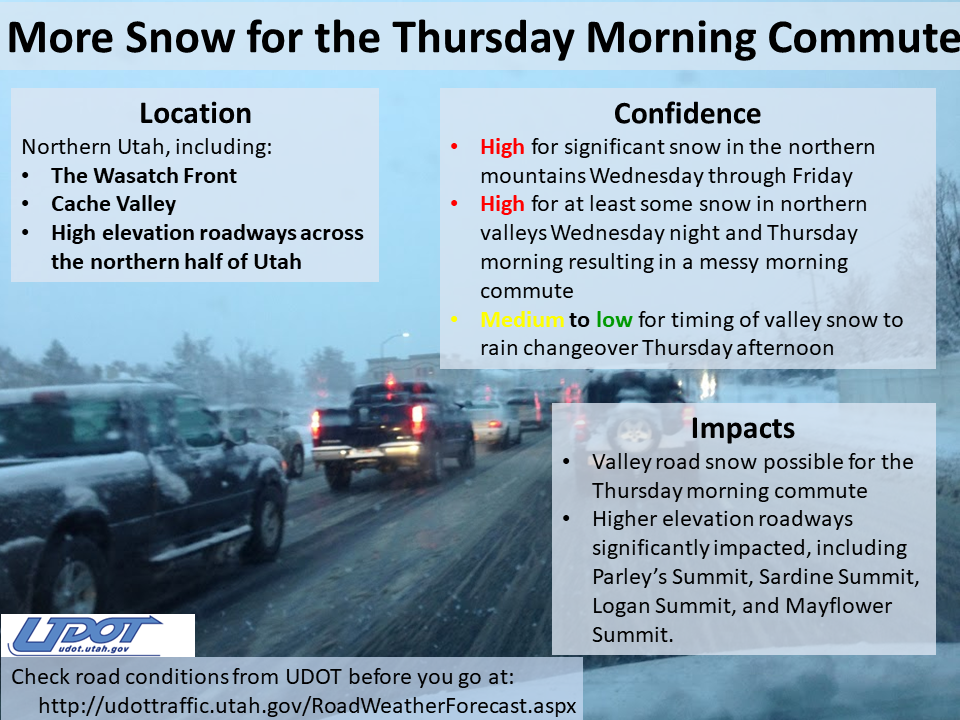
The NOAA has issued a winter weather advisory, beginning Wednesday night (02/05/20) lasting through late Friday afternoon (02/07/20) for the Wasatch Mountains. Alta Ski Area and surrounding ski resorts could see upwards of 20″ of new snow with wind gusts as high as 55 mph.
...WINTER WEATHER ADVISORY IN EFFECT FROM MIDNIGHT WEDNESDAY
NIGHT TO 4 PM MST FRIDAY...

* WHAT...Snow expected. Total snow accumulations of 10 to 20
  inches. Winds gusting as high as 55 mph.

* WHERE...Wasatch Mountains I-80 North, Wasatch Mountains South
  of I-80, Western Uinta Mountains and Wasatch Plateau/Book
  Cliffs.

* WHEN...From midnight Wednesday night to 4 PM MST Friday.

* IMPACTS...Travel could be very difficult. Strong gusty winds may
  cause areas of blowing snow.

- NOAA 02/04/20
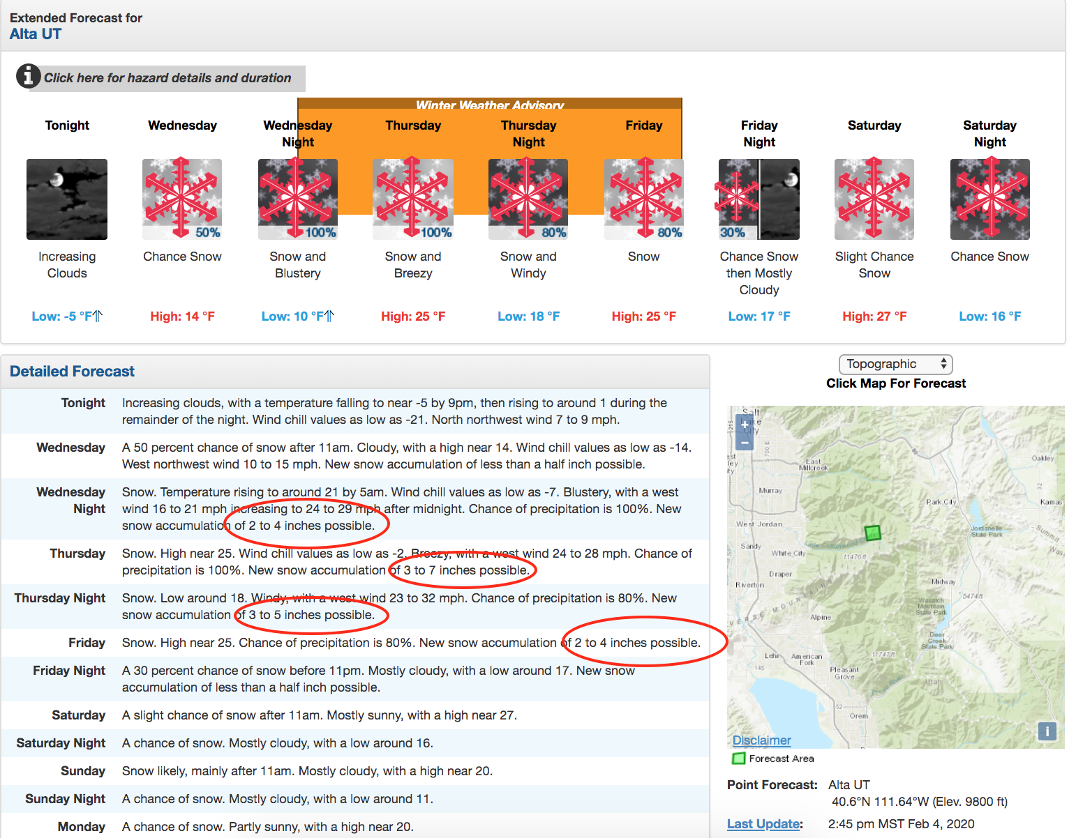
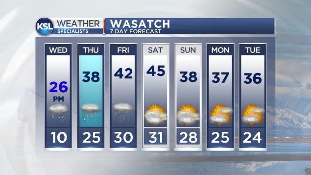
The Utah Avalanche Center reports that we will see a break in the action today and tonight before the next storm arrives tomorrow afternoon through Friday. This storm will be quite different from the last: it will bring a warm front with heavy, dense snow, warming temperatures, and moderate to strong northwest winds. Upwards of 2 FEET of snow is possible by later Friday.
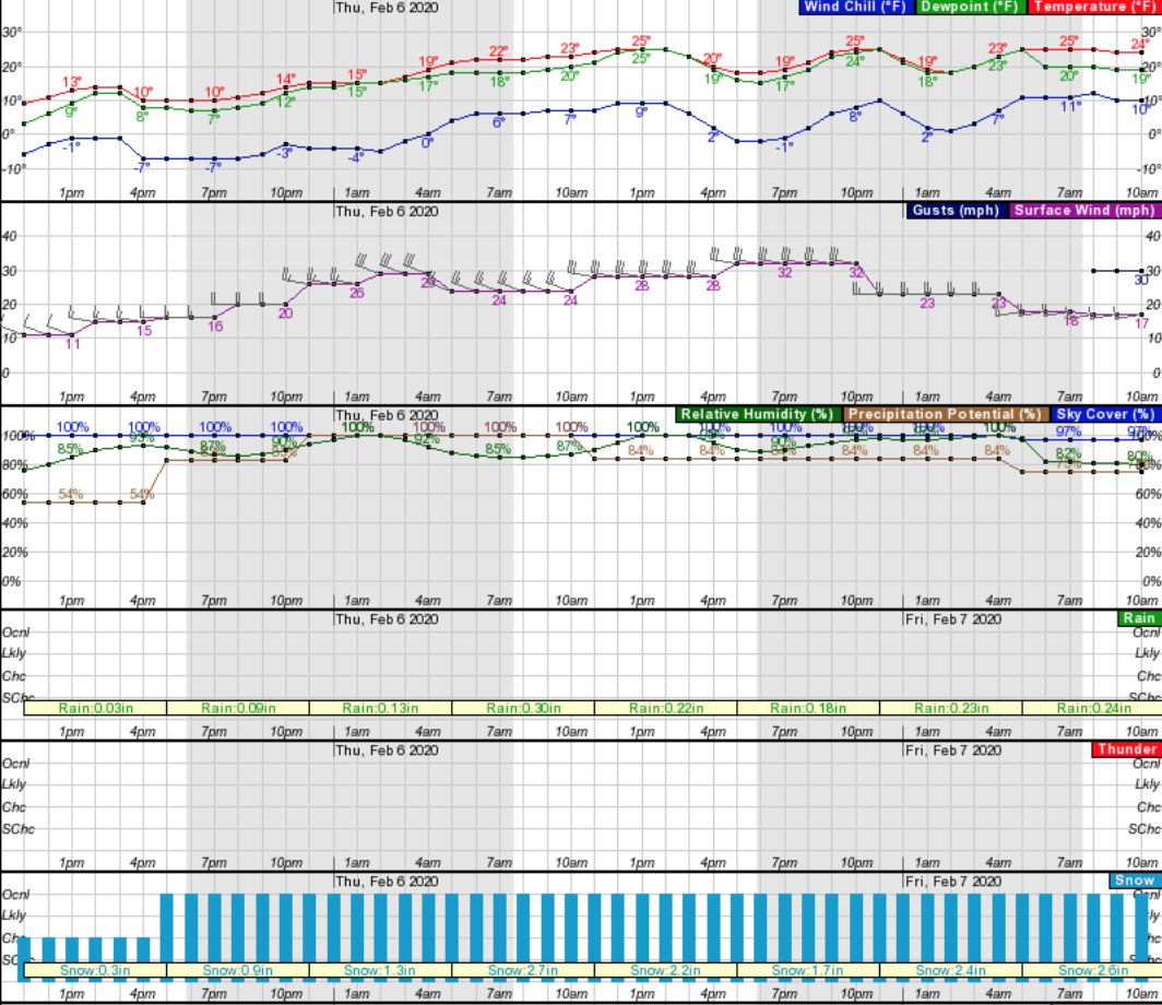
2′ of snow may fall by Friday, February 7. There will be a brief break in the weather before another winter storm system moves into the Wasatch on Saturday potentially lasting into early next week. It’s snowy start to February for Utah!
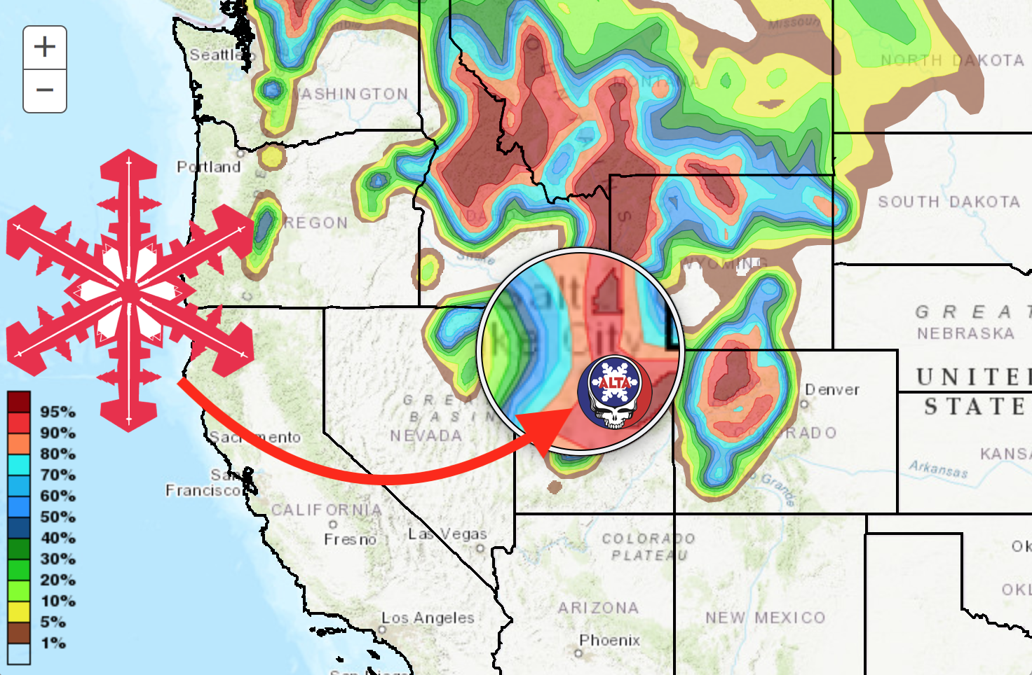
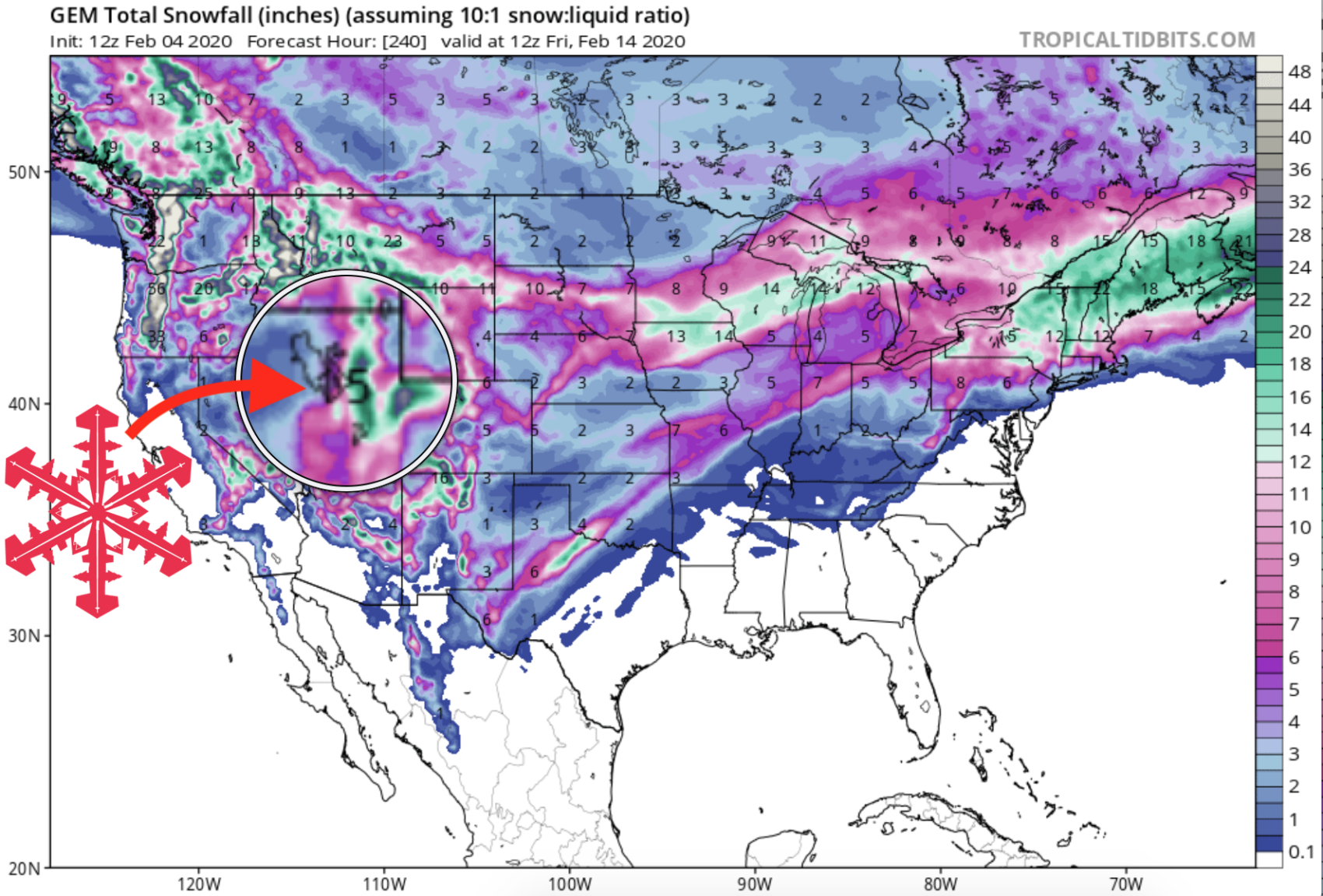
GEM Snowfall Forecast Model:
Other Info: