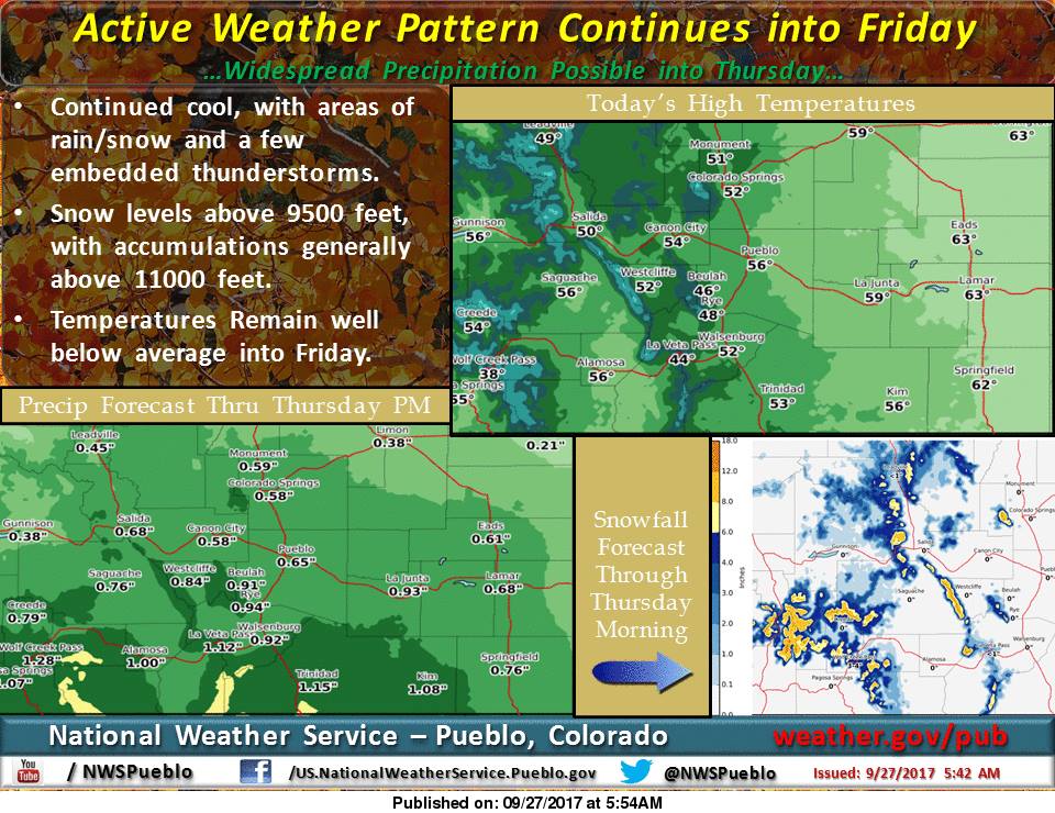
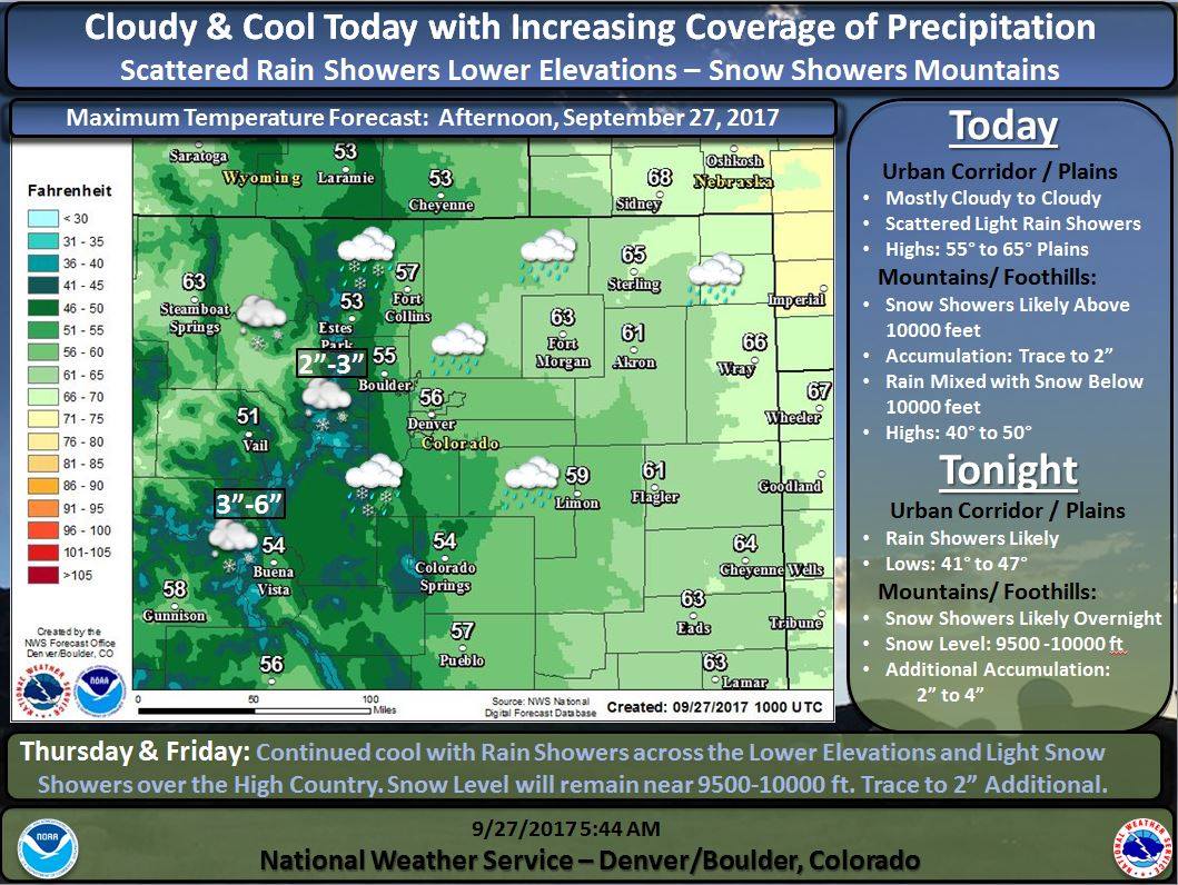
The National Weather Service has issued a Winter Weather Advisory for Colorado. A cold front is expected to move through and turn rain to snow, along with lowering snow levels as the storm progresses.
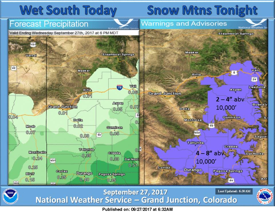
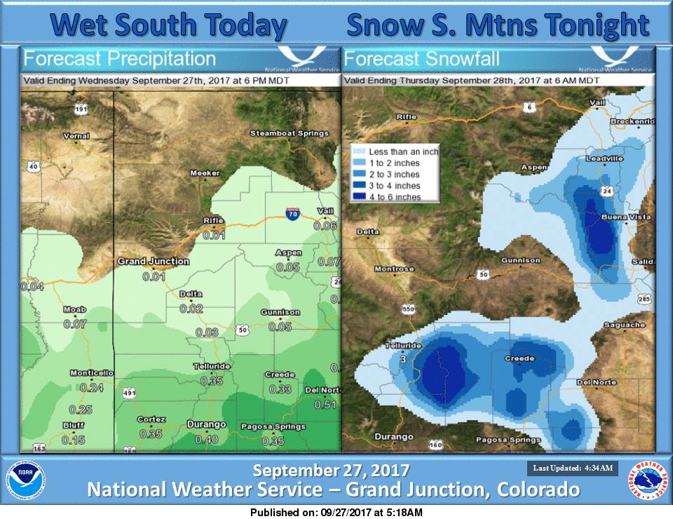
4-8+” of Snow Above 11,000ft Wednesday – Thursday Morning.
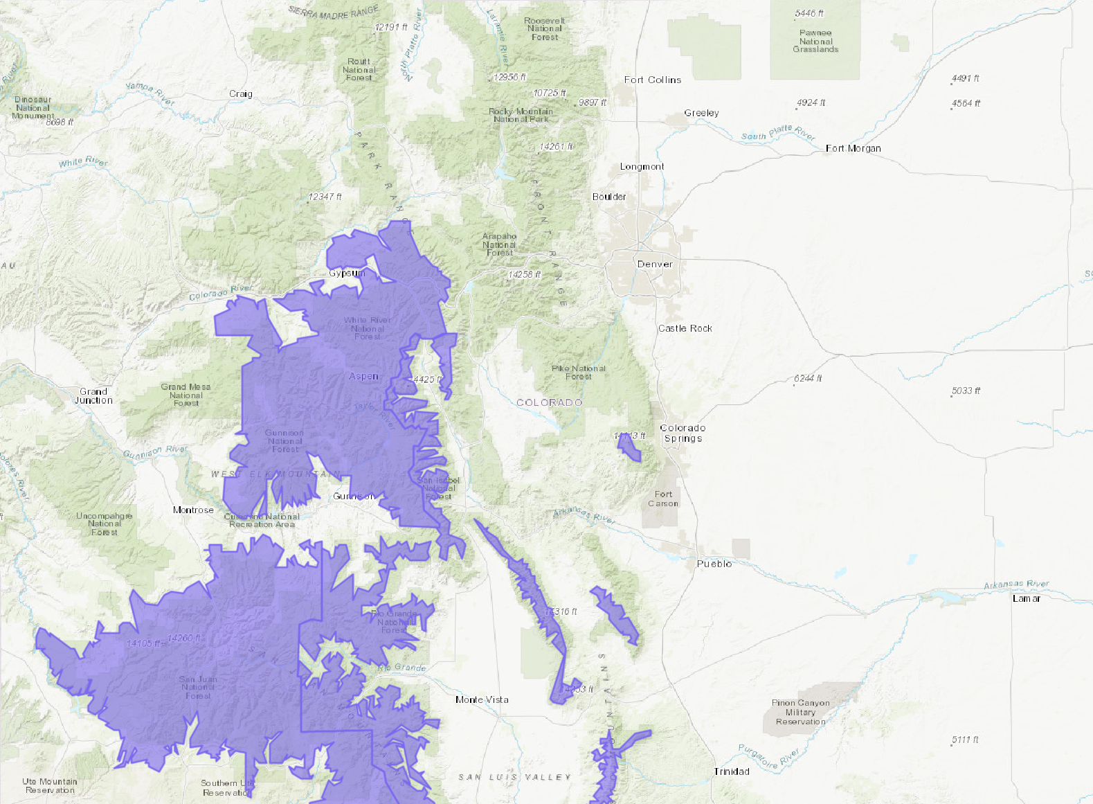
NOAA Has Issued A Winter Weather Advisory For:
- Colorado
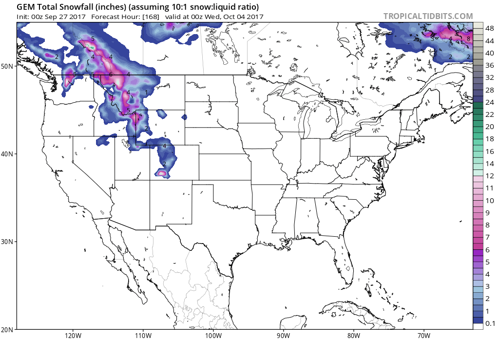
Snow levels are expected to hover around 11,000ft, but they may drop down to 10,000ft during heavy snow showers.
Additional Storm Info:
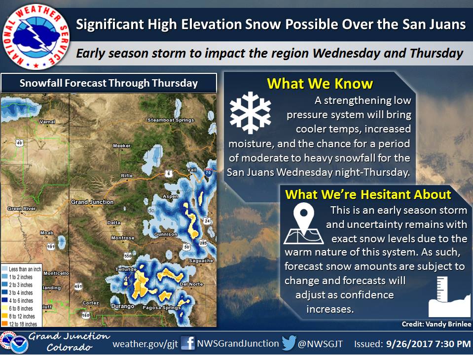
Colorado: 4-8+” of Snow Above 11,000ft Wednesday – Thursday Morning
* SNOW ACCUMULATION...4 to 8 inches with locally higher amounts
 possible.
- NOAA Grand Junction, CO
Colorado Winter Weather Advisory:
URGENT - WINTER WEATHER MESSAGE
National Weather Service GRAND JUNCTION CO
330 AM MDT Wed Sep 27 2017

Northwest San Juan Mountains-Southwest San Juan Mountains-

...WINTER WEATHER ADVISORY IN EFFECT FROM 3 PM THIS AFTERNOON TO
9 AM MDT THURSDAY...

The National Weather Service in Grand Junction has issued a
Winter Weather Advisory for snow above 11,000 feet which is in
effect from 3 PM this afternoon to 9 AM MDT Thursday.

* LOCATIONS...San Juans mountains near and above 11,000 feet.

* TIMING...Snow will begin after 3PM and continue through tomorrow
 morning.

* SNOW ACCUMULATION...4 to 8 inches with locally higher amounts
 possible.

* SNOW LEVEL...11,000 feet but possibly lowering to 10,000 feet
 under heavier showers.

* WINDS...Southeast 10 to 15 MPH.

* VISIBILITY...Down to 1/2 mile at times.

* IMPACTS...Travel on mountain roads and passes will become
 difficult this afternoon and overnight.

