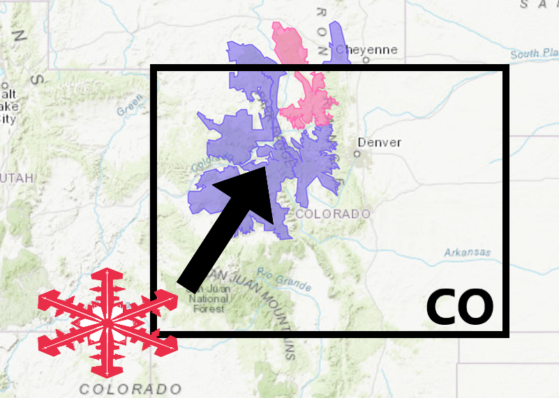
The National Weather Service has issued a Winter Weather Advisory for Colorado.
It’s in effect until 12:00am tonight.
Snow is expected to impact the area throughout that time.
Colorado:
- 2-4″ of Additional Snowfall Tonight
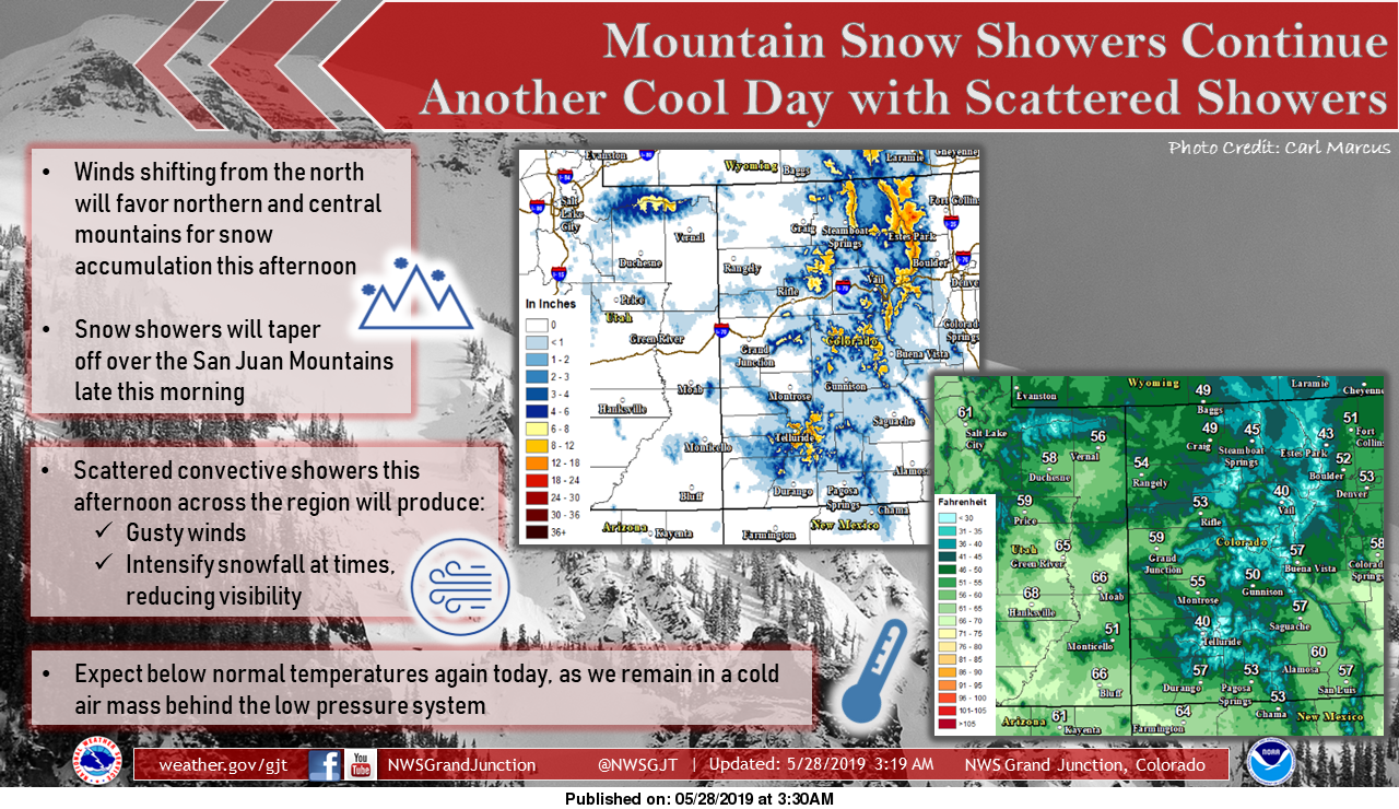
“As the low pressure system moves to our northeast, winds will shift from the north, northwest. Snow accumulation will favor the northern and central Colorado mountains, while tapering off the San Juan Mountains this morning. Scattered and convective showers are still possible across the forecast area this afternoon, which will produce gusty winds at the surface and may intensify snowfall, reducing visibility at times. Otherwise, expect partly cloudy to cloudy skies and below normal temperatures today.”
– NOAA Grand Junction, CO
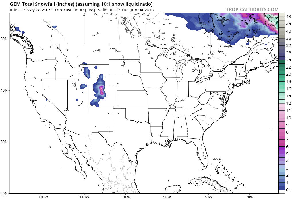
The snow level will be near 7500 feet over northern Colorado and around 8500 feet along the I-70 Corridor.
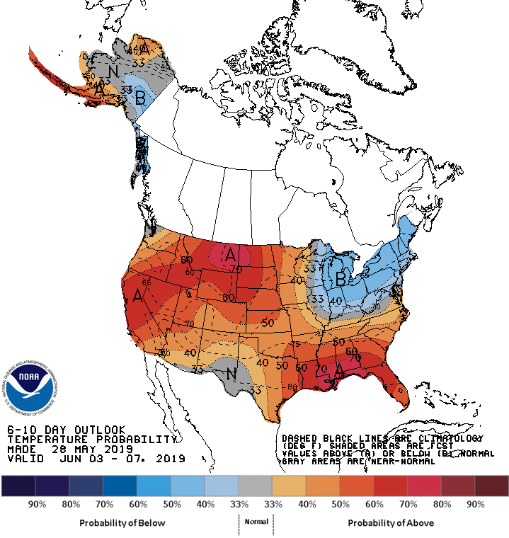
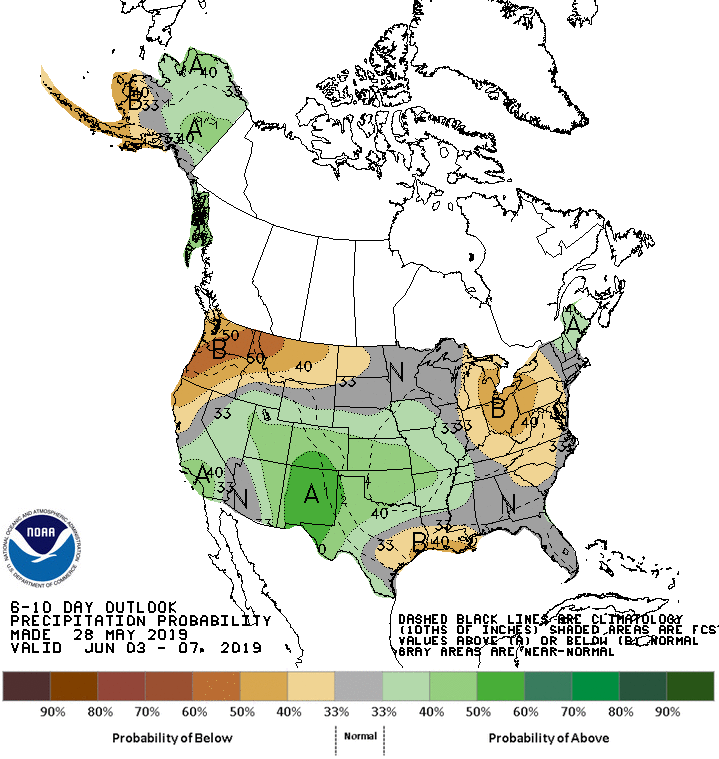
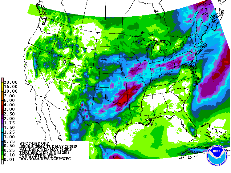
The 6-10 day outlook calls for above average temperatures and above average precipitation in Colorado.
Additional Storm Info:
Colorado: 2-4″ of Additional Snowfall Tonight
* Snow. Additional snow accumulations of 2 to 4 inches,
  with storm totals 3 to 7 inches along the I-70 Corridor
  through Summit County, and up to 12 inches in the mountains
  near Rabbit Ears Pass.
- NOAA Denver, CO
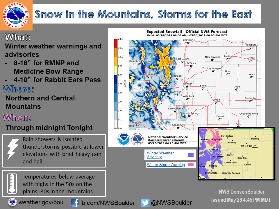
Winter Weather Advisory:
URGENT - WINTER WEATHER MESSAGE
National Weather Service Denver CO
250 PM MDT Tue May 28 2019

...MODERATE TO HEAVY SNOW FOR THE NORTHERN MOUNTAINS...

.A strong Pacific storm system will bring more snow to the
mountains through this evening, but then gradually pull away from
the area later tonight.

The snow level will be near 7500 feet over northern Colorado and
around 8500 feet along the I-70 Corridor. The heaviest snow totals
will occur over the mountains in the northern border area, but a
period of heavier snow will still bring moderate snow accumulations
into the I-70 mountain corridor through this evening.

Rabbit Ears Pass-
The Mountains of Summit County, the Mosquito Range, and the
Indian Peaks-
Including the cities of East Slopes Park and Northern Gore
Ranges, Gore Pass, Rabbit Ears Pass, Berthoud Pass, Breckenridge,
East Slopes Mosquito Range, East Slopes Southern Gore Range,
Eisenhower Tunnel, Indian Peaks, Kenosha Mountains, Mount Evans,
Williams Fork Mountains, and Winter Park

...WINTER WEATHER ADVISORY REMAINS IN EFFECT UNTIL MIDNIGHT MDT
TONIGHT...

* WHAT...Snow. Additional snow accumulations of 2 to 4 inches,
  with storm totals 3 to 7 inches along the I-70 Corridor through
  Summit County, and up to 12 inches in the mountains near Rabbit
  Ears Pass.

* WHERE...The Mountains of Summit County, the Mosquito Range,
  and the Indian Peaks and Rabbit Ears Pass.

* WHEN...Until midnight MDT tonight.

* ADDITIONAL DETAILS...Plan on slippery road conditions with slush
  and snow on the higher passes this evening.