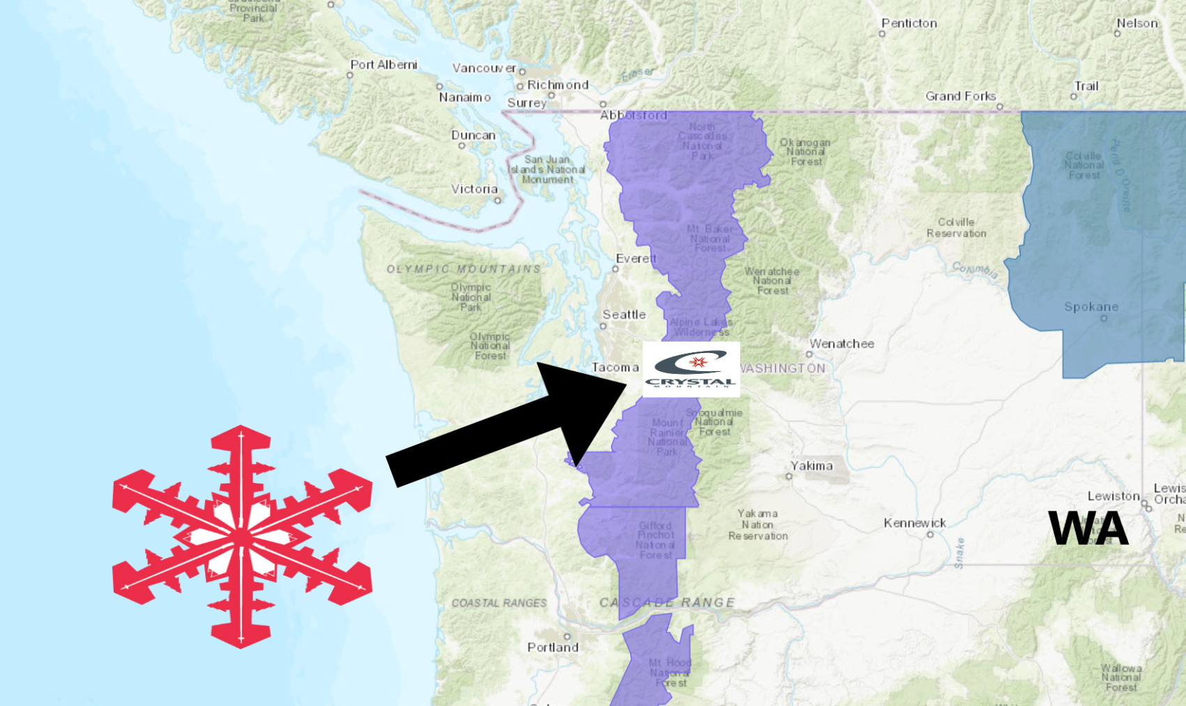
The National Weather Service has issued a Winter Weather Advisory for Crystal Mountain Resort, WA. It’s in effect from 5:00pm this afternoon – 12:00pm Tuesday.
Snow is expected to impact the area throughout that time.
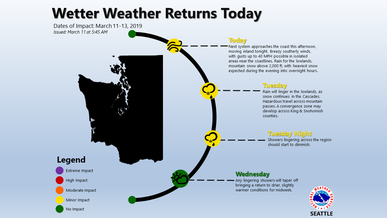
The heaviest snowfall is forecasted to impact the area tonight.
Crystal Mountain Resort, WA:
- 8-15″ of Snow Today – Tuesday
“A Winter Weather Advisory has been issued for the Cascades from Whatcom County south through Lewis County beginning 5 PM Monday and continuing through Noon Tuesday. Snow accumulations of 8 to 15 inches will be possible, making for hazardous travel conditions across the Passes.”
– NOAA Seattle, WA
Towards the end of the month, you can get lift tickets for Crystal Mountain for only $40 here.
Snow is expected to fall above 2,000ft.
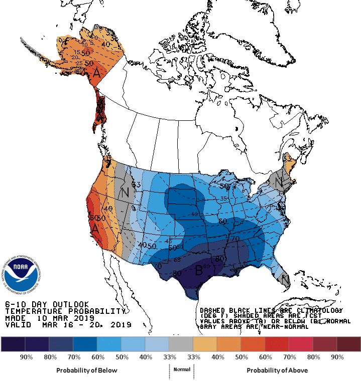
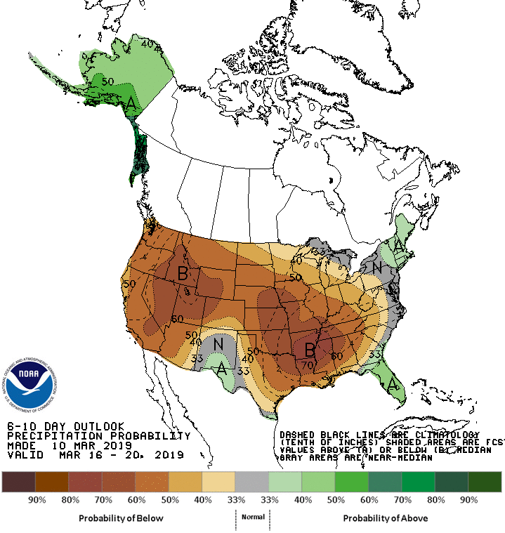
The 6-10 day outlook calls for below average precipitation and above average temperatures in Washington.
Additional Storm Info:
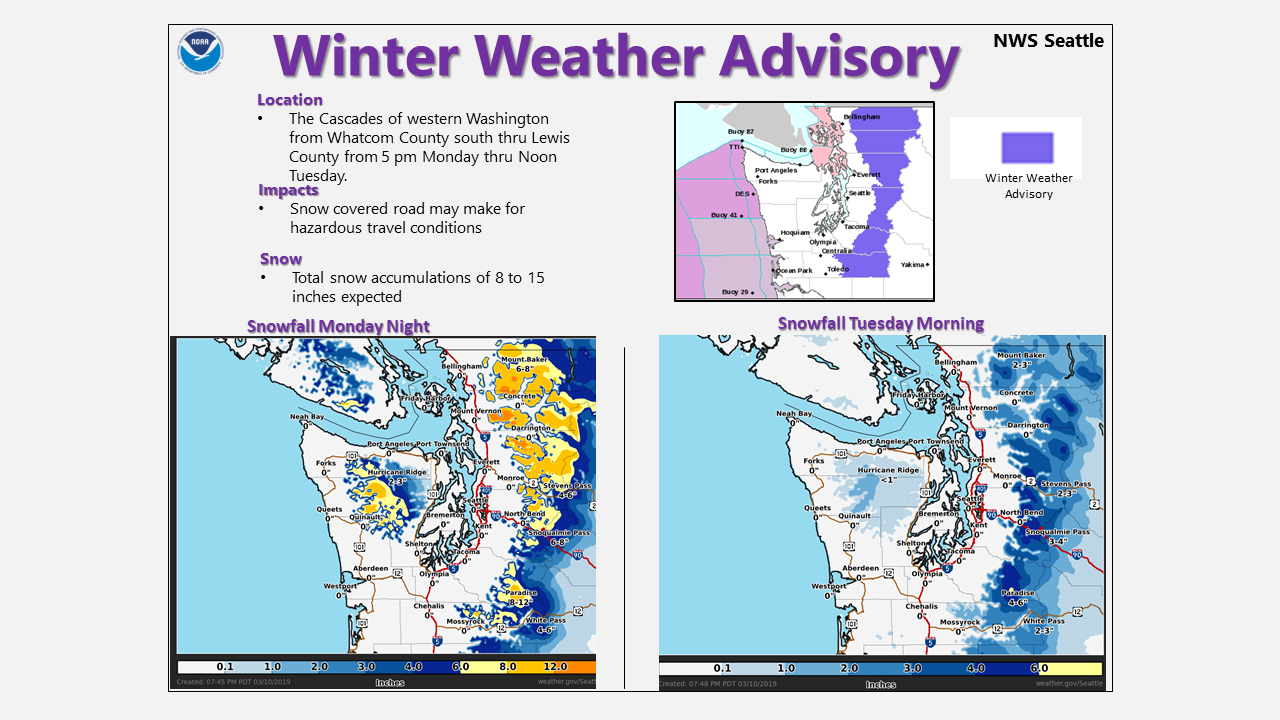
Washington: 8-15″ of Snow Today – Tuesday
* Snow expected. Total snow accumulations 8 to 15 inches expected.
  The heaviest snowfall will likely occur Monday night.
- NOAA Seattle, WA
Winter Weather Advisory:
URGENT - WINTER WEATHER MESSAGE
National Weather Service Seattle WA
317 AM PDT Mon Mar 11 2019

Cascades of Whatcom and Skagit Counties-
Cascades of Snohomish and King Counties-
Cascades of Pierce and Lewis Counties-
including Concrete, Hamilton, Lyman, Maple Falls, Deming,
Newhalem, Darrington, Baring, Stevens Pass, Skykomish,
Snoqualmie Pass, Morton, Ashford, Packwood, Randle, Paradise,
and Longmire

...WINTER WEATHER ADVISORY REMAINS IN EFFECT FROM 5 PM THIS
AFTERNOON TO NOON PDT TUESDAY...

* WHAT...Snow expected. Total snow accumulations 8 to 15 inches
  expected. The heaviest snowfall will likely occur Monday
  night. Heaviest snowfall Tuesday morning will be in a
  convergence zone around Stevens and Snoqualmie passes.

* WHERE...Cascade mountains of Whatcom and Skagit Counties,
  including the Mount Baker Ski Area, Cascade mountains of
  Snohomish and King Counties, including Stevens Pass, and
  Snoqualmie Pass and Cascade mountains and valleys of Pierce
  and Lewis Counties, including the Crystal Mountain Ski Area
  and Paradise on Mount Rainier.

* WHEN...From 5 PM Today through Noon PDT Tuesday.