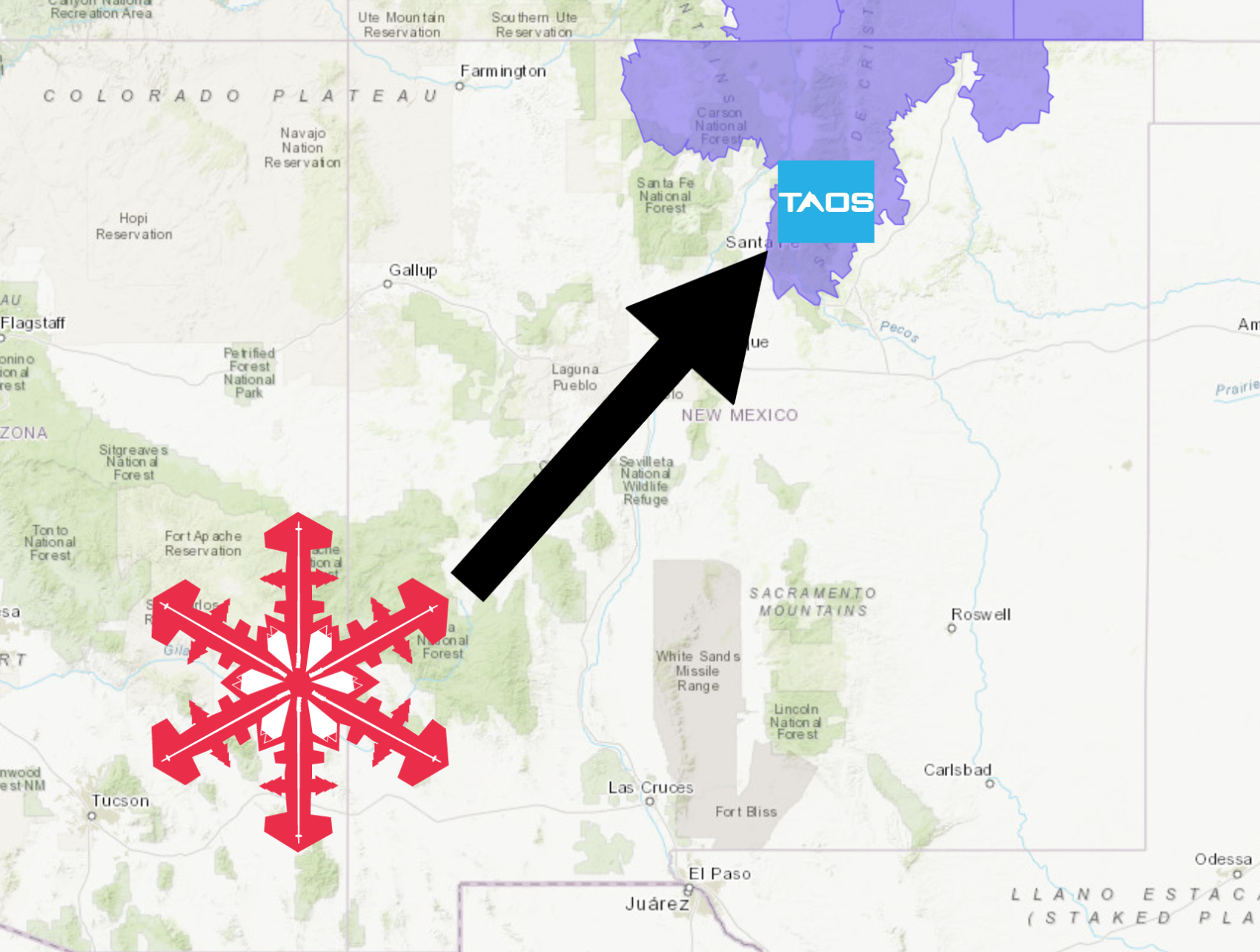
The National Weather Service has issued a Winter Weather Advisory for Taos Ski Valley, NM. It’s in effect until 5:00am Saturday morning. Snowfall is expected to increase in intensity throughout the day today, before diminishing tonight.
New Mexico:
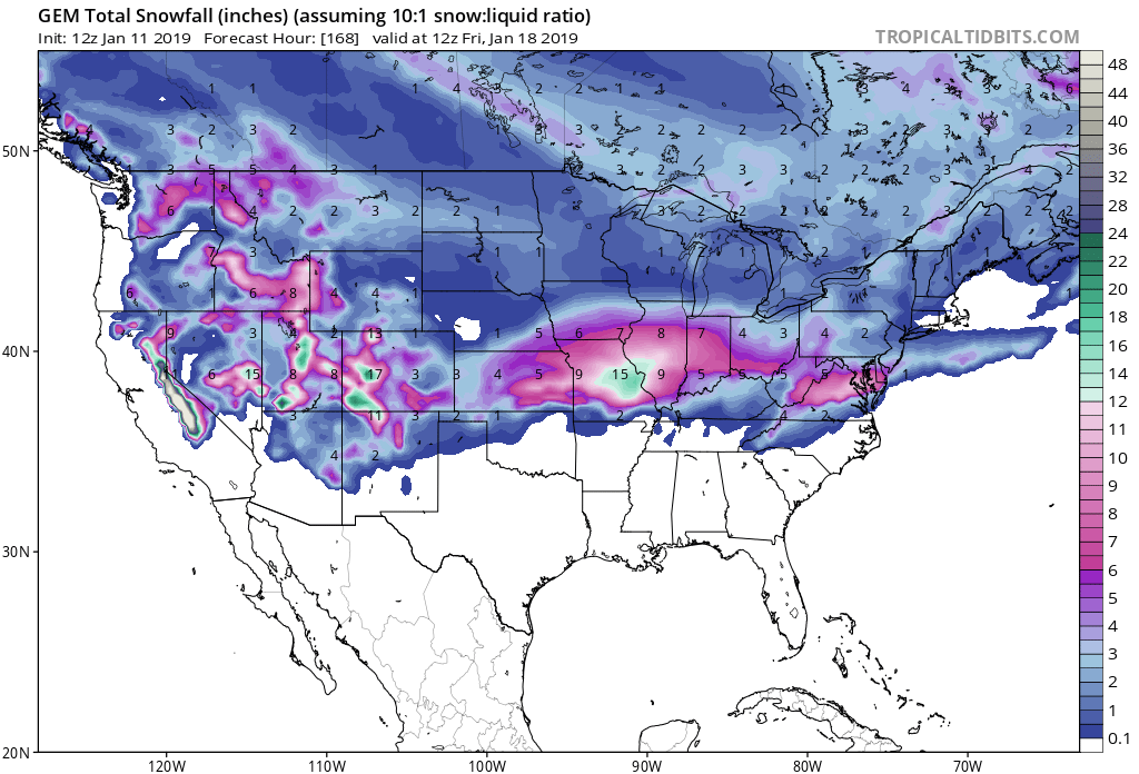
- 4-10″ of Snow Tonight – Saturday Morning
“Snow will continue across the northern mountains and far northeast NM today. This snow will impact the I-25 corridor between Santa Fe and the Colorado Border, though the greatest impacts are expected around Raton Pass. Use caution if travelling through this area today or tonight.”
– NOAA Albuquerque, NM
Taos Ski Valley, NM has received 3″ of snow in the past 24 hours and it’s still snowing, so they’re set up for a great weekend of skiing and riding.
The highest accumulations are expected to occur above 7,000ft.
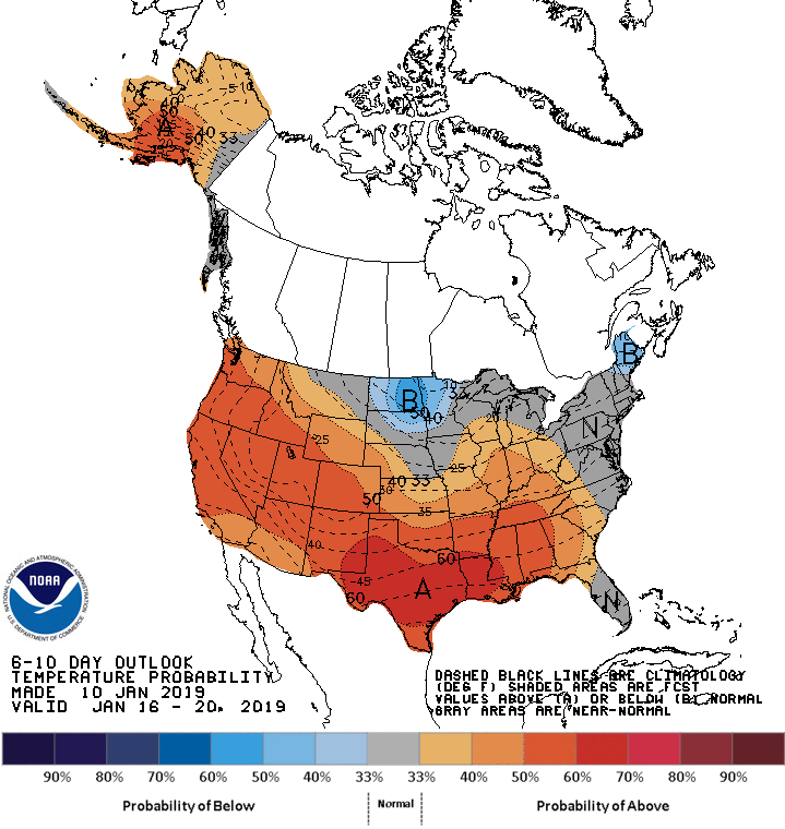
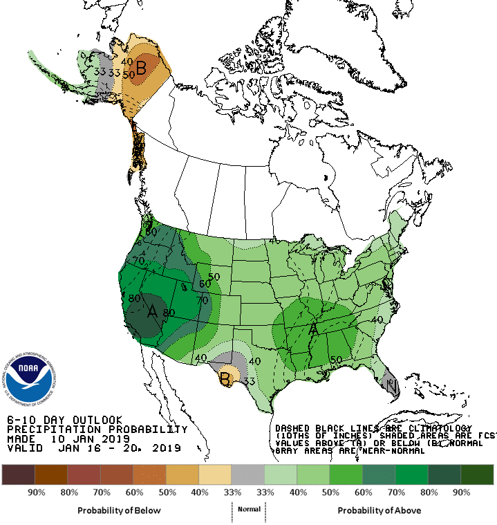
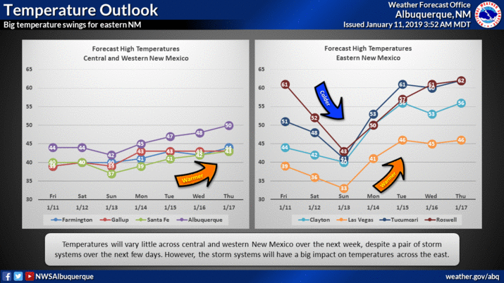
The 6-10 day outlook calls for above average temperatures and above average precipitation in New Mexico.
Additional Storm Info:
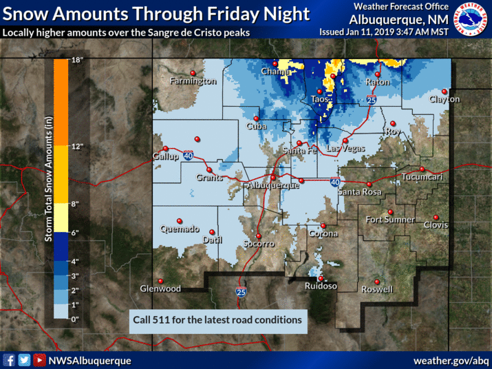
New Mexico: 4-10″ of Snow Today – Saturday Morning
* Snow expected. Total snow accumulations of 3 to 6 inches
  expected below 7500 feet and 4 to 10 inches above 7500 feet.
- NOAA Albuquerque, NM
Winter Weather Advisory:
URGENT - WINTER WEATHER MESSAGE
National Weather Service Albuquerque NM
214 AM MST Fri Jan 11 2019

...SNOW RETURNS TO PORTIONS OF NORTHERN NEW MEXICO...

.Another round of snow and travel impacts are expected across the
Sangre de Cristo and Tusas Mountains, Upper Rio Grande Valley as
well as the Raton Ridge and Johnson Mesa area. Snow will continue
to increase in intensity through the day before diminishing
tonight. However, strong northerly winds near Raton Pass will
create areas of blowing snow tonight before the snow subsides.

San Juan Mountains-West Slopes Sangre de Cristo Mountains-
Northern Sangre de Cristos above 9500 feet/Red River-
Southern Sangre de Cristos above 9500 feet-
East Slopes Sangre de Cristo Mountains-Upper Rio Grande Valley-
Raton Ridge/Johnson Mesa-

...WINTER WEATHER ADVISORY IN EFFECT UNTIL 5 AM MST SATURDAY...

* WHAT...Snow expected. Total snow accumulations of 3 to 6 inches
  expected below 7500 feet and 4 to 10 inches above 7500 feet.
  North winds gusting as high as 35 mph near and east of Raton
  Pass tonight.

* WHERE...Tusas Mountains, Sangre de Cristo Mountains, Upper Rio
  Grande Valley, Raton Ridge and Johnson Mesa.

* WHEN...Until 5 AM MST Saturday.

* ADDITIONAL DETAILS...Travel could be very difficult, especially
  along I-25 through Raton Pass. Snowpacked and icy roads are
  likely. Blowing snow may reduce visibility below one mile at
  times.