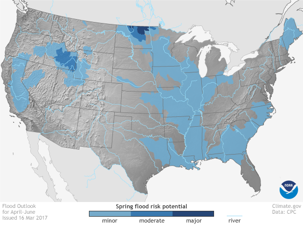
Spring Outlook: Risk of major flooding in North Dakota, moderate flooding in Idaho
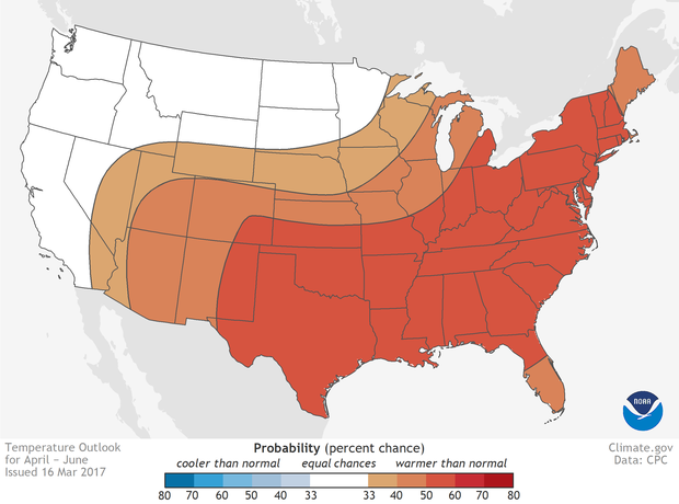
Warmer-than-average temperatures favored in much of U.S. this spring
by NOAA
March 16th, 2017
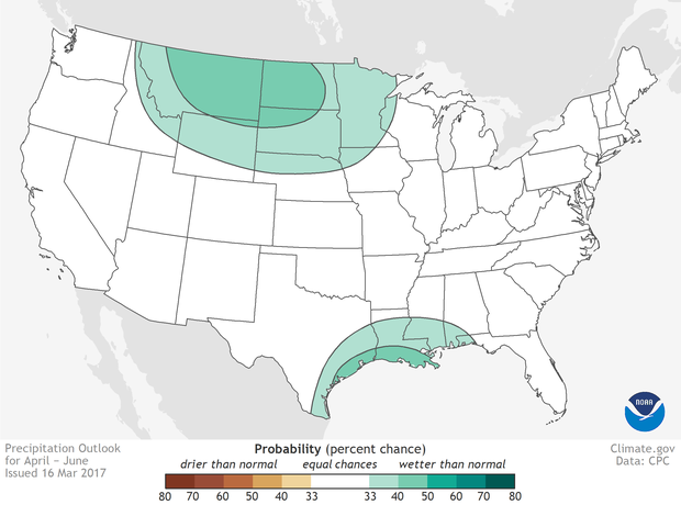
Northern North Dakota—the Souris River, Devils Lake and the northernmost reaches of the Red River—has the greatest risk of major flooding this spring, while moderate flooding is possible over southern Idaho in the Snake River basin, according to NOAA’s Spring Outlook released today. California, which saw extensive flooding in February, is susceptible to additional flooding from possible storms through the remainder of the wet season and later, from snowmelt.
“If you’re in northern North Dakota, or in the Snake River basin in Idaho, prepare for moderate to major flooding this spring,” said Tom Graziano, Ph.D., director of NOAA’s Office of Water Prediction. “Snowpack is heavy in the West and northern plains, and if our long term warm-up coincides with spring rains, already saturated soils will not be able to absorb the increased water, which would lead to increased runoff and potential flooding.”
But while the extreme north could see flooding, the rest of the country could be warmer than average, forecasters said. “Above average temperatures are favored for much of the U.S. this spring with the south-central Plains and eastern U.S. having the highest chance for warmer than average conditions,” said Jon Gottschalck, chief, Operational Prediction Branch, NOAA’s Climate Prediction Center.
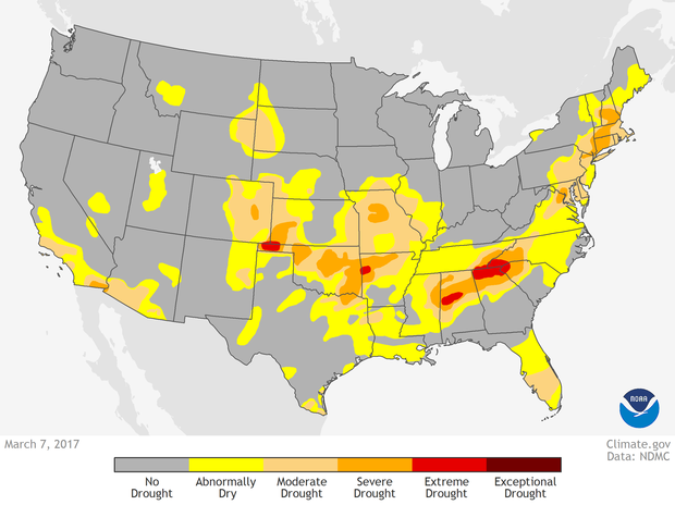
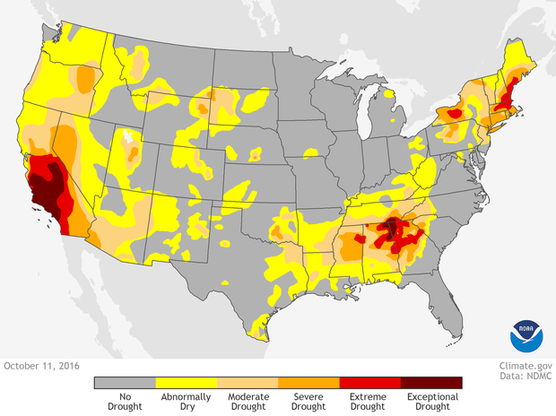
There was a remarkable turnaround in California’s five-year drought over the winter. According to the U.S. Drought Monitor, issued today, the geographic extent of drought in the state dropped from 73 percent three months ago to eight percent this week, due to near-record precipitation from a series of powerful winter storms. Also, in February, only three percent of the contiguous U.S. saw severe to exceptional drought, the lowest level in seven years.
Driving the forecast for major flooding in northern North Dakota is an extensive snowpack, containing up to four inches of liquid water that could increase with additional storms through April. When this snowpack melts, the already saturated and frozen soil won’t be able to absorb it, creating runoff and potential flooding. The location of greatest concern is Devils Lake, where forecasters are projecting a near record runoff that could cause the lake to rise three to four feet, possibly exceeding its record high flood level set in June 2011.
Spring 2017 temperature outlook
