View this post on Instagram
Palisades Tahoe, California, will remain closed today due to continued intense snowfall, high winds, and low visibility. Gusts of 190 mph were recorded at 8,900 feet.
- Related: SnowBrains Forecast: Season’s Heaviest Storm in California | Up To 120″ Expected at Ski Resorts
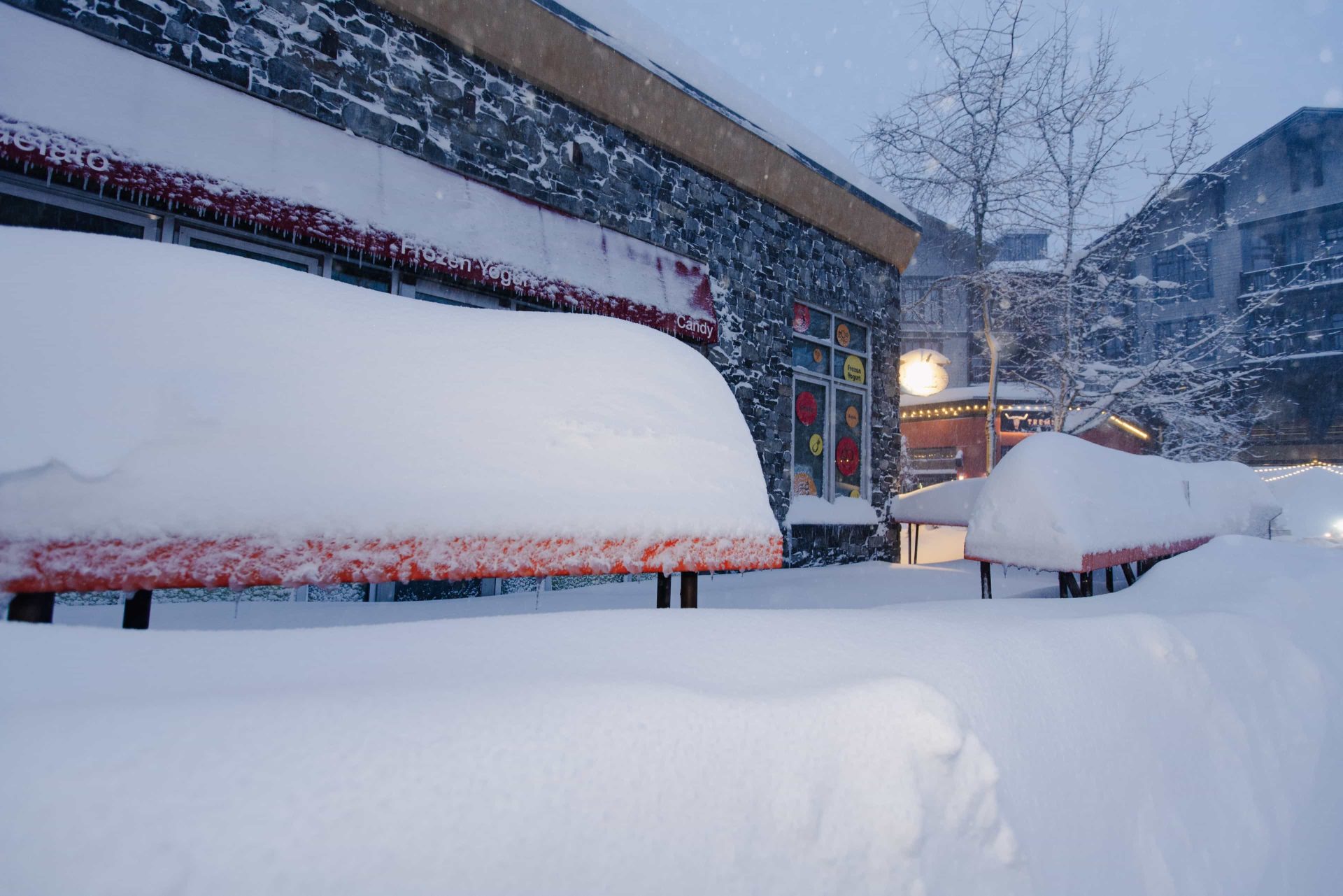
A further two feet of snow has fallen on the upper mountain since yesterday, bringing this storm’s 2-day snowfall total to 41”.
“Due to wind, visibility, new snowfall, and 16-21 inches of snow in the forecast, all chairlifts at Palisades Tahoe will be closed for the day today, Saturday, March 2nd.”
– Palisades Tahoe blog post
Our update today is essentially the same as yesterday, the resort wrote on its Operations Update blog page this. Due to extremely high rates of snowfall and winds over 100 mph, all chairlifts at Alpine will be closed tomorrow, Saturday, March 2nd. On the Palisades side, we are going to attempt limited lower mountain operations, with Resort Chair, First Venture, Far East, and Red Dog. Tonight is supposed to bring the strongest band of the storm, so we expect to have a significant amount of recovery work to do in the morning. We have had essential personnel on-hill all day, performing control work, maintaining access roads, and digging out chairlifts, but based on current conditions, if we are able to open at all, there will be significant delays.
You should also expect regional impacts to our roadways. Please make use of the CalTrans QuickMap app if you have to drive. Additionally, the Park & Ride will not run tomorrow, and local TART bus service is cancelled as well.
What will happen on Sunday? We don’t know yet. We’re certainly as eager as you are for fresh turns, but we have to put safety above all else. We will aim to release another update around 4pm on Saturday with information on what to expect for Sunday morning.

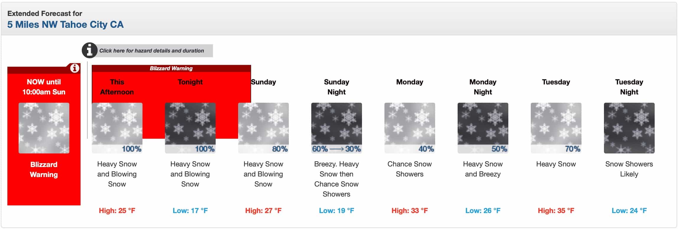
A Blizzard Warning is in effect in the area through Sunday morning.
...BLIZZARD WARNING REMAINS IN EFFECT UNTIL 10 AM PST SUNDAY...

* WHAT...Blizzard conditions likely, particularly through Saturday
  morning. There is a 10-20% chance of thunderstorms along the crest
  through this evening with snowfall rates of 4 to 6 inches per hour
  at times. Snow accumulations between 3 and 6 feet for Lake Tahoe
  communities, with 6 to 10 feet above 7000 feet. Winds gusting to
  70 mph in lower elevations and above 115 mph over Sierra ridges
  with significant drifting of snow.

* WHERE...Greater Lake Tahoe Area.

* WHEN...Until 10 AM PST Sunday.

* IMPACTS...Whiteout conditions with near zero visibility at times
  due to blowing snow. The strong winds and weight of snow on tree
  limbs may down power lines and could cause sporadic power outages.
  Travel will be treacherous and potentially life-threatening.

PRECAUTIONARY/PREPAREDNESS ACTIONS...

A Blizzard Warning means severe winter weather conditions are
expected or occurring. Falling and blowing snow with strong winds
are likely. This will lead to whiteout conditions, making travel
extremely dangerous. Do not travel. If you must travel, have a
winter survival kit with you. If you get stranded, stay in your
vehicle.