Forecast By SnowBrains Meteorologist – Eric McNamee
11:00 AM MST, Jan. 11, 2021
Forecast Summary:
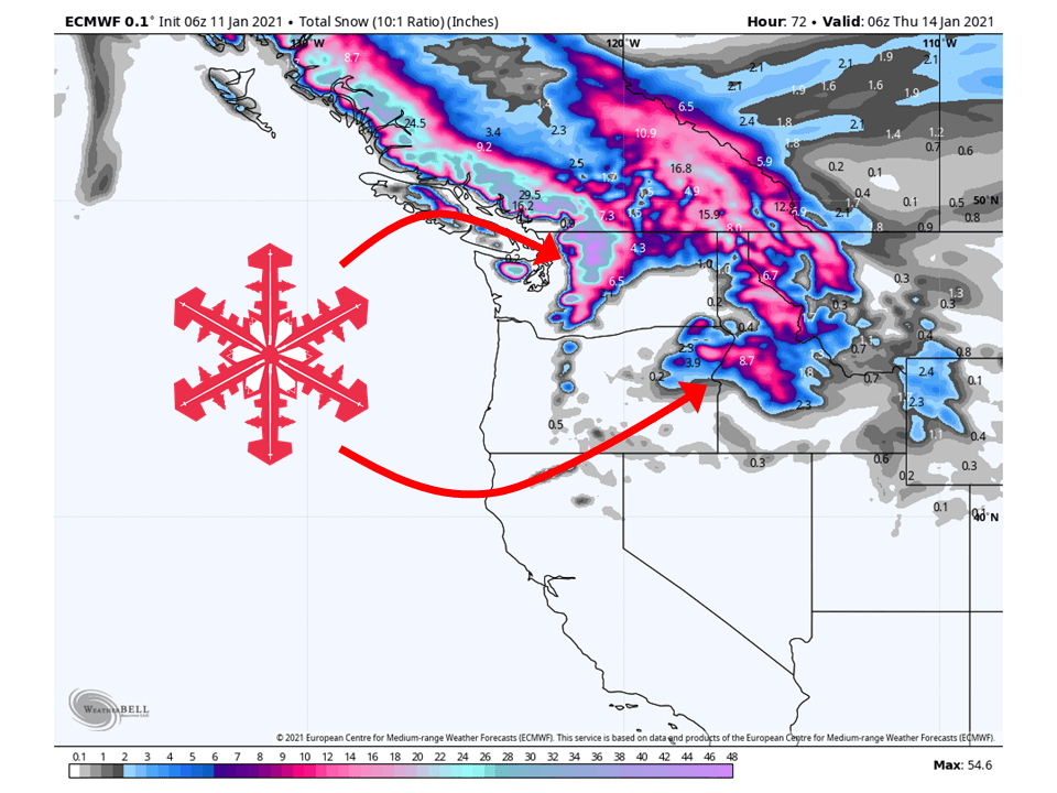
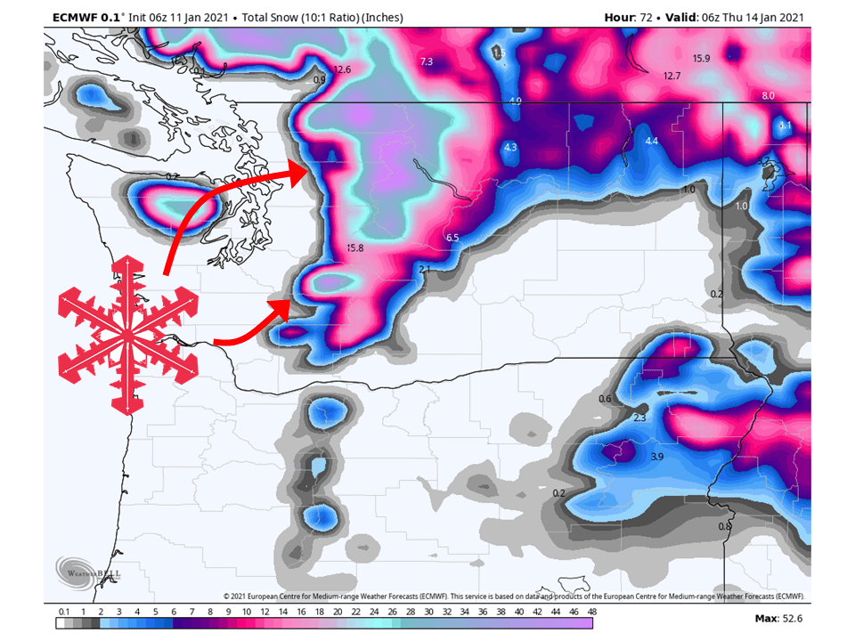
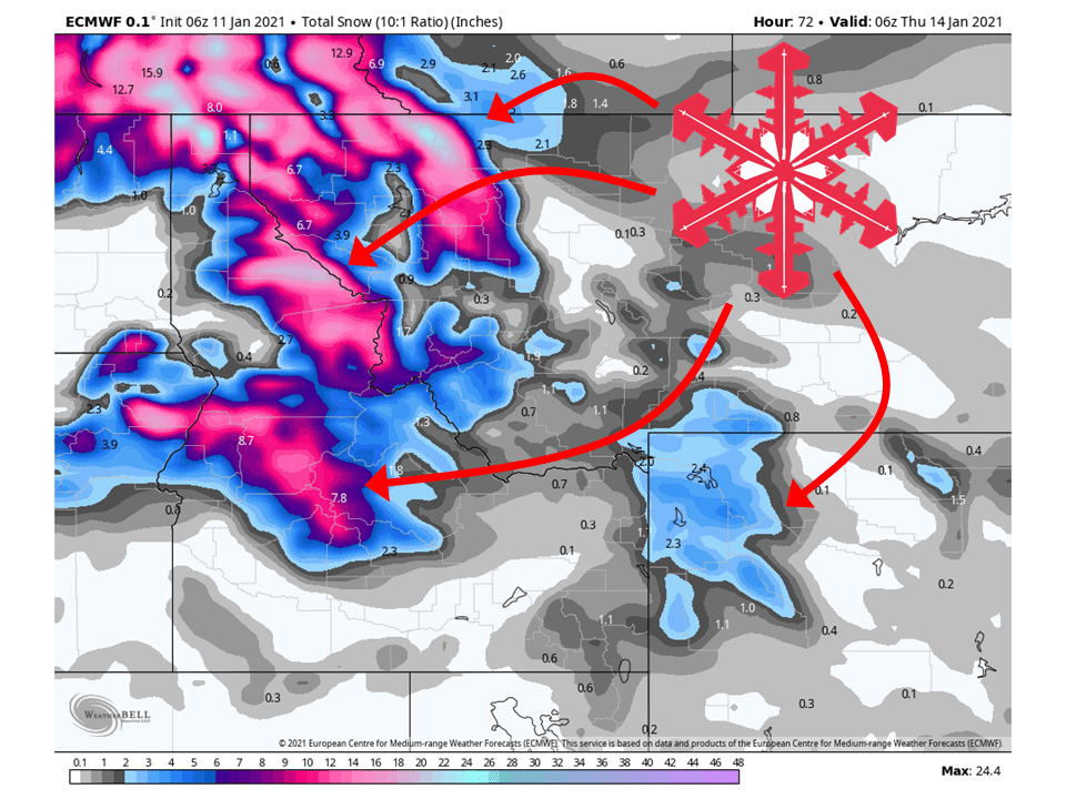
An atmospheric river event will take place in the northwestern US through Wednesday, bringing 1-3 FEET snow.
This will come in three parts, with snow levels rising this afternoon and Tuesday, then falling back down Wednesday.
Conditions look to dry out Thursday and Friday before another weak system moves through this weekend.
Minimal amounts are expected from the weekend system at this time.
Short-Term Forecast:
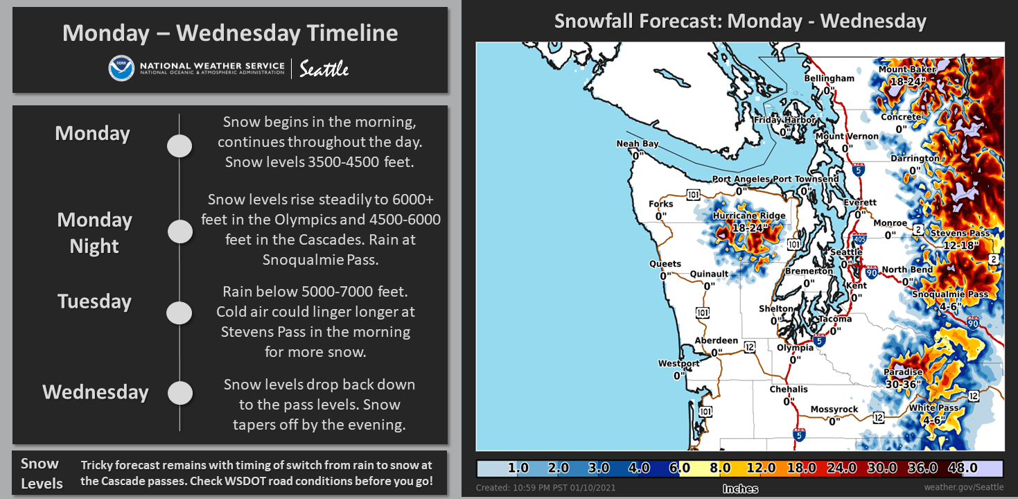
Monday-Wednesday:
A shortwave trough will move into the region today, primarily bringing 8-12″ of snow to the Washington Cascades.
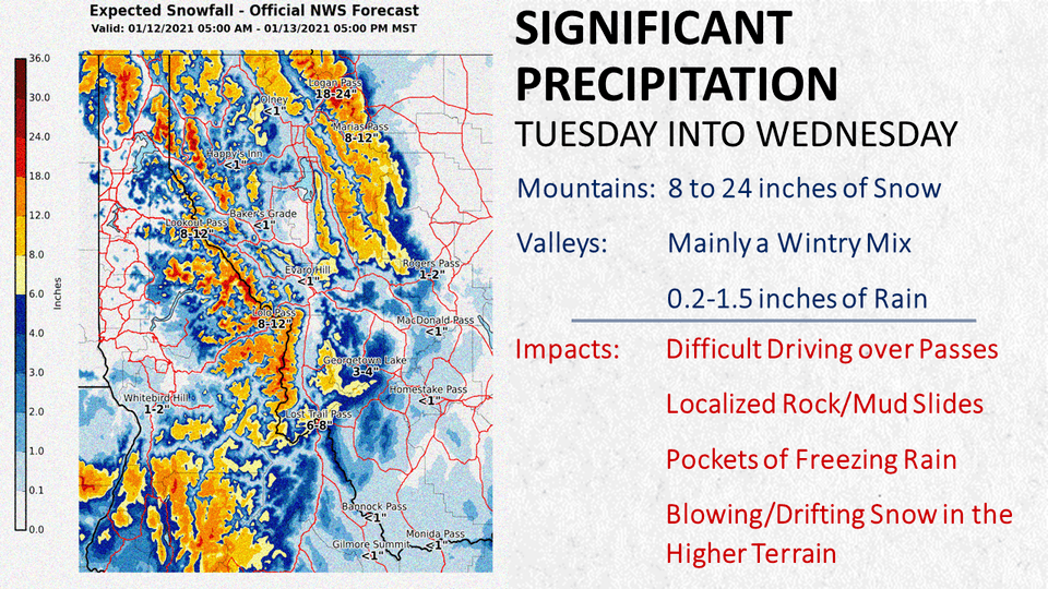
This same shortwave will bring moisture to the Northern Rockies on Tuesday and drop 6-12″ of snow to Northern Idaho and Western Montana.
During this same time, the next wave of moisture will move into Washington and bring an 8-12″ of snow to the Washington Cascades Tuesday.
This wave is where snow levels will rise across the region as warmer air moves in.
The next and final wave will move through during the day Wednesday, bringing an additional 8-16″ to the Washington Cascades and 6-12″ to Northern Idaho and Western Montana.
Colder air will be associated with this wave and drop snow levels back down.
Snow levels will rise considerably from today into
Tuesday as warm sub-tropical air mass arrives. With initial system
today, we`re looking at 3500 to 4500 feet with snow at the passes
starting out. Then with second wave tonight into Tuesday morning,
snow levels rise further - to 6000-7000 feet on the Olympic
Peninsula and 5000 to 7000 feet in the Cascades. The tricky part of
this forecast remains focused on Stevens Pass. Easterly flow may win
out longer than currently forecasted, keeping heavy snow going there
into Tuesday morning. Switchover time is still uncertain and
accumulations may hinge drastically on this. More confident in
earlier switchover at Snoqualmie Pass limiting amounts to several
inches there before rain. Have upgraded winter storm watch to a
winter weather advisory for the north and central Cascades.
Heaviest accumulations expected from Stevens Pass northward.
-NWS Seattle 1/11/2021
Long-Term Forecast:
Thursday-Sunday:
Conditions will dry out, for the most part, in the second half of this week as high pressure builds in over the Western US.
The exception is a weak shortwave trough will move in from Canada this weekend and track down the East side of the Rockies
This will bring some additional snowfall to the Northern Rockies, but amounts will be pretty minimal as this shortwave will be deprived of moisture.
Extended Forecast:
Sunday and Beyond:
Global ensembles indicate high pressure will dominate the overall pattern in the Western US.
This means there will be generally below-average precipitation across the Northwest, with the exception along the East side of the Rockies.
Pacific Northwest:
The Pacific Northwest looks to fair pretty well, primarily Washington, with 1-3 FEET of snow falling through Wednesday and possibly more in the highest elevations
Resorts that look to see the most snow are Crystal Mountain, Alpental, Mt Baker, and Stevens Pass.
Northern Rockies:
Like the Pacific Northwest, the Northern Rockies will fair pretty well through Wednesday with 1-2 FEET of snow falling.
Resorts that look to see the most snow are Whitefish Mountain, McCall, Tamarack, and Schweitzer.
USA:
Global ensembles indicate high pressure will dominate the overall pattern in the Western US.
This means there will be generally below-average precipitation across the Northwest, with the exception along the East side of the Rockies.