SnowBrains Forecaster Clay Malott wrote this forecast at 09:00 pm PST, April 24th, 2023
This week, a significant weather system will move through the western region, delivering substantial snowfall to Colorado, particularly in the Front Range area. For those seeking fresh powder, Arapahoe Basin, Loveland, and Winter Park are the top resorts to visit through the end of the week, with the prime skiing days anticipated to be Tuesday and Wednesday.
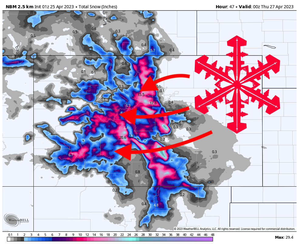
The storm system will bring energy and moisture to Colorado beginning Monday afternoon, initially affecting the higher elevation peaks before expanding overnight. The initial wave of moisture will arrive from the west and rapidly cover the central and northern mountain ranges. By Tuesday morning, the following overnight snow accumulation can be expected at resorts still operating lifts:
- Arapahoe Basin: trace-2”
- Loveland: trace-2″
- Breckenridge: trace-1″
- Copper Mountain: trace-2″
- Winter Park: trace-2″
- Purgatory: 1-3″
The storm’s next phase, intensifying on Tuesday morning, will be characterized by a complex mix of southwesterly, southeasterly, and easterly winds, complicating the forecast. Precipitation will increase throughout the day, peaking at resorts during the late afternoon after the lifts cease operations.
The following snowfall totals are anticipated from Tuesday morning (8 am) to the afternoon (4 pm). Notably, this storm will bring warmer and wetter conditions, resulting in denser snow. For the highest quality snow, visit higher elevation resorts like Arapahoe Basin or Loveland:
- Arapahoe Basin: 3-5″
- Loveland: 3-5″
- Breckenridge: 1-3″
- Copper: 1-3″
- Winter Park: 3-5″
On Tuesday afternoon, snowfall will intensify and continue into the evening and night, particularly in the Front Range. While model consensus for this storm is relatively strong despite its warm, dynamic nature, the American GFS model predicts significantly more precipitation in the Front Range on Tuesday afternoon than the Euro model. Strong northeasterly winds will bring significant snowfall on Tuesday evening, especially to resorts near the Continental Divide like A-Basin and Loveland. However, reported totals on Wednesday morning may be at the lower end of the predicted range due to the unpredictable nature of these dynamic spring storms. Here are the expected overnight totals for Wednesday morning:
- Arapahoe Basin: 7-12”
- Loveland: 9-13″
- Breckenridge: 3-6″
- Copper: 3-6″
- Winter Park: 9-13″
Most precipitation should have passed by Wednesday morning, and the sun may even emerge in the afternoon! Looking ahead, another storm from the northwest could develop on Thursday night – stay tuned for updates on this potential system as more information becomes available.