Forecast by SnowBrains forecaster Clay Malott
Monday, November 28th, 10am PST
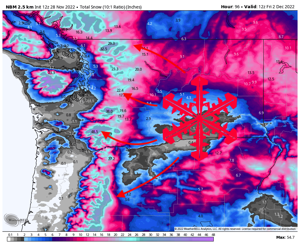
A major winter system will bring significant snow to Washington and Oregon this week, dropping 2-3 feet on local resorts. The most favorable resorts for this system will be Mt. Baker, Crystal Mountain, and Snoqualmie Pass.
Lingering showers from the last storm will persist in the mountains through Monday afternoon. The next system begins on Tuesday afternoon, starting at the Washington-Oregon border and filling into the north. Precipitation rates will continue to increase throughout the day on Tuesday, dropping a few inches at resorts over the course of the day. Precipitation will peak early on Wednesday morning.
By Wednesday morning, conditions will be excellent across the region. Here are what I see as reasonable totals at local resorts (including totals from Monday, so reported totals on Wednesday morning will likely be 2-4″ lower):
- Mt. Baker (4,400′): 14-18″
- Stevens Pass (4,900′): 15-18″
- Crystal Mountain (5900′): 12-18″
- Alpental (3,500′): 14-20″
- Mt. Hood (6,600′): 18-22″
Precipitation will begin to fade but will continue to stick around throughout Wednesday, especially in northern Oregon. By the end of the ski day on Wednesday, resorts will have picked up another 3-6″, making ski conditions excellent all day long.
The major precipitation will wrap up overnight Wednesday, and by Thursday morning, here are what I see as likely totals:
- Mt. Baker (4,400′): 24-32″
- Stevens Pass (4,900′): 22-28″
- Crystal Mountain (5900′): 22-28″
- Alpental (3,500′): 24-30″
- Mt. Hood (6,600′): 35-40″
Temperatures throughout this entire storm will be optimal and the snow quality will be superb.
I think these totals are leaning toward the lower end of what will actually fall, so don’t be surprised if totals end up outperforming the forecast. Fingers crossed!
Precipitation will continue to linger in the mountains through Friday when the next storm begins to move in. Stay tuned for a forecast with updated specifics about that system later this week.
