Forecast By SnowBrains Meteorologist – Eric McNamee
Brought to you by Alta Ski Area
10:20 AM MST, 3/19/2021
Forecast Summary:
A shortwave trough will move through Utah this weekend, bringing 6-10″ of snow to the Wasatch and more for the Cottonwoods.
Conditions will remain active through most of the forecast, with a temporary clearing Monday but systems will return during the remainder of the week.
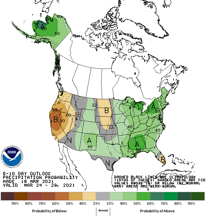
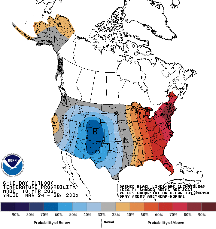
Below-average temperatures in the extended forecast with about average temperatures.
Resorts that look to see the most snow are Alta, Snowbird, Brighton, Solitude, Park City, Canyons, Deer Valley, Snowbasin, Powder Mountain, and Beaver Mountain.
Short-Term Forecast:
Friday-Sunday:
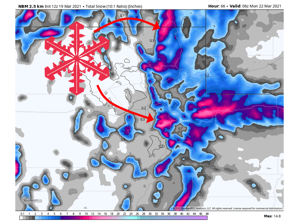
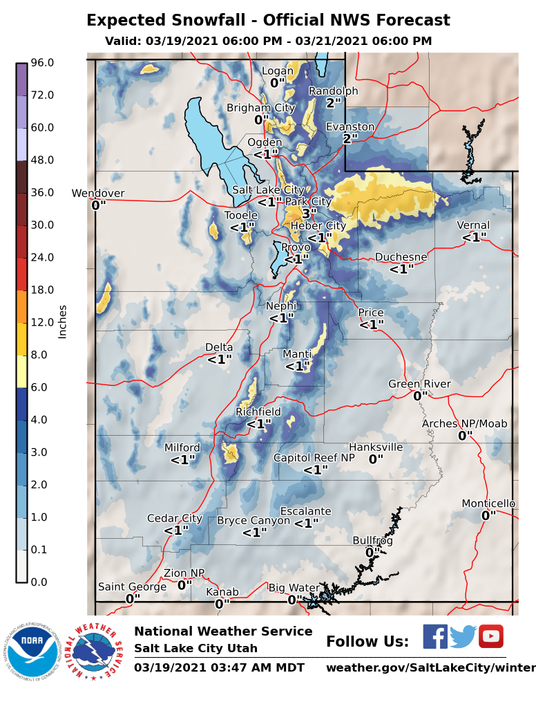
6-10″ of snow is expected to fall across the Wasatch through Sunday, with more expected in the Cottonwoods.
Snow will start early tomorrow morning ahead of an approaching cold front and fill in throughout the day Saturday.
Flow will switch to the northwest Saturday afternoon and allow for orographic precipitaion to ramp up during the night.
Some lake-enhancement is likey as well due to the cold air mass and relatively warm lake temperatures.
This will favor the Cottonwoods.
Snow will taper off during the day Sunday as the trough splits and digs further south.
Long-Term Forecast:
Monday-Thursday:
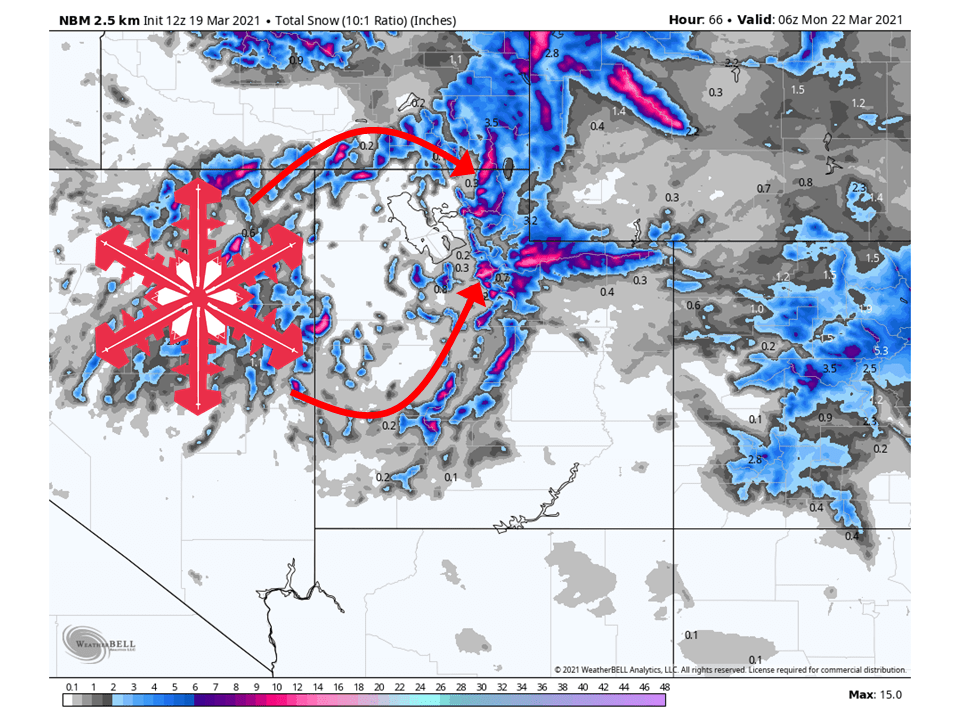
Conditions will clear out temporarily Monday before another trough moves through the state Tuesday.
This trough will lack moisture but has a pretty cold air mass associated with it which will allow for higher SLRs and low-density snow.
Another trough looks to move through Thursday, but this could change since it is 6+days out.
Extended Forecast:
Thursday and Beyond:
Global ensembles are indicating near-average precipitation and below-average temperatures in the extended.
**Alta Forecast**
8-14″ of snow is expected at Alta through Sunday as the trough moves through the state.
Snow will start early tomorrow morning ahead of the approaching cold front and fill in throughout the day Saturday.
Flow will switch to the northwest Saturday afternoon and allow for orographic precipitaion to ramp up during the night.
Some lake-enhancement is likey as well due to the cold air mass and relatively warm lake temperatures.
Conditions will clear out Monday before another trough moves through Tuesday.
This trough looks like it will lack moisture but will move in from the northwest and has a cold air mass associated with it.
This will favor Alta with its general flow direction and high SLRs.
Another system is possible later next week.