Forecast By SnowBrains Meteorologist – Eric McNamee
12:35 PM MST, Dec. 8, 2020
Forecast Summary:
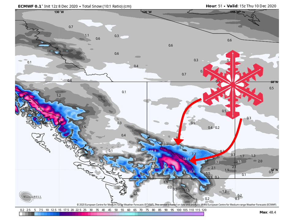
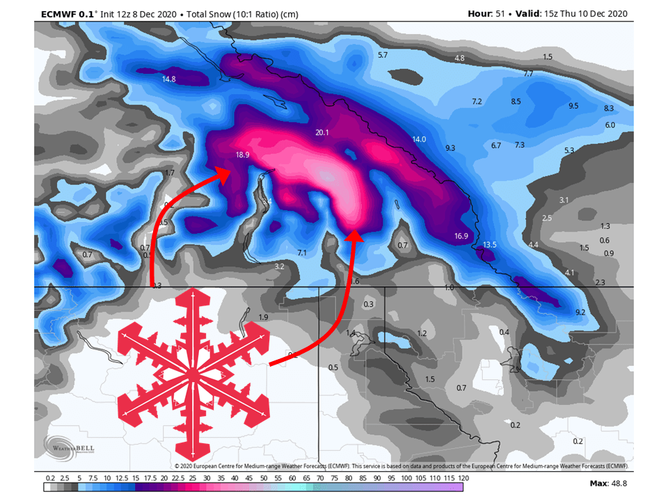
A shortwave trough will move through British Columbia and bring 6-18″ of snow to interior portions of the province.
The trough will be a quick hitter and should be out of the region by Thursday afternoon.
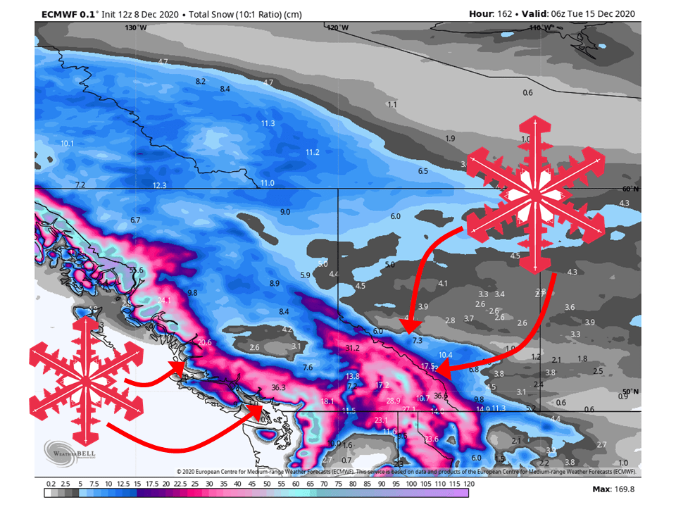
More snow is likely this weekend with more moisture moving into the region.
Resorts likely to see the most snow are Revelstoke, Kicking Horse, and Panorama.
Short-Term Forecast:
Tuesday-Thursday:
A shortwave trough currently off the B.C. coast will move inland today, bringing 6-18″ of snow across the region.
This trough will move through quickly and be out of the region by Thursday afternoon.
A ridge of high pressure will then build over the region heading into the weekend.
Long-Term Forecast:
Friday-Monday:
Some slight ridging will settle over the area through Saturday before another shortwave trough looks to move in this weekend.
At the moment, very moist southwesterly flow looks to develop ahead of this trough.
This will bring the chance for widespread precipitation to the area and heavy mountain snow.
Exact amounts are unknown at this time.
Extended Forecast:
Tuesday and Beyond:
Global ensembles indicate a shift in the pattern may take place next week with a longwave trough developing over western North America.
This would bring back widespread snowfall and cooler temperatures.