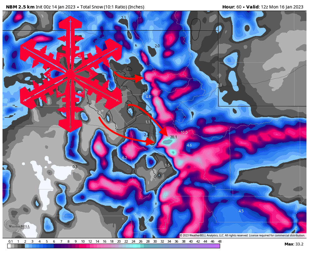
Forecast by Clay Malott, 1/13/23 at 9:30pm PST
In a continuation of a seemingly endless series of storms for Utah, the region is once again looking at a productive system from Saturday afternoon through Sunday night. This storm will build an already legendary snowpack and make for excellent ski conditions over the holiday weekend.
The storm will start on Saturday afternoon, dropping just a dusting on Wasatch resorts at the end of the ski day. Precipitation rates will increase overnight into Sunday morning. Here are what I see as reasonable totals by first chair on Sunday:
Snowfall: Saturday night – Sunday morning
- Cottonwood resorts (Alta, Snowbird, Solitude, Brighton): 4-6″
- Park City resorts (Park City, Deer Valley): 3-5″
- Northern resorts (Powder Mountain, Snowbasin, Beaver Mountain): 2-4″
- Southern resorts (Eagle Point, Brian Head): 3-5″ (5-8″ at Brian Head)
Precipitation rates will continue to increase throughout the day on Sunday, bringing very snowy conditions and refills all day! By the time the lifts stop spinning, here are possible totals:
Snowfall: Sunday morning – Sunday afternoon
- Cottonwood resorts (Alta, Snowbird, Solitude, Brighton): 6-8″
- Park City resorts (Park City, Deer Valley): 4-6″
- Northern resorts (Powder Mountain, Snowbasin, Beaver Mountain): 3-5″
- Southern resorts (Eagle Point, Brian Head): 2-4″
After peaking on Sunday afternoon, precipitation rates will begin to decrease again into the night. I don’t see there being much accumulation overnight, with the Cottonwoods and PC/DV looking at an inch or two, and the northern and southern mountains looking at a trace to an inch.
I think the numbers above are lowballing this storm a bit, especially for the Cottonwoods. The lower level winds that are feeding the moisture to the mountains are out of the southwest for much of the event, which is not an optimal wind direction for these mountains. This wind shifts to come out of the northwest late Sunday morning, so I’m optimistic that the northwest flow will boost the reported totals above the forecasted totals above. However, this shift in wind direction might be too little too late, especially since winds closer to the surface will lag behind and may stay stuck in a south-south-westerly direction even on Sunday. Deer Valley may perform well with this southwest flow as they did earlier this week, where they picked up 18″ overnight while the rest of the Wasatch resorts picked up no more than 12″.
It’s always better to under-forecast a storm than over-forecast it, and that’s what I did here; I’d be surprised if totals fail to surpass my forecast; fingers crossed for this weekend to outperform the forecast!

Monday will be mostly dry with a few snow showers in the southern mountains. A smaller second wave arrives on Monday night. I’ve seen several other forecasters and automated forecasts have high hopes for this second wave, but I’m really not seeing it. This will be another southwest flow event with limited upper-level vertical motion (thus very reliant on orographic influence), so I do not see the Wasatch doing very well with this follow-up system. As I anticipated, the model trend across all the models over the past day or so has not been good for the Wasatch.

I’m anticipating just a few inches of snow for most mountains, with the only respectable totals being found in the southern mountains, particularly at Brian Head, where the confluence of upper-level dynamics, ample moisture supply, and strong winds should create some decent totals. Brian Head is looking at ~2″ during the day on Monday (mainly in the afternoon), 4-8″ on Monday night, and another few inches on Tuesday & Tuesday night. This will be very light, fluffy snow, so the ski conditions will be excellent.
The next opportunity for Utah snow beyond this storm will come on Thursday of next week as a cold, energetic trough moves into the region. There’s still a lot of uncertainty in the forecast this far out with such a dynamic system, but it’s something to watch over the next few days as the models lock in on a solution.
Utah’s seemingly endless fire hose of moisture will slow down after the system late next week as the Pacific Jet retracts into a more meridional (wavy) pattern. This pattern is more reminiscent of a typical La Niña pattern, which can go either way for Utah but is typically favorable for the northern Wasatch.