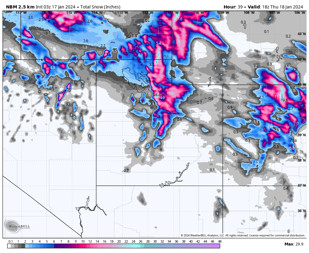
NBM snow total for Utah through Thursday afternoon. Credit: WeatherBell
An arctic outbreak last week brought dangerously cold temperatures and widespread snow to much of the US. Utah didn’t get nearly as cold as the other side of the Rockies, but did see colder temperatures and a large swath of new mountain snow. The state’s snowiest resorts located in the Cottonwoods saw 5-7 feet of snow, while other Northern Utah resorts, that don’t typically do as well, saw 4-6 feet as well.
A new trend is beginning to emerge, with a series of much warmer, but still wet, storms expected to bring a solid amount of new snow to Utah over the next week or two.
Short-Term Forecast
The first evidence of this trend is a storm that will impact the northern and central parts of the state Wednesday and into Thursday morning. The first batch of snow showers arrive early Wednesday morning, but snow likely continues almost nonstop until midday Thursday. While this didn’t look like a significant storm a few days ago, it now looks like 1-2 feet of new snow can be safely expected for the Northern Wasatch.
Here is the expected snowfall totals through Thursday morning:
- Alta: 14-24”
- Brighton: 14-22”
- Solitude: 14-22”
- Deer Valley: 8-14”
- Snowbird: 14-22”
- Powder Mountain: 12-18”
Warm and Wet Pattern Ahead
The next week will see waves of rain and high mountain snow across the US. While winter storms usually bring colder air down from the Arctic, these storms will draw warmer air from the Pacific. It looks like much of the country will see above normal precipitation and temperatures by this time next week. Probably quite a welcome sight to those in the midwest…
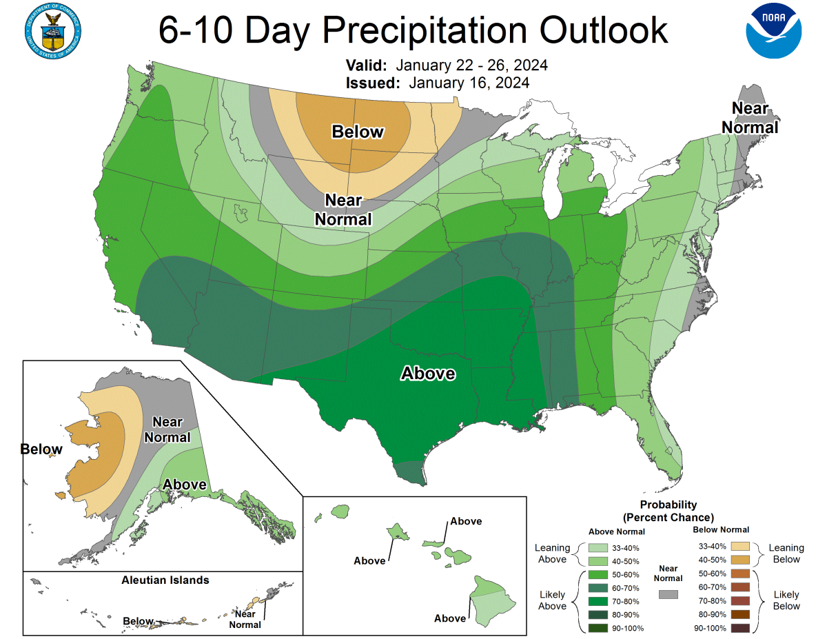
Credit: NOAA
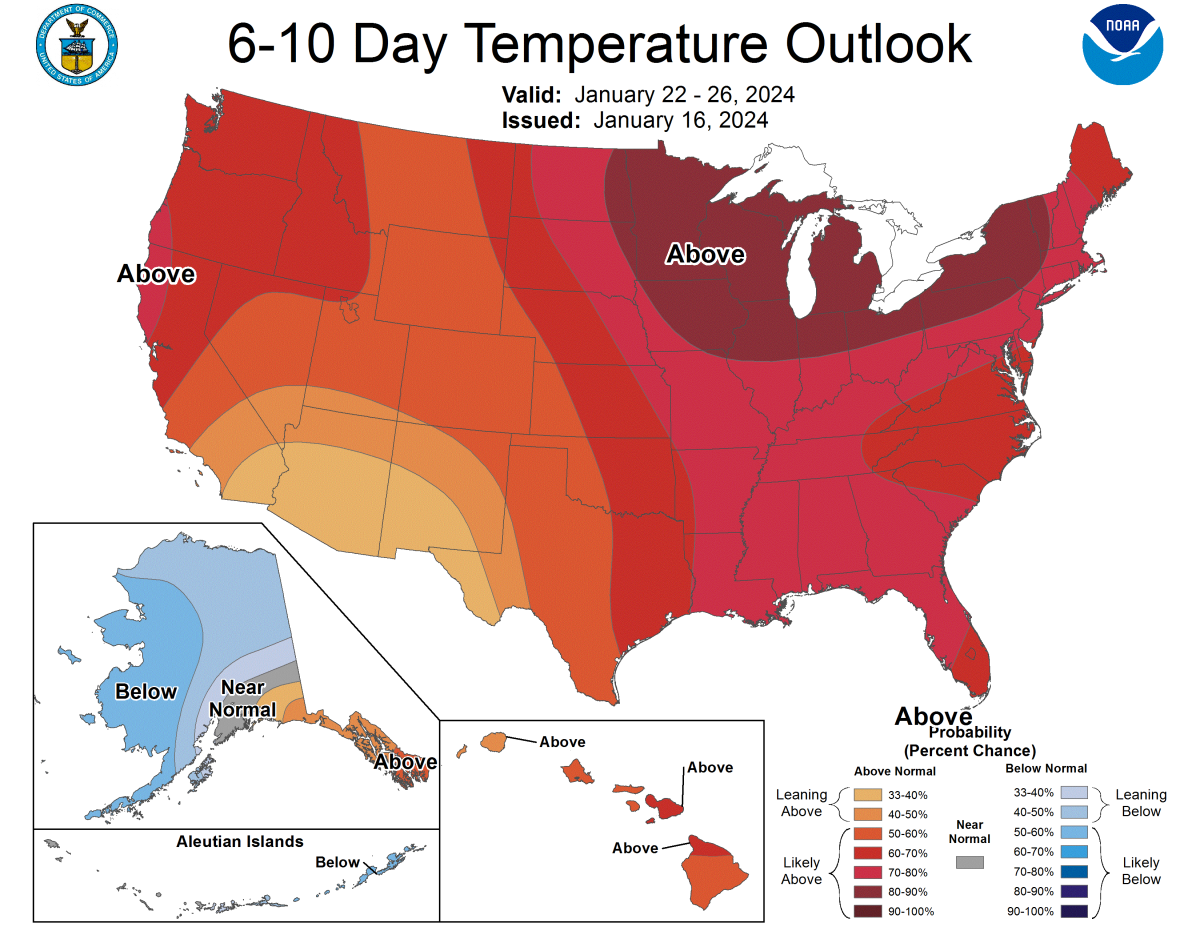
Credit: NOAA