
Forecast prepared 1900 MST SAT, Feb 24
Forecast Summary
Utah’s snowpack is fat after a very snowy February. Alta has broken its record for the wettest February since reliable record-keeping began in 1980.
Utah skiers/riders have two big storms to watch over the next week. The first comes Monday PM-Tuesday, and the second comes next weekend. Between the two, snowfall accumulations of 2-4 feet appear likely in the Upper Cottonwoods, with feet of new snow for the mountains across the state.
Tuesday will be the day to get after it for storm #1, and Sunday/Monday are looking promising next week.
Snowpack Update
Hydrologists use a network of weather instrumentation called SNOTEL sites to measure how much water weight is contained in the snowpack in mountain ranges across the West. Skiers can use this data to see where the best coverage is.
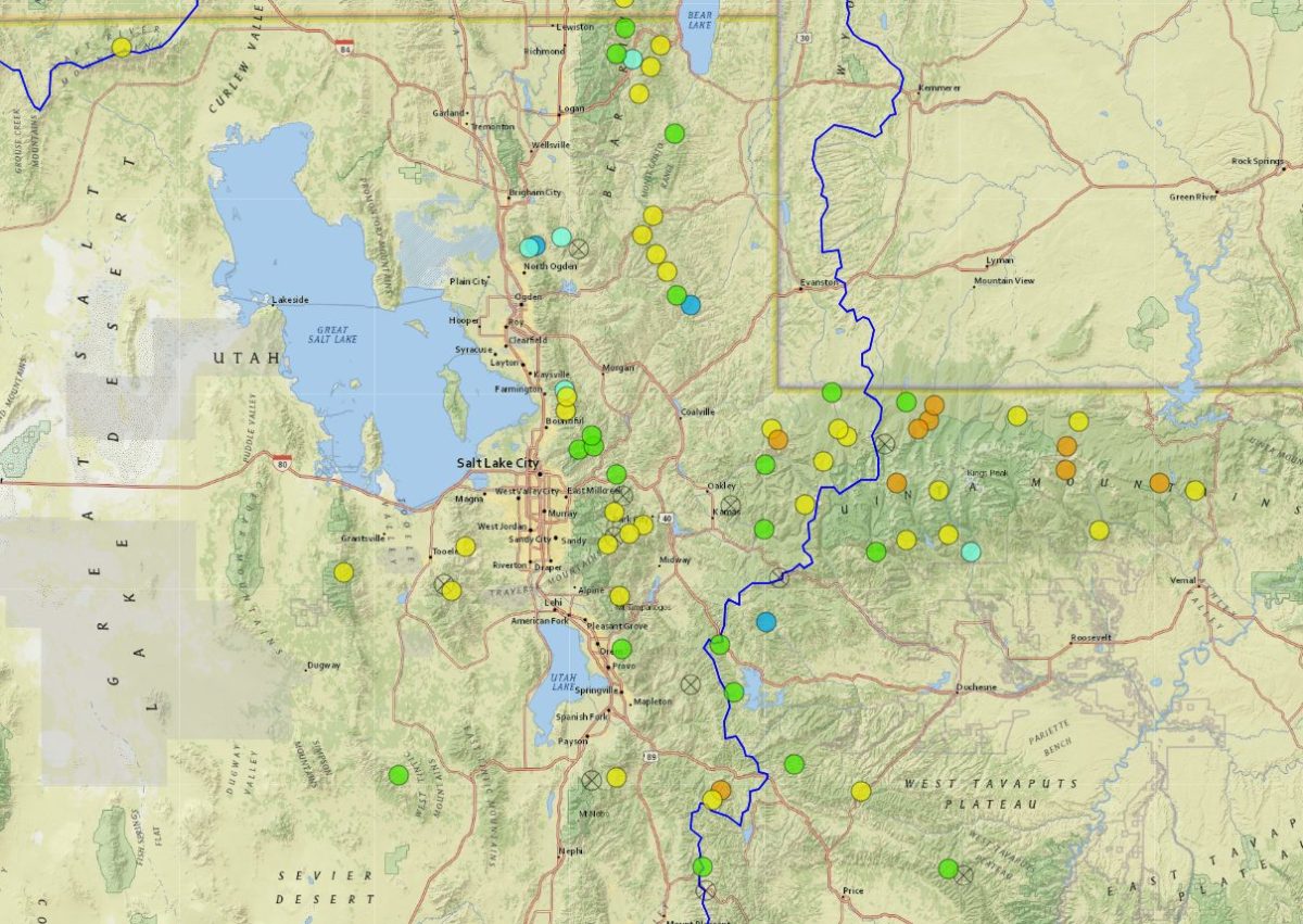
This map shows you how the current snowpack compares with what is normal for this time of year. As you can see, the Wasatch in Central & Northern Utah is among the only ranges in the US seeing above-average snowfall this season:
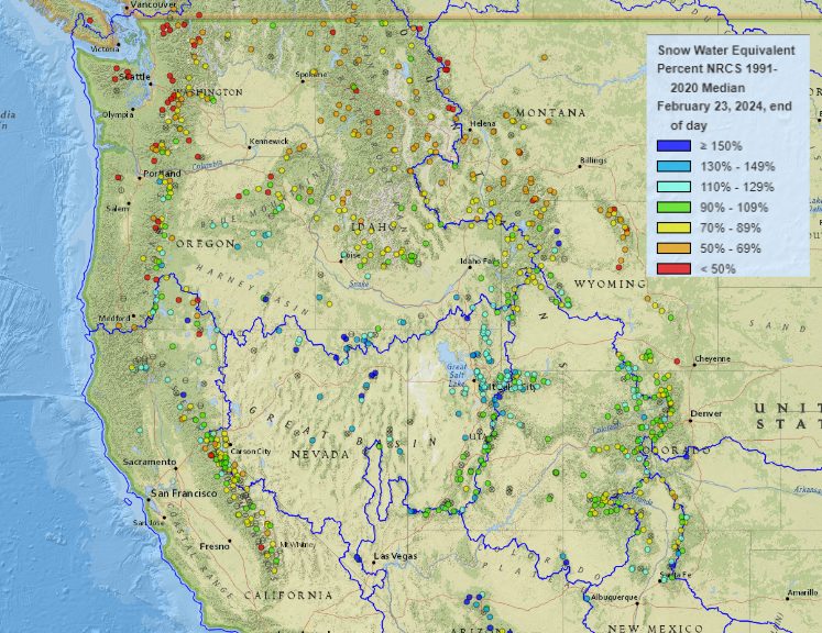
To further drive home this point, the blue and green dots in this map are sites where an average winter’s snowpack is already on the ground – even though we still have 1-2 months of snowpack building season left. Yellows mean almost a whole season’s worth of snow already.
These numbers will only improve with a couple of storms on deck.
Short Term – Through Tuesday Evening
Storm #1 begins on Monday, lasting into the day on Tuesday.
Rain/snow showers begin to fire up across northern Utah through the day on Monday, trending more intense as the day progresses. Snow levels will be around 6500-7000′, and 1-2″ of cream isn’t out of the question prior to resort closures Monday afternoon.
A cold front sweeps across the state overnight, dropping snow levels to valley floors and bringing a period of very heavy snow to the ski areas. The heaviest snowfall will wrap up Tuesday morning, but mountain snow showers will tack on an extra inch or two through the day. The cooling temps will mean fluffier snow overnight, and conditions will be very good for the first few laps on Tuesday.
A bit of lake effect snow will be possible as a very cold airmass moves in behind the front. Flow out of the northwest will mean the Cottonwoods stand to benefit from this. Forecasting lake effect snow is tricky, but this is a wildcard that could make Tuesday extra special if all works out just right.
Look for the following total accumulations by last chair Tuesday:
- Alta/Bird: 10-18″
- Solitude/Brighton: 8-14″
- Park City/Deer Valley: 5-10″
- Sundance: 4-8″
- Snowbasin/Powder Mtn: 4-8″
- Brian Head: 2-4″
- Eagle Point: 4-8″
Long Range Prospects
Looking at another series of chances for snow Saturday-Tuesday of next week. There’s still a week before the storm arrives, but weather models are in suprisingly good agreement that a very powerful trough will develop over the US West by next weekend:
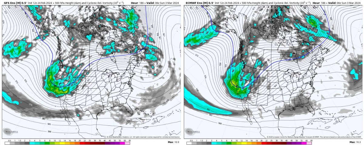
It’s too soon to speculate on the exact timing and amounts of mountain snow from this, but keep a close watch on this weekend and the first half of next week as this trough ejects inland across the Great Basin.
Despite the long lead time, a trough like this one will bring a multi-day period of active weather and also a much cooler airmass to the area. I won’t be surprised to see this storm produce heavier snowfall across the Wasatch than our Monday-Tuesday event.