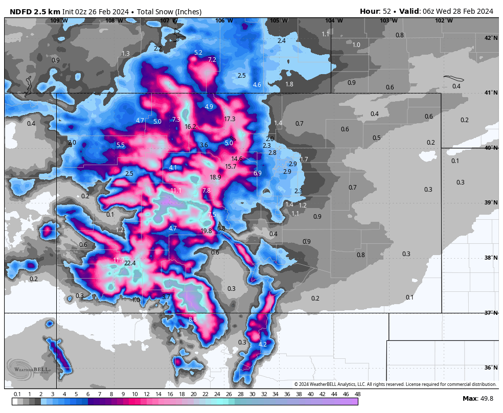
NWS Estimated Snow Totals. Source: maps.weatherbell.com
Forecast Summary
The abnormally warm and windy pattern in Colorado comes to an end on Tuesday when a cold front sweeps across the state from the northwest. Snow showers start popping up over the mountains Monday morning, almost a full 24 hours in advance of the cold front. With relatively warm temperatures, snow should be fairly wet and heavy on Monday.
After the front moves through Tuesday morning, temperatures will drop 5-10 degrees, winds will decrease, and snow will become lighter and fluffier. Snow continues most of the day Tuesday before tapering off Tuesday evening. This leaves us with a few fantastic powder days between Wednesday-Friday.
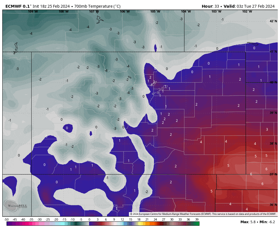
The advancing cold front on Tuesday. Source: maps.weatherbell.com
Snow forecast for some major CO resorts:
- Steamboat: 5-10″
- Telluride: 8-14″
- Vail: 7-14″
- Winter Park: 8-14″
- Aspen: 6-12″
- Breckenridge: 6-12″
- A Basin: 10-16″
- Wolf Creek: 18-30″
Extended Forecast
A short, dry break comes to an end Saturday night when another cold front moves in. While it’s too early to discuss snow totals, it looks like generally lighter snow totals but colder temperatures. This storm will bring snow across much of the western US, with a bullseye on the Sierras.
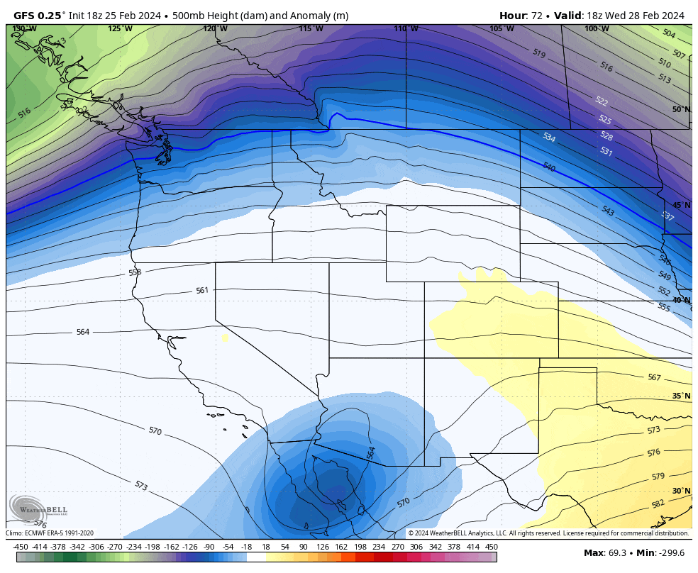
Next week’s deep trough moving across the western US. Source: maps.weatherbell.com
The active pattern continues past next weekend, with long-range models showing several more storms of varying intensities lined up to hit Colorado.