Forecast prepared 2100 MDT on March 29, 2024
Summary
The past week brought phenomenal skiing and riding to the Wasatch. I’m told Tuesday, in particular, is in contention for best of the season in the Upper Cottonwoods.
A very active weather pattern will persist through the holiday weekend, bringing another 1-2 feet of snow to the Cottonwoods. Other resorts in the state will also see plenty of freshies.
Conditions stay snowy as we head into April. There are two more systems to watch, one arriving April 5th-6th and the next sometime around the 8th-9th.
Brief Recap
The past five days have been impressive. Most resorts saw 25-50″ of snow between the 24th and 29th, with Alta and Brighton tied for deepest spot of the week at 51″ each.
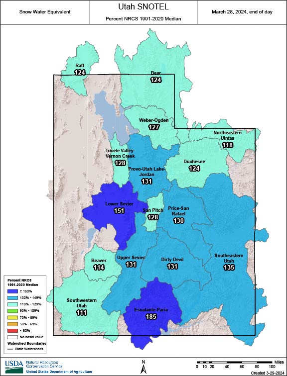
This active stretch has helped to set up a very healthy spring snowpack. Blue areas mean more snow than normal:
Weekend Forecast
More snow is coming tonight and through the weekend. As I write, snowfall is resuming in the Cottonwoods and will continue until Saturday morning as a warm front lifts northward through the area.
Northern Utah resorts should have a solid 2-4″ of new snow by the first chair Saturday. Snow will continue through most of the day and trend lighter through the afternoon. Riding conditions should be really nice by midday.
An atmospheric river will start to impact the state Saturday night. This will more heavily impact the southern half of the state, but all resorts will see snow from this feature as it overspreads the state overnight and into Sunday morning. Look for another 3-6″ for most northern resorts and 6-12″ down south from this wave.
Eventually, we flip to a moist northwest flow Sunday evening into Monday. Snow showers continue to produce new snow, especially in the Cottonwoods. We’ll finally dry out by Monday evening.
Saturday, Sunday, and Monday should offer fresh snow to ride. Saturday and Sunday’s snow will be a touch warmer/denser, with colder air slowly filtering in on Monday. I plan to ski something in the backcountry on Tuesday morning in hopes of slightly fluffier snow.
By then, I’m expecting the following:
- Alta/Bird: 12-24″
- Solitude/Brighton: 10-20″
- Park City/Deer Valley: 7-12″
- Sundance: 7-12″
- Snowbasin/Powder Mtn: 6-14″
- Brian Head: 6-12″
- Eagle Point: 5-10″
Long Range Powder Prospects
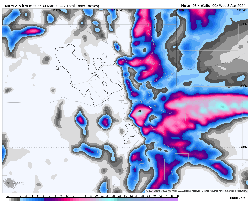
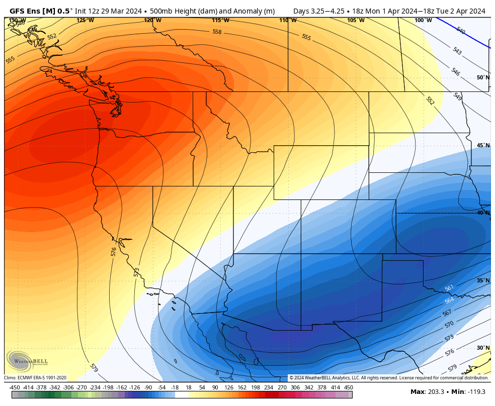
It’s looking pretty good after this weekend, too. We’ll have a few days of sun next week before another storm system pushes into the West sometime April 5th-6th:
This is a pretty good look for more heavy snow. We look to stay active, too, with another chance at a storm around the 8th or 9th.
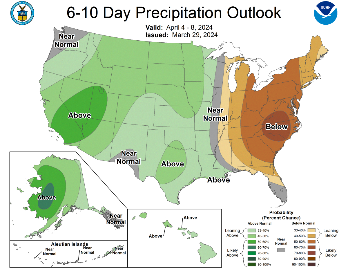
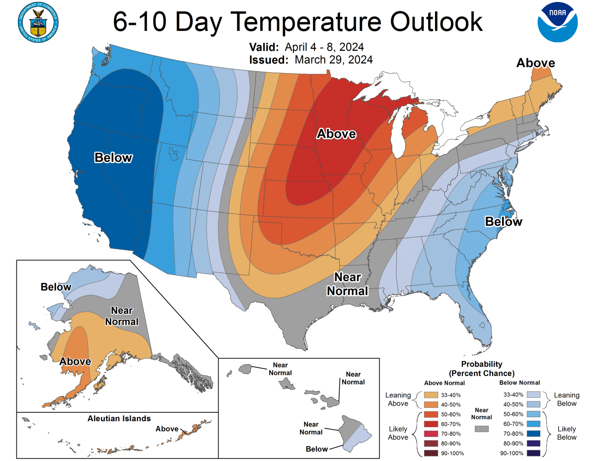
CPC long-range outlooks look nice: