Forecast By SnowBrains Chief Meteorologist – Eric McNamee
8:20 pm MST, 10/20/2021
Forecast Summary:
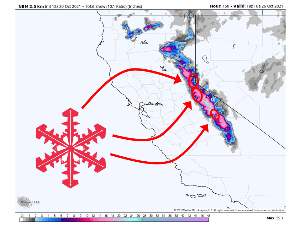
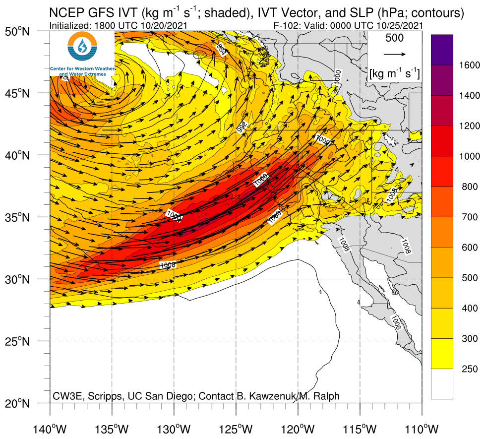
An atmospheric river will slam into the Sierra Monday and bring FEET of snow to the high Sierra through Tuesday.
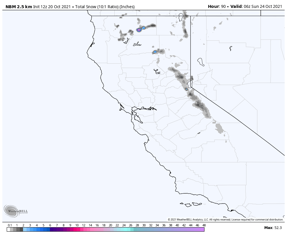
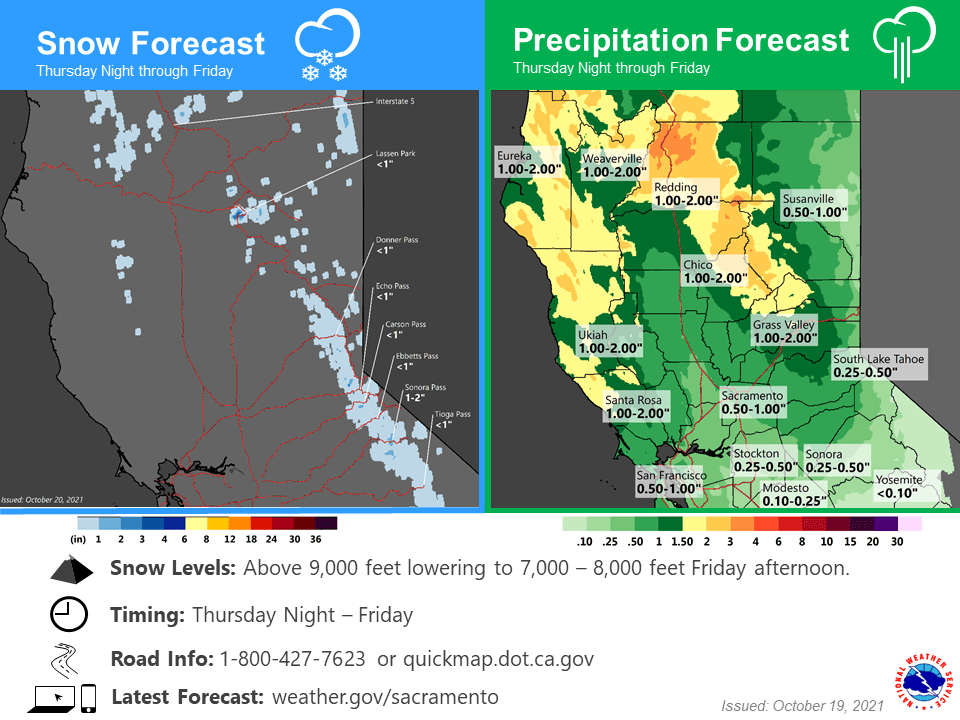
Before then, a separate system will hit the Sierra Thurs night/Fri, primarily bringing rain with light accumulations in the high elevations.
At least 1-2 feet is possible at the base of Kirkwood and Mammoth, with more the higher in elevation you go.
About 1-2 feet is possible around Tahoe.
An active pattern looks to continue in the long term.
Short-Term Forecast:
Thursday-Saturday:
A warm atmospheric river will hit the Sierra Thursday night through Friday and primarily bring rain, with some light snow accumulations.
Snow that does accumulate will be pretty high in elevation.
Conditions will then temporarily dry out Friday night before the next system moves in on Saturday.
Like the first system, this will be warm and primarily bring rain.
Long-Term Forecast:
Wednesday-Saturday:
Precipitation will pick up Sunday evening as the main event moves in and brings FEET of snow to the Sierra Monday/Tuesday.
Snow levels will start high with this event too but drop quickly as colder air moves in.
Right now, it looks like snow levels will drop to around 5,500-6,500 feet by Monday.
As mentioned, at least 1-2 feet is possible at the base of Kirkwood and Mammoth, with more the higher you go up in elevation.
About 1-2 feet is possible around Tahoe.
There is still quite a bit of time leading up to this event, so snow totals could change, but trends have been consistent as of late.
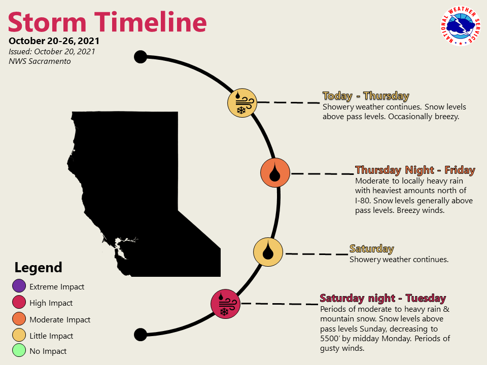
Sunday night through Monday is the time frame expected to see the
strongest impacts. Heavy rain and gusty winds are expected. Snow
levels are expected to lower to 5500 to 6500 feet by Monday
morning leading to the possibility of 1 to 2 feet of snow to fall
at pass levels through Tuesday. Chain controls and hazardous
mountain travel is likely.
- NWS Sacramento 10/20/2021
Extended Forecast:
Sunday and Beyond:
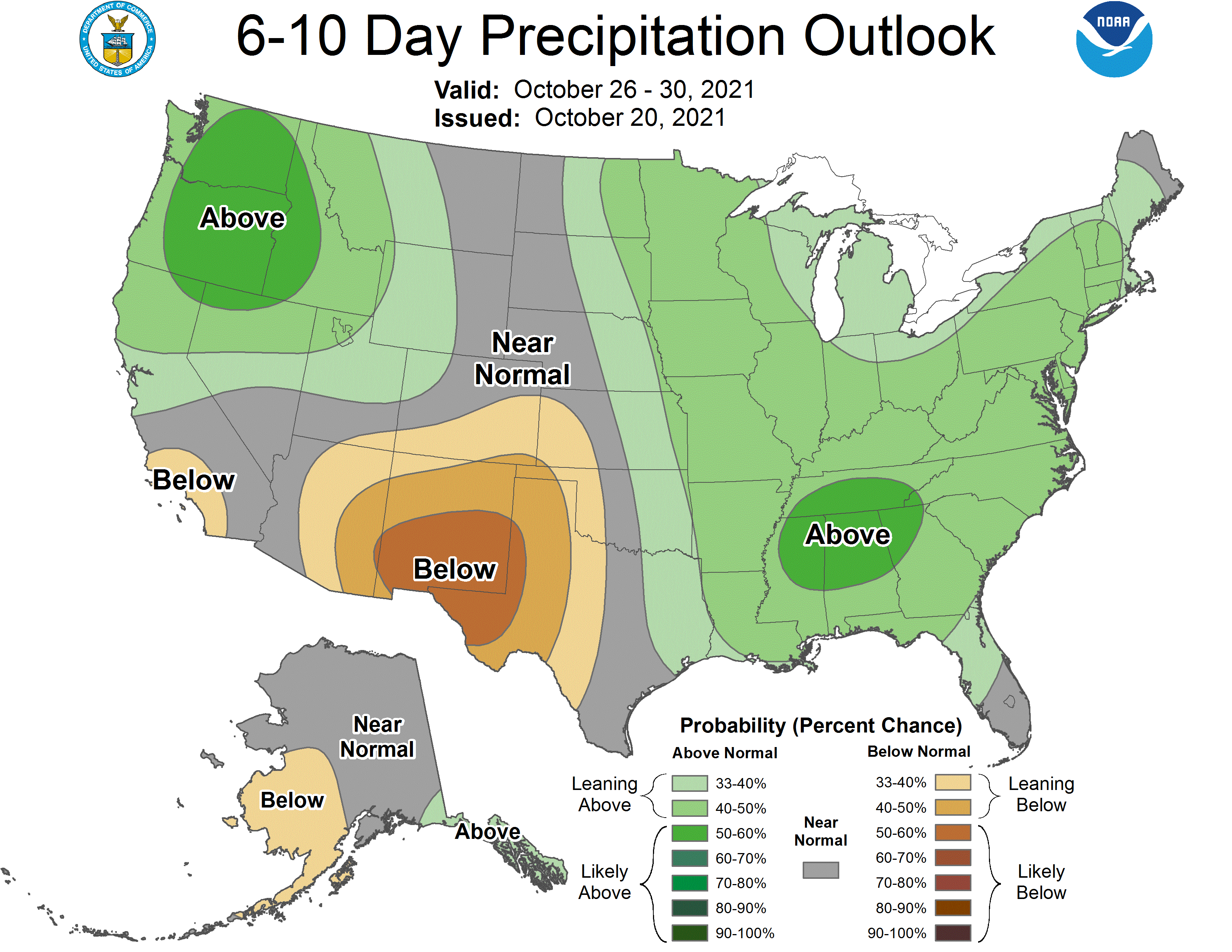
Global ensembles are indicating above-average precipitation across the northern part of California.