Forecast By SnowBrains Meteorologist – Eric McNamee
12:10 PM MST, 2/24/2021
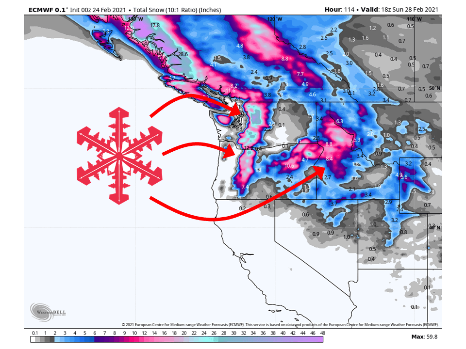
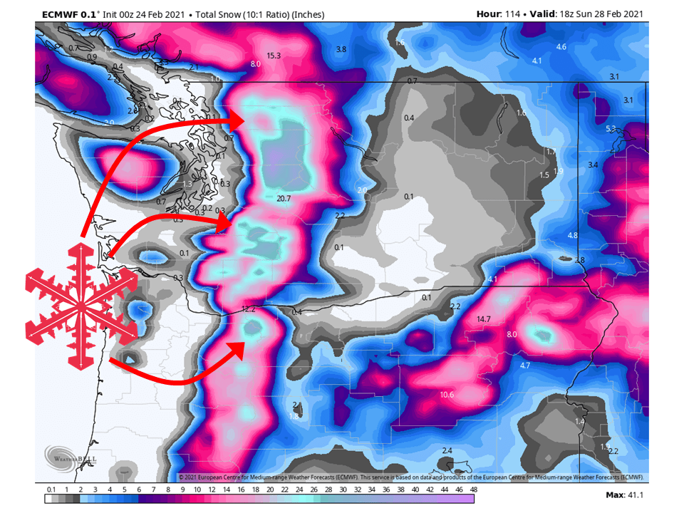
A series of shortwave troughs will move the northwestern US through Saturday, bringing 1-4 FEET snow, with higher amounts in the High Cascades.
Snow levels are expected to remain below pass level with colder air already in place.
Another system will move through briefly Sunday/Monday.
Conditions are expected to dry out heading into next week as high pressure builds over the region.
Short-Term Forecast:
Wednesday-Friday:
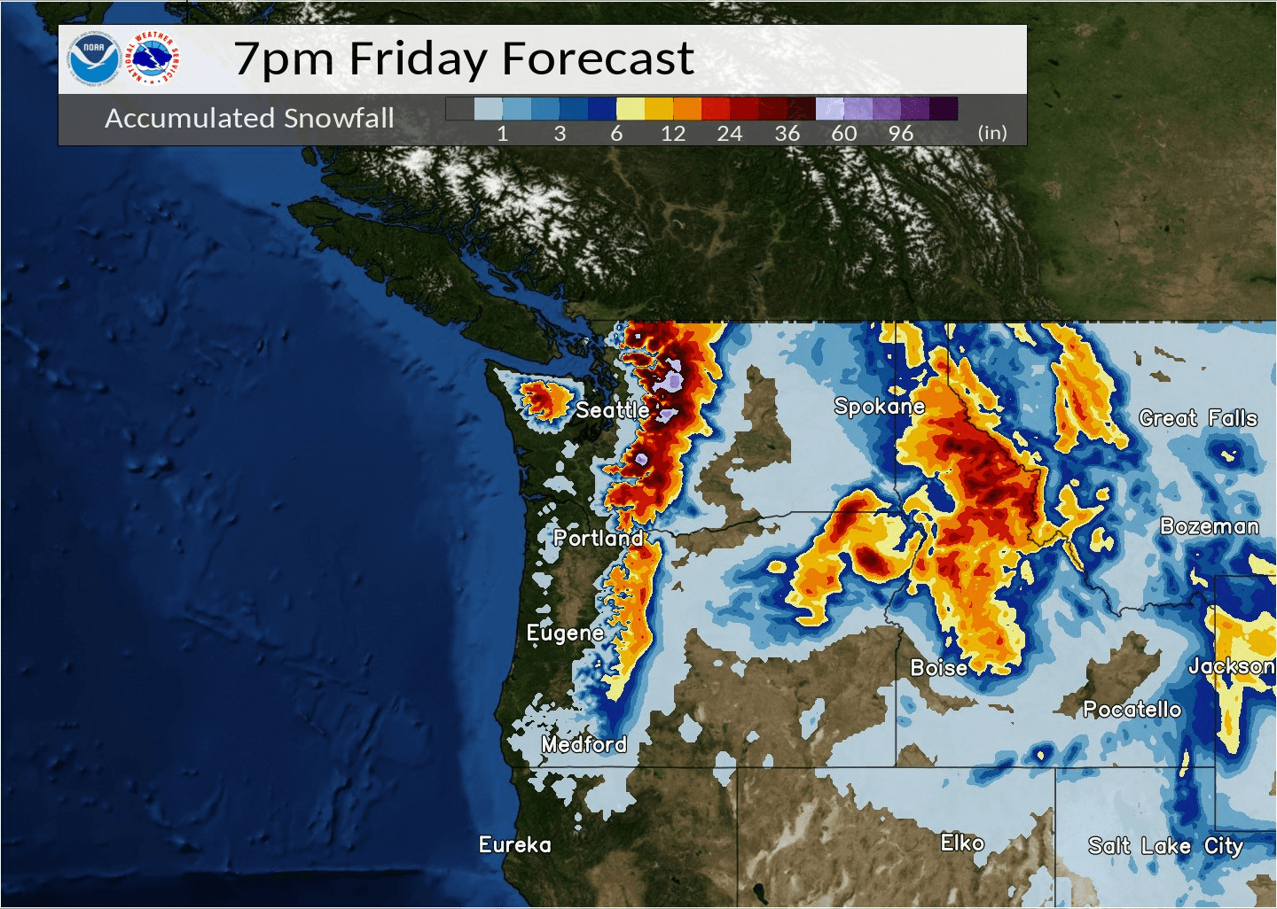
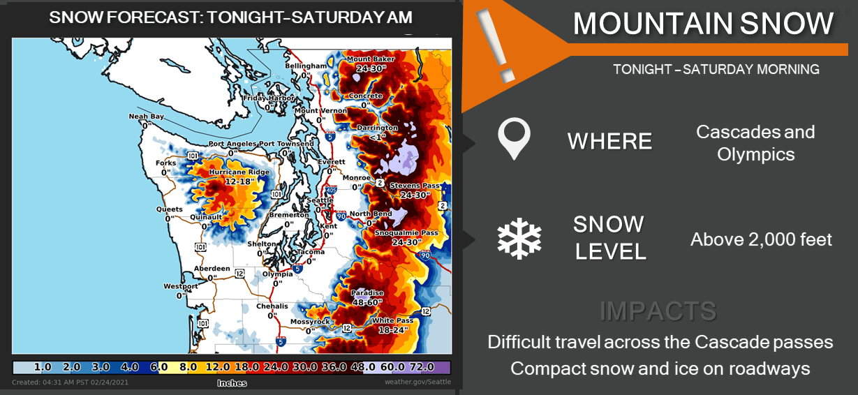
The first wave of moisture will slam into the PNW tomorrow, bringing 12-18″ of snow to the Washington Cascades through Thursday night.
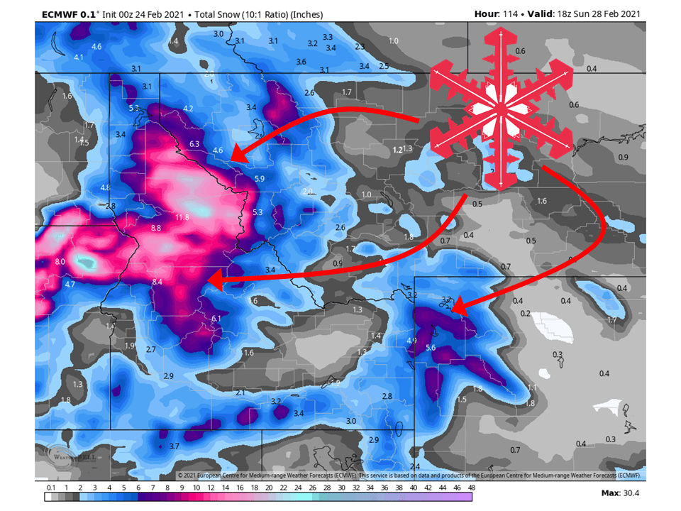
This same wave of moisture will fill in across the Northern Rockies Friday and drop 8-12″ of snow to Northern Idaho and Western Montana.
Continued onshore flow will keep snow going in the Cascades Friday, bringing an additional 1-2 FEET of snow.
Long-Term Forecast:
Saturday-Tuesday:
Snow will continue through the day Saturday under unstable flow from the WNW.
This will result in an additional 6-12″ of snow to fall in parts of Northern Idaho and Western Idaho Saturday.
Conditions will dry out temporarily Sunday before another disturbance moves through Monday.
Extended Forecast:
Sunday and Beyond:
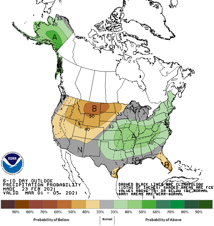
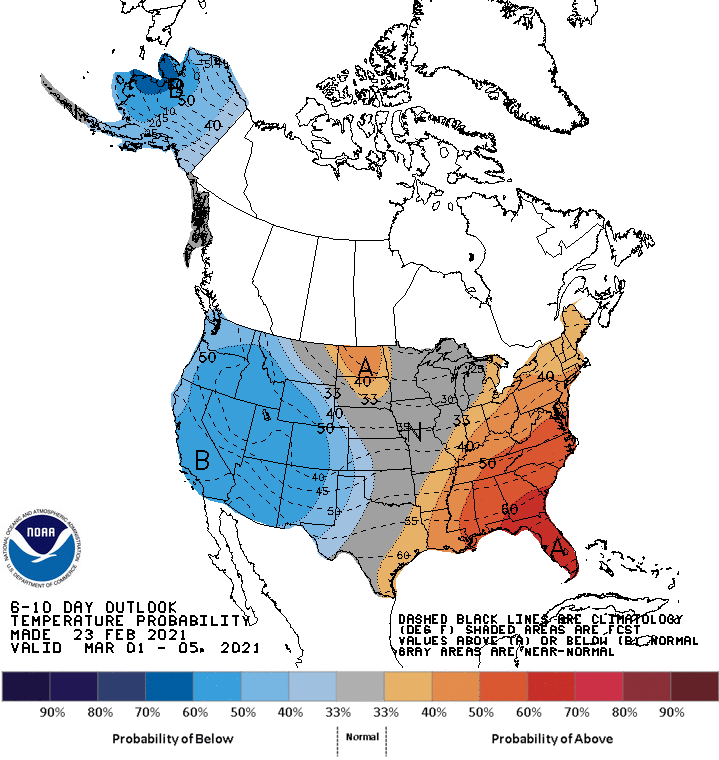
Global ensembles indicate below-average temperatures and below-average precipitation across the Northwest US through the extended period.
Pacific Northwest:
The Pacific Northwest looks to fair pretty well, primarily Washington, with 2-4 FEET of snow falling through Saturday and more likely in the highest elevations.
Resorts that look to see the most snow are Crystal Mountain, Alpental, Mt Baker, Stevens Pass, Hoodoo, and Timberline.
Northern Rockies:
The Northern Rockies will fair pretty well through Saturday with 1-3 FEET of snow falling.
Resorts that look to see the most snow are McCall, Tamarack, Schweitzer, Grand Targhee, and Jackson Hole.
USA:
Global ensembles indicate below-average temperatures and below-average precipitation across the Northwest US through the extended period.