Written by SnowBrains Meteorologist Nathan Tarino
Forecast Updated 2/12/23
Forecast Summary
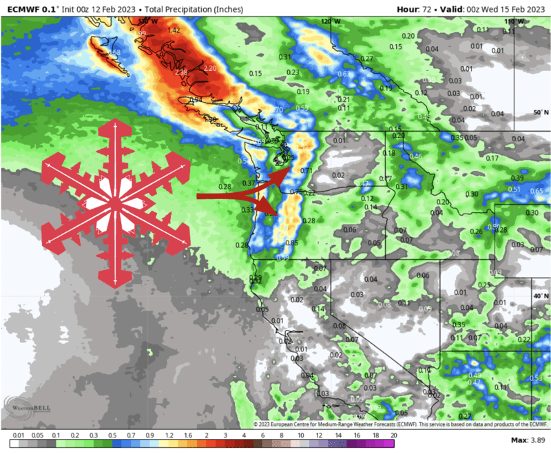
An excellent storm is on the way to the Pacific Northwest. Snow will fall over the Cascades Sunday night through Tuesday, with excellent skiing on Monday and Tuesday. Snow levels will get low, making for high-quality snow at the resorts.
Monday looks like the day to ski in Washington, and Tuesday looks best if you’re in Oregon. But both days will be pretty good across the region, either way.
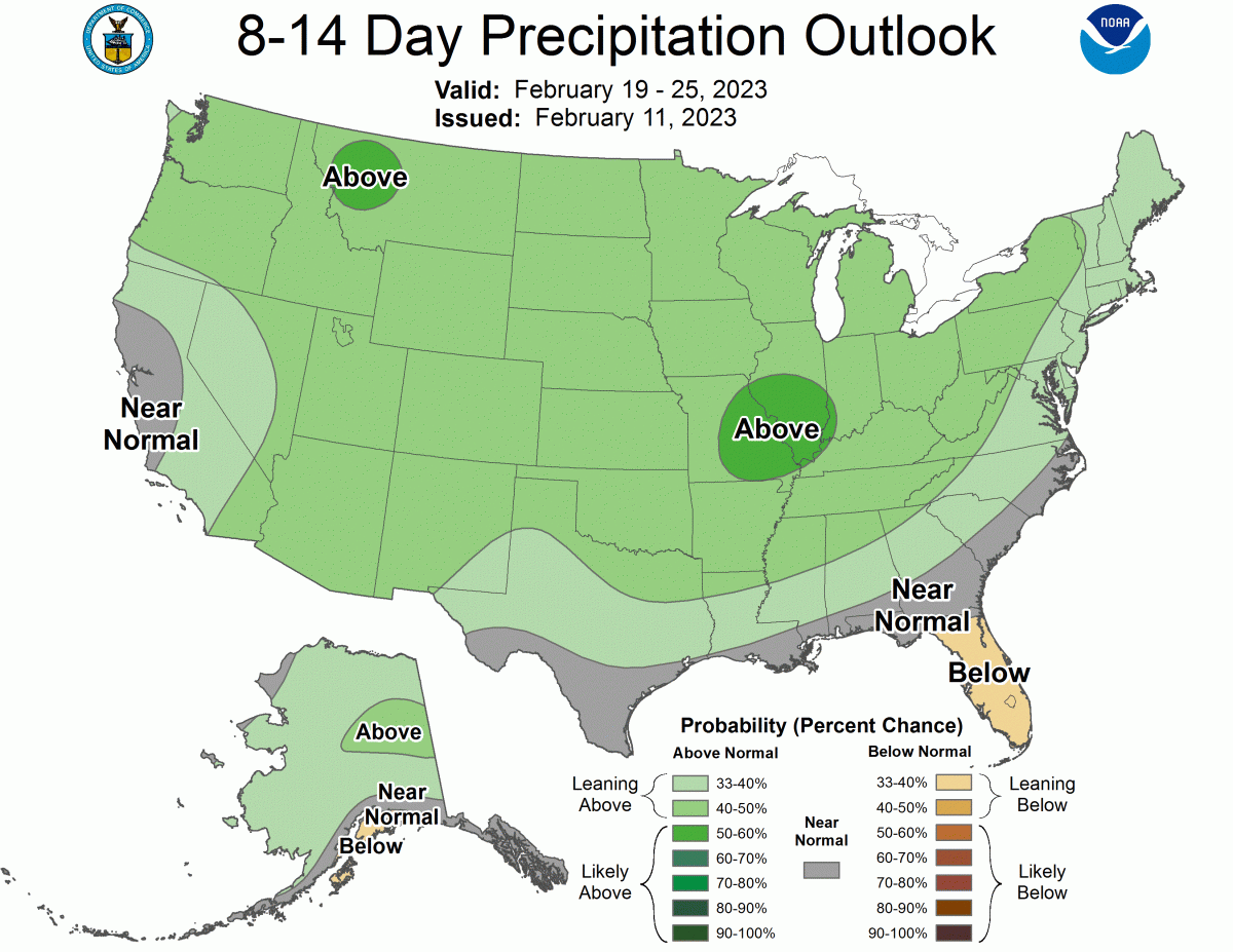
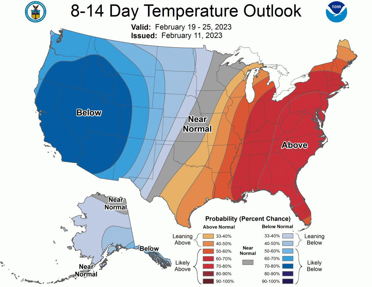
The long-range forecast outlook inspires some stoke, too, with the cool and active weather forecasts to close out the month.
Short Term Forecast
In Washington:
A couple of mountain snow showers fire up by Sunday evening, then trend much heavier around midnight as a frontal band of snow moves through. After a few hours of steady snow, a long-duration barrage of convective snow showers will keep the snow coming through the day Monday.
Snow levels, initially as high as 4500′ or so, will very quickly crash down close to 2500′ by Monday morning, falling further through the day to around 500′ by Monday evening.
Snow tapers off late Monday, though a couple of showers linger through the night.
Monday will be the best day to ski across the state. A bit of extra snow is likely after resorts close up on Monday, so Tuesday may also offer some soft turns.
By Tuesday morning, expect the following storm totals:
- Mt. Baker: 12-18″
- Crystal: 10-16″
- Stevens Pass: 12-18″
- Alpental: 10-16″
In Oregon:
A deteriorating and, by this point somewhat anemic band of snow will show up by early Monday morning, bringing the first burst of snow. A long-duration period of sporadically heavy snow showers will continue after that through the day on Monday and into Tuesday. Heavy snow is likely early Tuesday morning as an embedded disturbance pushes through the area, too.
Snow levels initially near 4500′ will quickly fall to 2500′ by midday Monday and eventually down comfortably under 1000′ by Tuesday morning. Not something you see all the time in Oregon, and such a cold airmass will make for unusually low-density snowfall through most of this storm. It should make for some genuinely great conditions.
Fantastic skiing/riding will exist on Monday and Tuesday, but I think Tuesday will be the more spectacular of the two.
By Tuesday evening, expect the following storm totals:
- Mt. Hood (Meadows & Timberline): 12-20″
- Willamette Pass: 10-18″
- Bachelor: 14-22″
- Hoodoo: 8-14″
Extended Outlook
Though a few days of drier weather will follow up this dump, early indications suggest a favorable upper-level pattern may set up as we head into the later parts of February. Ensembles show a trough developing over the northwest closer to the end of the month, which would likely bring another stretch of cold and snowy weather.
The CPC’s extended outlooks reflect this: