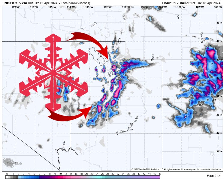
NWS Snow Forecast. Source: maps.weatherbell.com
Forecast Summary
Forecast written on Sunday, April 14, 2024, at 9 p.m. MST
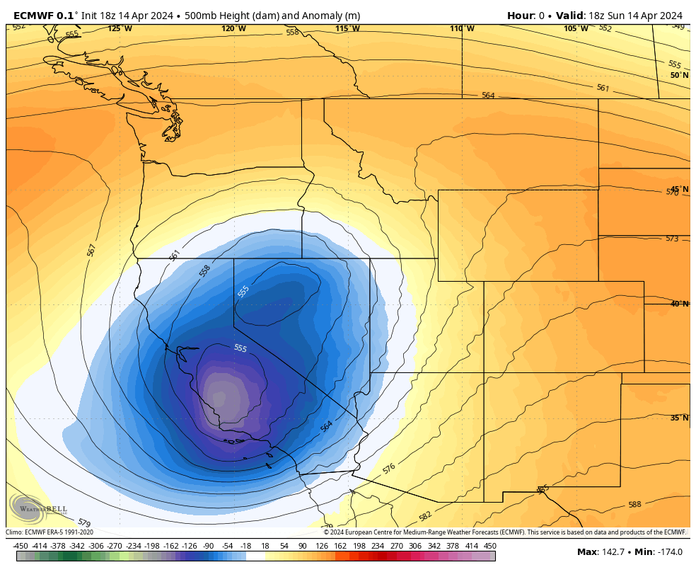
A low pressure system moves west-to-east across Southern Utah on Monday.
Widespread valley rain and mountain snow begin tonight and continue all day Monday before tapering off Monday night.
A much drier pattern sets up for the next week beginning on Tuesday.
Low tracking across Utah on Monday. Source: maps.weatherbell.com
A low-pressure system is moving into Utah, producing scattered rain/snow showers. Rain/snow becomes more widespread on Monday morning, with the bulk of precip falling as snow across the high points of the Wasatch Mountains.
Steady snow continues all day Monday, with heavy snow expected at times across Central Utah. Snow levels vary between 6,000 and 7,000 feet, so some resorts may see a significant amount of their precipitation fall as rain, at least at the base.
Estimated Snow Totals:
- Alta/Bird: 10-18″
- Solitude/Brighton: 8-16″
- Park City/Deer Valley: 2-6″
- Snowbasin/Powder Mtn: 2-5″
- Brian Head: 8-14″
- Eagle Point: 7-15 ″
Extended Forecast
After this storm, the Western US enters a dry pattern for the next week or more. Next week looks mild and dry, so take advantage and hit the slopes!
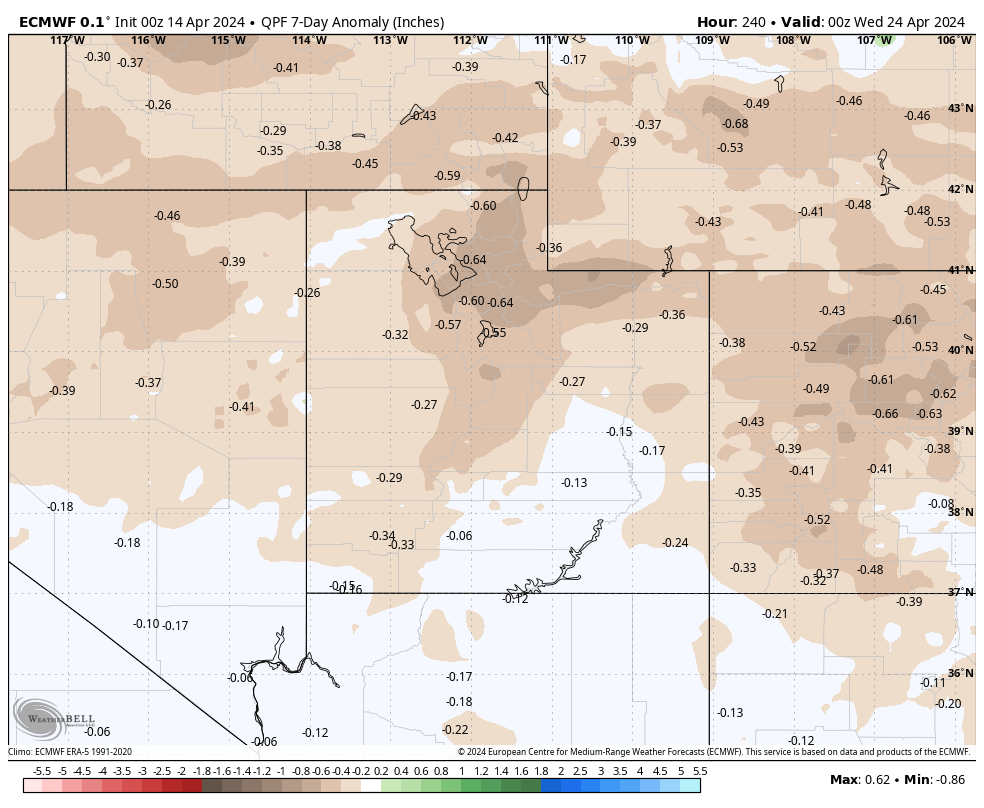
Precip anomalies for next week. Source: maps.weatherbell.com