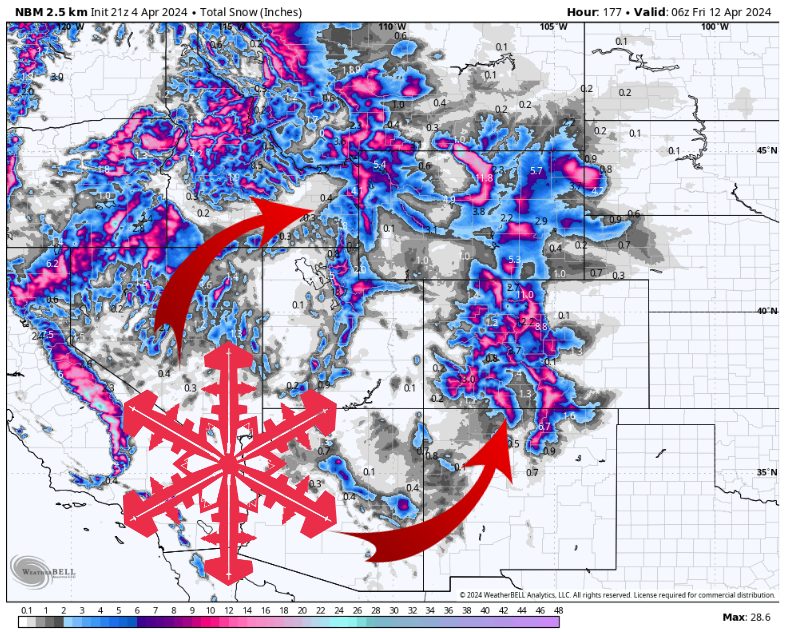
Expected snow totals this week. Source: maps.weatherbell.com
Forecast prepared the morning of Friday, April 5th
Forecast Summary
A strong cold front arrives in Utah and Western Wyoming Friday afternoon, and Colorado overnight, with very strong winds out ahead of the front followed by mountain snow behind the front. This front brings relatively light snow accumulations to UT/CO resorts, but hangs around a bit longer and produces a bit more snow around the Tetons in WY.
Snow showers continue on Saturday, primarily for Utah and Wyoming, with some convectively-enhanced snow showers expected at times. There is a lot of atmospheric instability, so snow showers are expected to produce locally heavy snow, at least for brief periods. The Cottonwoods in UT likely get the most snow of anywhere on Saturday, with widespread showers popping up in the UT desert.
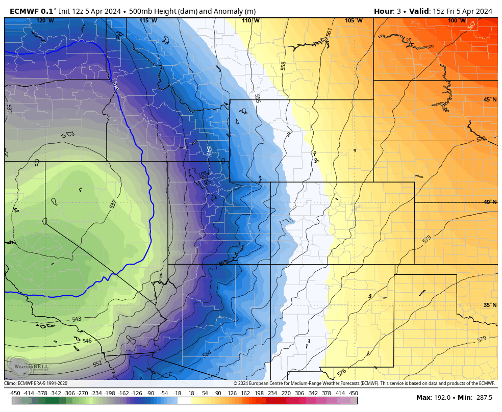
The first low splitting off into a second low. Source: maps.weatherbell.com
Another low pressure system keeps snow going, primarily in Colorado, Monday and into Tuesday. This low is weaker than the first, but is still strong enough to produce up to 1′ of snow in spots across Southern Colorado.
Forecast snow totals for major CO/UT/WY resorts through Tuesday:
- Steamboat (CO): 3-6″
- Telluride (CO): 6-12″
- A Basin (CO): 8-18″
- Cottonwoods (UT): 15-25″
- Snowbasin/Pow Mow (UT): 8-16″
- Grand Targhee (WY): 6-15″
- Jackson Hole Mtn Resort (WY): 5-12″
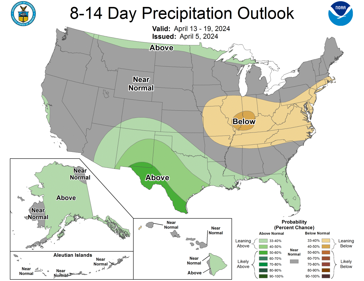
Extended Forecast
The Rockies enter a very dry pattern after Tuesday, with an enormous ridge sitting over the Western US. Temperatures climb up to well above normal next weekend ahead of another weak storm potentially setting up for the following week.
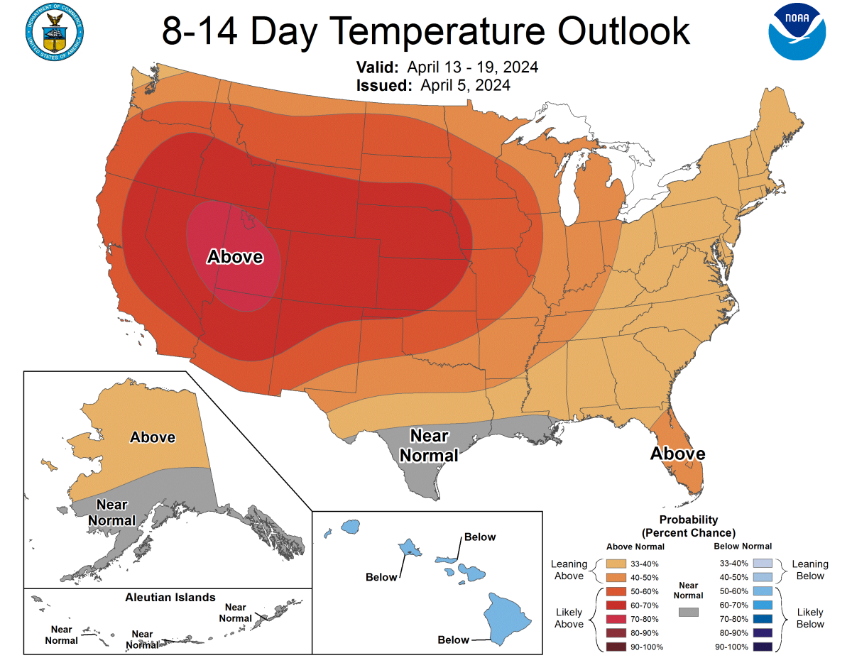
SPC 8-14 day outlook. Source: https://www.cpc.ncep.noaa.gov/products/predictions/814day/