In what seems to be a late-season miracle, California is about to get hit by its second major storm this week. This storm should drop as much as 2 FEET on resorts, favoring the central Sierra near Mammoth.
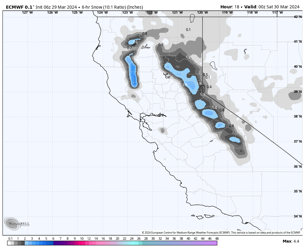
Precipitation at resorts begins early Friday afternoon and ramps up throughout the day and staying strong into the night. Daytime totals on Friday should be in the 1-4″ range for Tahoe resorts and 3-5″ at Mammoth. Below is the ECMWF projection for snowfall by the end of the day on Friday. Keep in mind that this is with a 10:1 SLR (in reality it will be higher), so keep in mind that this is likely under-forecasting:
Snowfall rates will peak sometime around midnight before steeply falling off by Saturday morning. By Saturday morning, here are forecasted storm totals:
- Western Lake Tahoe (Palisades, Sugar Bowl, Kirkwood): 6-12″
- Central Lake Tahoe (Northstar, Homewood): 6-10″
- Eastern Lake Tahoe (Mount Rose, Heavenly): 4-8″
- Mammoth: 16-24″
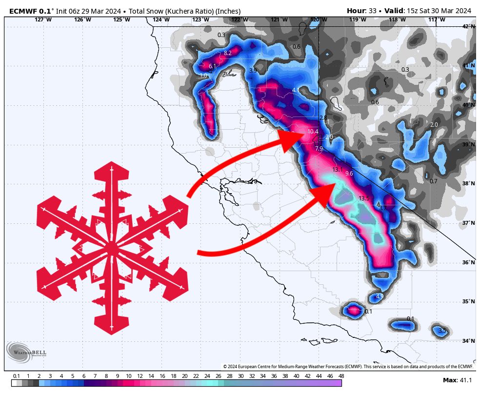
Below is the ECMWF storm total forecast by Saturday morning. Notice the central and southern Sierra favored:
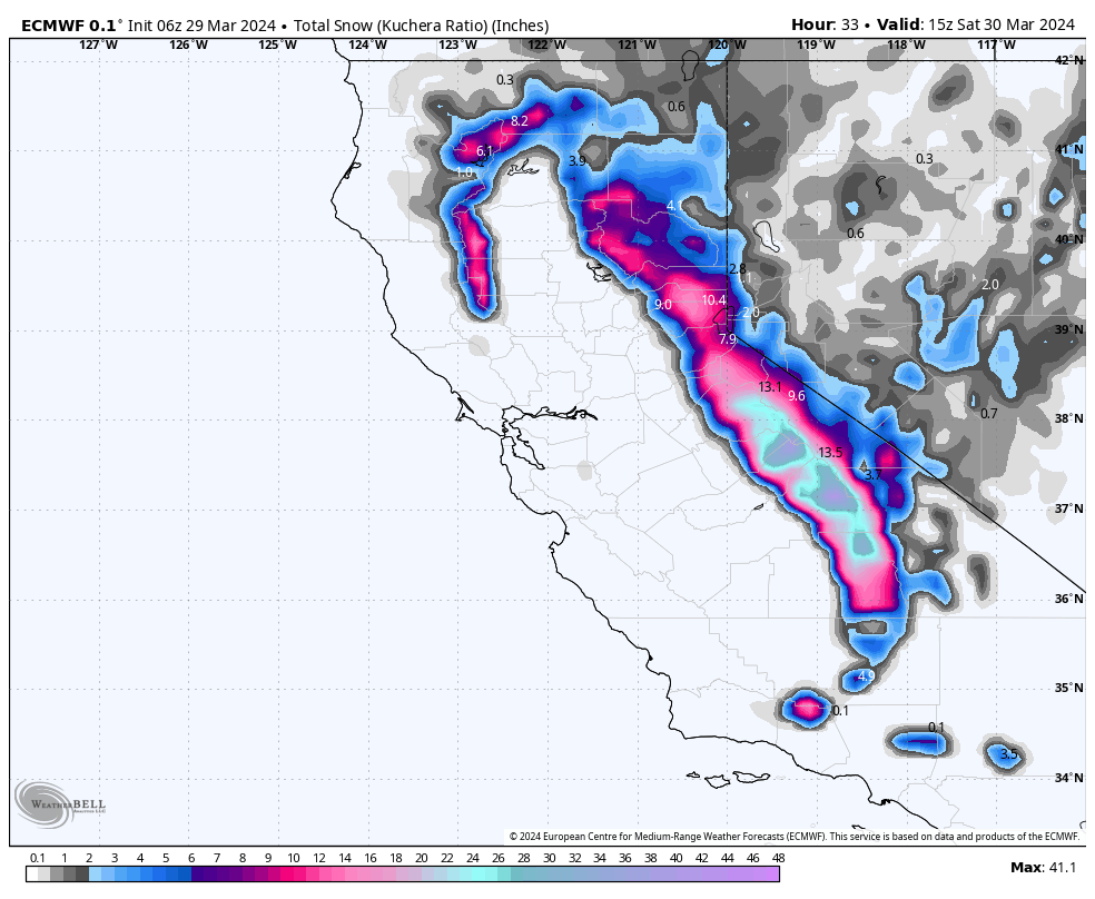
Clearly, Mammoth will be the winner on Friday night and will provide some excellent turns on Saturday. Not only will Mammoth see the most moisture, but their higher elevation will also mean colder temperatures and lighter density snowfall. Winds will be low on Saturday, so there’s a decent chance that mountains will be able to open their upper-elevation terrain once avalanche control is complete.
Precipitation will linger in the region over the next several days, primarily in the north near Tahoe. We’re likely looking at an additional 4-8 inches for Tahoe resorts by Sunday night.