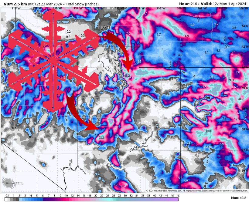
A week of snow building up in Utah. Source: maps.weatherbell.com
Forecast prepared the evening of Saturday, March 23
Forecast Summary
An active week in Utah begins Saturday night as a cold front brings several inches of widespread mountain snow.
Snow showers continue for the next few days, with some convectively-enhanced snow showers expected at times.
The active pattern continues through next weekend, but plenty of uncertainty when it comes to snow totals.
Near Term
A cold front is moving across Utah Saturday night, ushering in a swath of mountain snow. This first batch should produce a few inches of snow across most of the Northern Utah resorts before it dissipates overnight.
Snow showers linger into Sunday morning, becoming more widespread Sunday afternoon as daytime heating promotes the development of additional showers, some of which may produce briefly heavy snow. Location and timing of any of these heavier showers are almost impossible to forecast with reasonable accuracy, but wherever these showers end up, they could put down a quick inch or two of snow, with perhaps more over the highest summits.
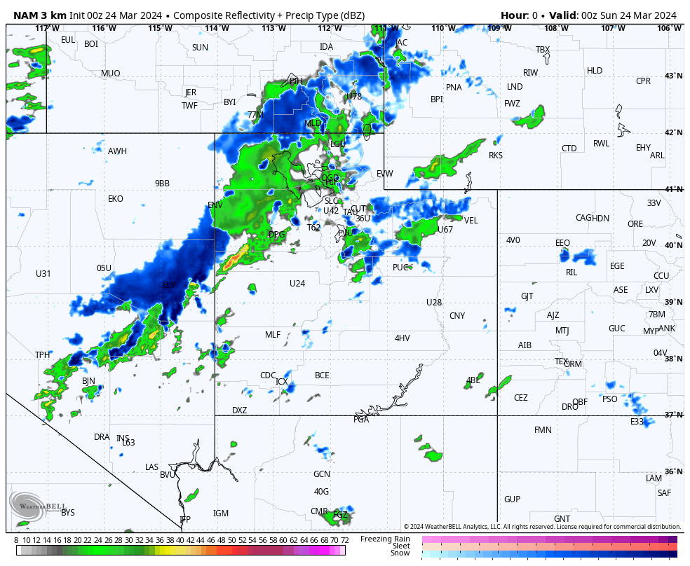
The initial band of snow, and snow showers increasing again Sunday afternoon. Source: maps.weatherbell.com
This pattern continues Monday and Tuesday, with a few snow showers at night, increasing in coverage during the daytime.
Estimated Snow Totals Through Tuesday:
- Alta/Bird: 12-24″
- Solitude/Brighton: 10-18″
- Park City/Deer Valley: 6-12″
- Sundance: 4-12″
- Snowbasin/Powder Mtn: 6-18″
- Brian Head: 6-12″
- Eagle Point: 5-10″
Extended Outlook
There is a brief dry period on Wednesday as the cold air and instability recedes.
However, another cold front may move in again on Thursday, at least for a short time. Utah appears to be right on the southern edge of an unstable airmass on Friday and most of the weekend. Depending on where exactly that airmass ends up, it could result in significantly more snow or next to nothing.
As for next week, it looks like the pattern remains active and unusually cool. This setup is ideal for an extended ski season.
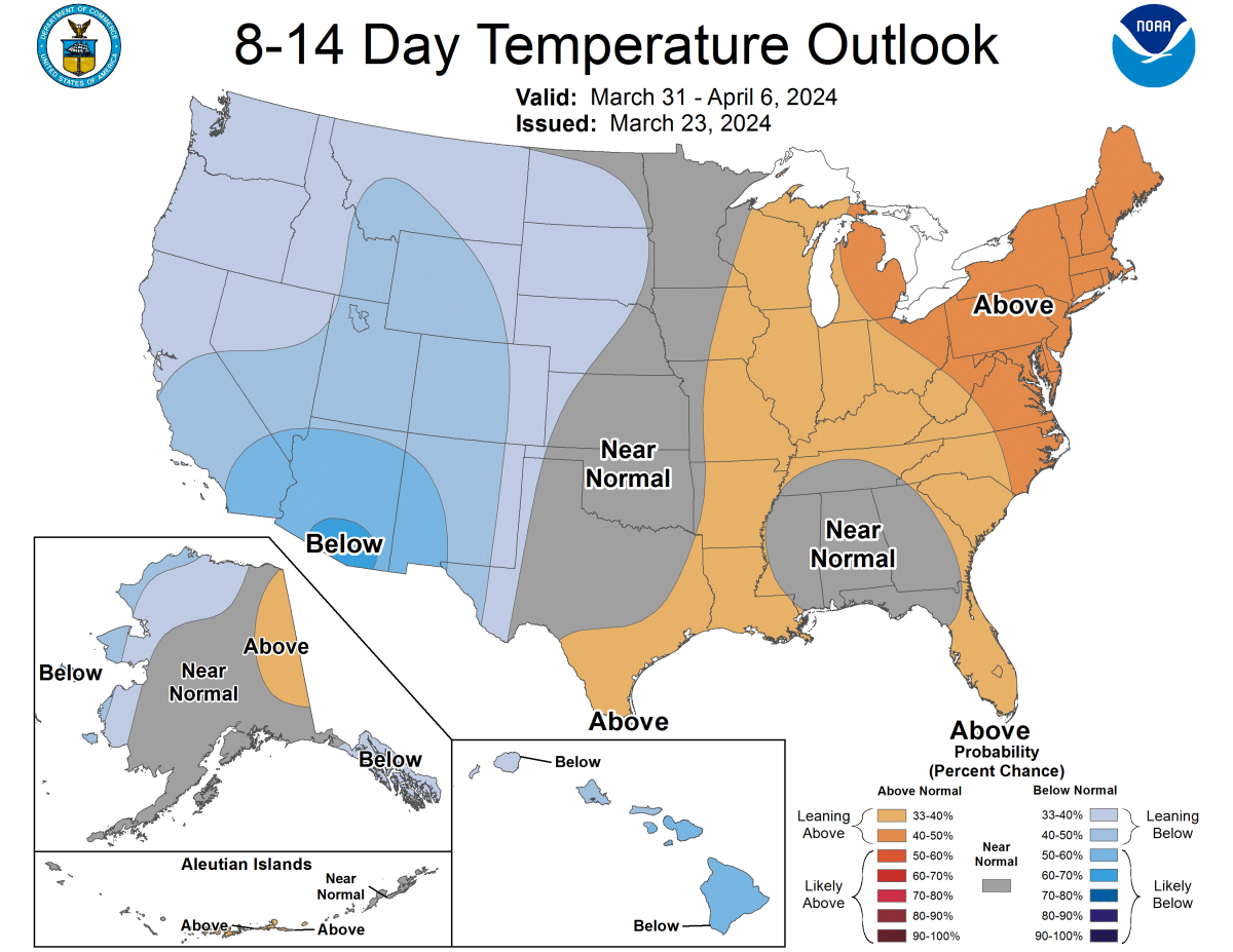
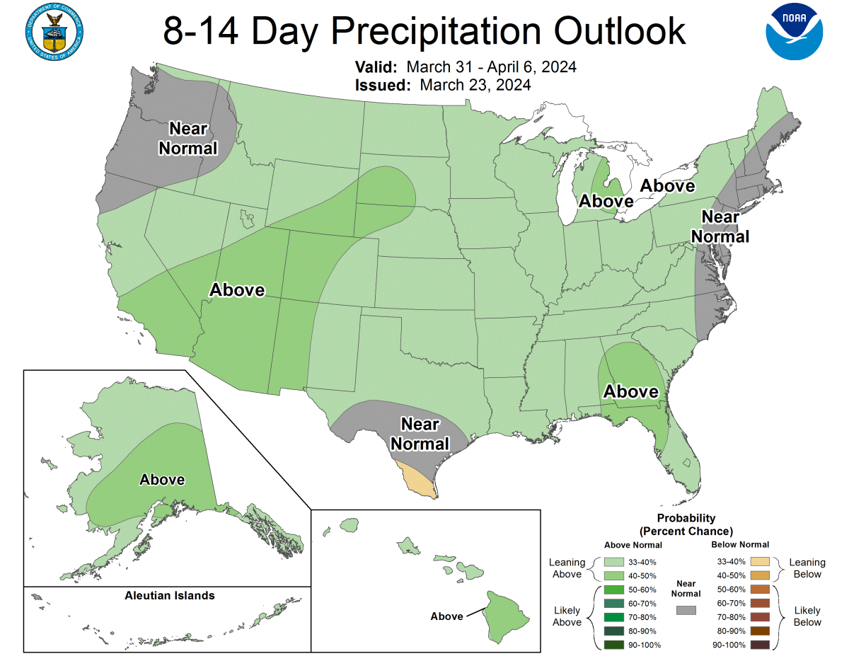
Source: https://www.cpc.ncep.noaa.gov/products/predictions/814day/