This forecast was written by Clay Malott at 9 pm PST on March 13th, 2023
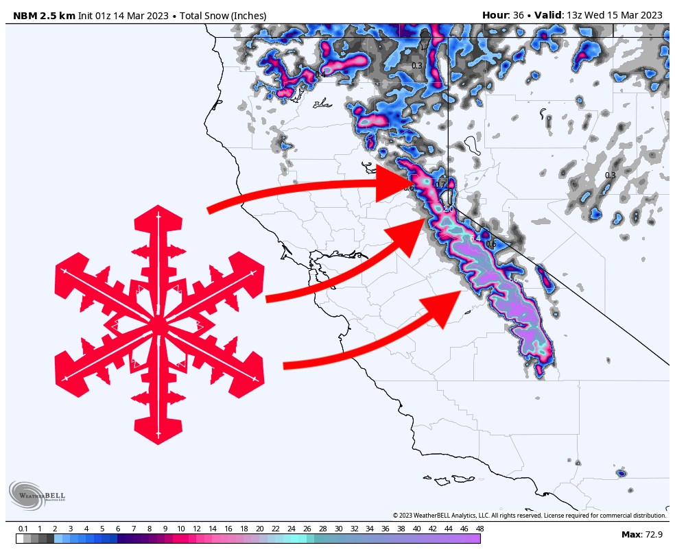
In what feels like an endless series of storms, California will be slammed yet again this week, bringing another 1-3 feet to an already record-breaking snowpack.
The first moisture arrives on Monday night. Temperatures will be fairly warm overnight but will still allow precipitation to remain all snow, albeit heavy and wet. By Tuesday morning, here are what I see as realistic totals around the region:
- West Tahoe basin (Palisades Tahoe, Sugar Bowl, Kirkwood): 6-10″
- Central Tahoe basin (Northstar, Homewood): 3-6″
- East Tahoe basin (Heavenly, Mt. Rose): 3-5″
- Mammoth: 2-5″
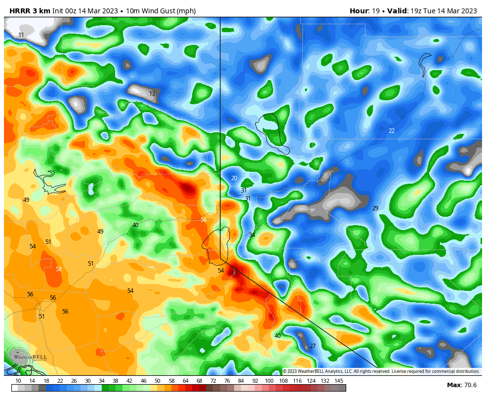
Tuesday presents a tricky forecast, with temperatures at the resorts bringing a complicated combination of rain, mix, and snow. Snow levels will peak in the early afternoon at around 7,500 feet, although mixed precipitation could make it several hundred feet below that. Precipitation will be very intense during the day, meaning regardless of the precipitation type, it will be a very wet day of skiing full of rain, mix, and wet, creamy snow. Tuesday will also be extremely windy, with 50+ mph gusts along the ridges:
Temperatures plummet on Tuesday evening and will allow the precipitation type to return to snow. By Wednesday morning, here are what I see as realistic overnight totals:
- West Tahoe basin: 8-12″
- Central Tahoe basin (Northstar, Homewood): 3-7″
- East Tahoe basin (Heavenly, Mt. Rose): 6-9″
- Mammoth: 10-15″
I could see Kirkwood picking up as much as 15″ or more on Tuesday night due to its higher elevation. If I were chasing powder on Wednesday, that’s where I’d be headed!
The precipitation will be basically done by Wednesday morning. Temperatures will remain very mild this week, so be sure to stay on north-facing slopes for the best-kept powder after this system!
The next opportunity for major storminess will come at this time next week, around the 20th-22nd. Keep an eye out for an updated forecast later this week with more details on this system!
Atmospheric river. Soon to be washed out to the ocean. So CA reenters it’s drought conditions. As per the political agenda of CA’s preference.
Too bad they don’t embrace the benefits of building dams. Goofball enviroMENTALISTS get in the way.
A large part of CA is a desert BTW.
Much of the central valley is desert but was changed into productive farmland via large reservoirs and ditch systems built in the late 1800’s and early 1900’s. LA & SD are desert areas that rely on water infrastructure and dams built in the early 1900’s.
CA as it is now could not exist had this infrastructure not been built 100 years ago. Why did modern day Californians lose the ability to new build dams and ditches? Did they forget how to do it?