California is currently on the tail end of one of the most significant atmospheric river events in the past decade, dropping 60-100″ across most of the Sierra Nevada mountains.
While the atmospheric river is poised to shortly fizzle out, a highly active pattern is in store for much of the West next week.
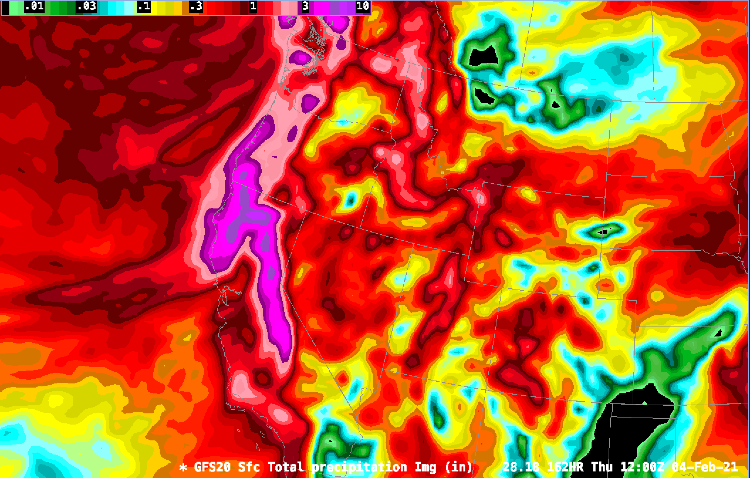
Below is a look at the GFS forecast for QPF (not snowfall) over the next seven days.
As you can see, the forecast is looking productive for most of the west. The Pacific coast, including California, Washington, and Oregon, are favored heavily. The Wasatch, Tetons, and parts of Idaho will also do well. The Rockies will still receive respectable snow totals.
Exact snowfall forecasts
I forecast snowfall by taking the mean QPF of a number of different forecast models and multiply by calculated SWE ratios using the Kuchera method. If I missed your resort, let me know in the comments, and I’ll add it as soon as possible!
Mt. Baker: 2.5″ SWE // 32″ snowfall
Squaw Valley: 4.4″ SWE // 52″ snowfall
Jackson Hole: 1.5″ SWE // 20″ snowfall
Alta: 1.65″ SWE // 23″ snowfall
Snowmass: 0.7″ SWE // 11″ snowfall
Wolf Creek: 1.15″ SWE // 22″ snowfall
Just looked at the Sun Valley website and they appear to be in the bulls eye of the northern track as they are showing 31″ in the last 24 hours and a winter storm warning is in effect until Friday 5 pm with another 6-16″ forecast.
New storm total at Sun-Valley is over 51″ and still snowing.