
Here we go again. It’s hard not to get discouraged. The climate models looked so promising the last week of October, now not so much…
California is sitting under an omega blocking ridge. An omega ridge is characterized by a low-high-low from west to east, which doesn’t break down very easily. Geographically for Tahoe it is delineated by a upper trough by the dateline, an upper ridge in the far west, and an upper trough for the Eastern continental U.S. This pattern is commonly a very persistent one which typically takes 21 days to cycle.
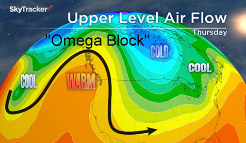
An omega block is ordinarily characteristically warm.
So basing our outlook on a typical ridge cycle of this nature, with the development of the ridge on the 2nd of November our first shot at a storm would be around the 23rd of the month. Sounds crazy but it is supported by the positive Pacific North American pattern (+PNA) for at least the next two weeks. If this outlook holds that would take us through the 20th. The current +PNA is most likely being aided by the warm water along the Pacific coast, which stretches all the way up into the gulf of Alaska.

Currently the models are contradicting the prediction of a 2-3 week dry spell. The European Model (EMCWF) has a trough for the 11th. The Global Forecasting System (GFS) shows a trough for the 13th-14th, although we would be on the southern fringe. Then another trough in the GFS for the 19th that digs farther south and hits Tahoe. Needless to say there is no continuity in these models. The possibility that the ridge breaks down sooner than expected is plausible, but for now going to stick with the dry forecast until sometime between the 21st-23rd.
So much for a big November (245% of normal) the Climate Forecasting System was forecasting. Normal precipitation for Tahoe City is 4.41 inches of liquid in November. If we are going to attempt to break even it looks like we will be waiting for the last week of the month to make it happen. Completely going to disregard the CFS (Fantasy Charts) for this post the way it has been performing, it currently cant be trusted.
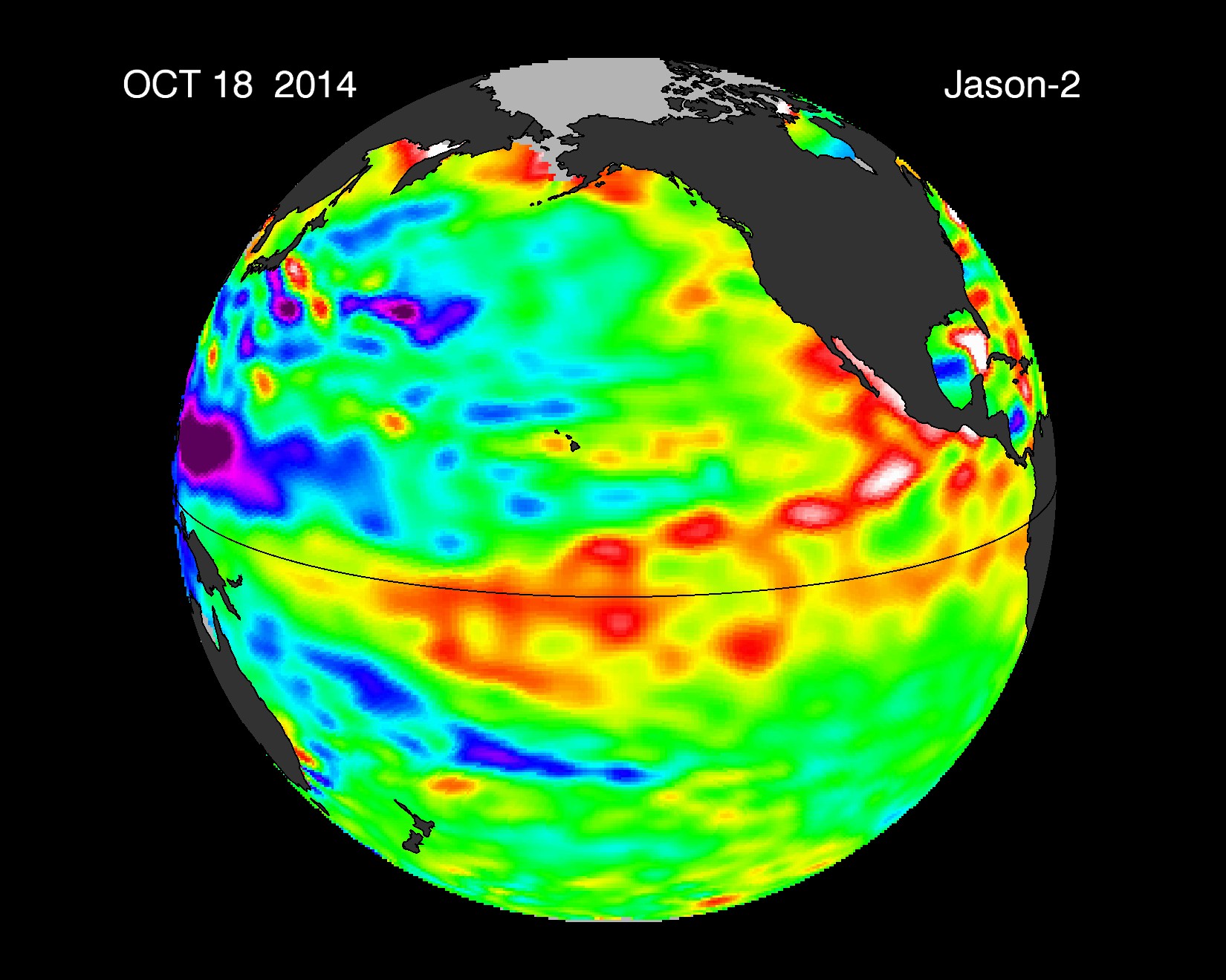
El Nino Update
It looks as though the Kelvin Wave activity is finally rising to the surface in the El Nino Basin. The sea surface temperatures anomalies (SSTA’s) in the Nino 3.2 region has increased from .5C to .71C. We want to see it continue to rise up to 1 degree Celsius. The Nino 3.4 region near the dateline SSTA’s are between .9 degree C and 1 degree C. It’s hard not to get discouraged when you are starting off a 2-3 week dry spell. Nonetheless El Nino is continuing to intensify! As far as El Nino is concerned we are heading closer and closer to reaching moderate. All we need now is for the reaction with the atmosphere to trigger and major changes will begin to occur!
RIP Tahoe skiing
Better it happens now than in December right?
You are not mentioning that there is a super typhoon in the Pacific which is influencing the ridge formation. If that storm wasn’t there, we’d likely be in a different pattern. I do see why everyone is concerned considering this is how winter looked most of last season.
And last year sucked
Great. It is seriously sickening to think we could have another and 4th year of this. Wow…