Noaa has lowered the snow levels from 8,500 feet to 7,000 feet. This is a good thing. Maybe we’ll get a crack at some damn fun skiing tomorrow morning. Tomorrow you’ll want to head straight up to Granite Chief to get the most snow with the best quality
NOAA.gov:
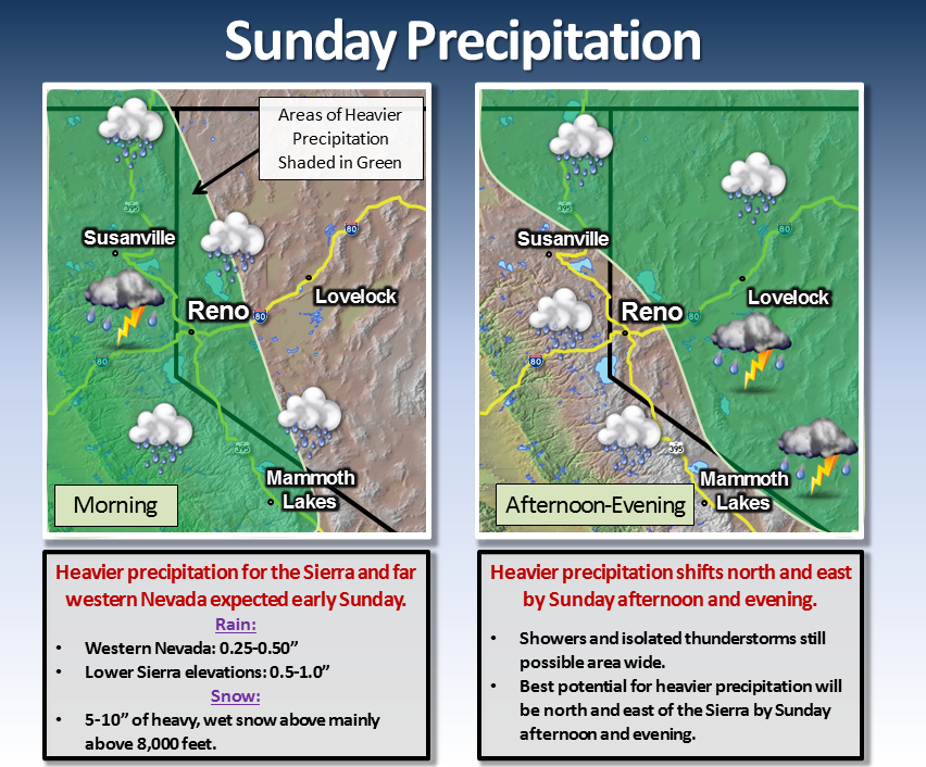
“A low pressure system off the central California coast will increase shower and isolated thunderstorm activity by Sunday morning. The first round of heavier precipitation will occur along a front across the Sierra and far western Nevada Sunday morning with up to a quarter inch to one half inch of rainfall possible for western Nevada. Across the Sierra, snow levels will fall to near 7,000 feet by Sunday afternoon. A slushy 1 to 2 inches of accumulation is possible across higher passes with 5 to 10 inches of heavy wet snow possible mainly above 8,000 feet. Up to a half inch to one inch of rainfall is possible for lower elevations in the Sierra. The second round of heavier precipitation will set up towards the Oregon border and across the western Nevada Basin and Range areas as the front pushes through and afternoon heating destabilizes the atmosphere.”
This makes it easy to stay home with the fam and eat PEEPS.
I’m shocked. Rain? In Tahoe? This season?