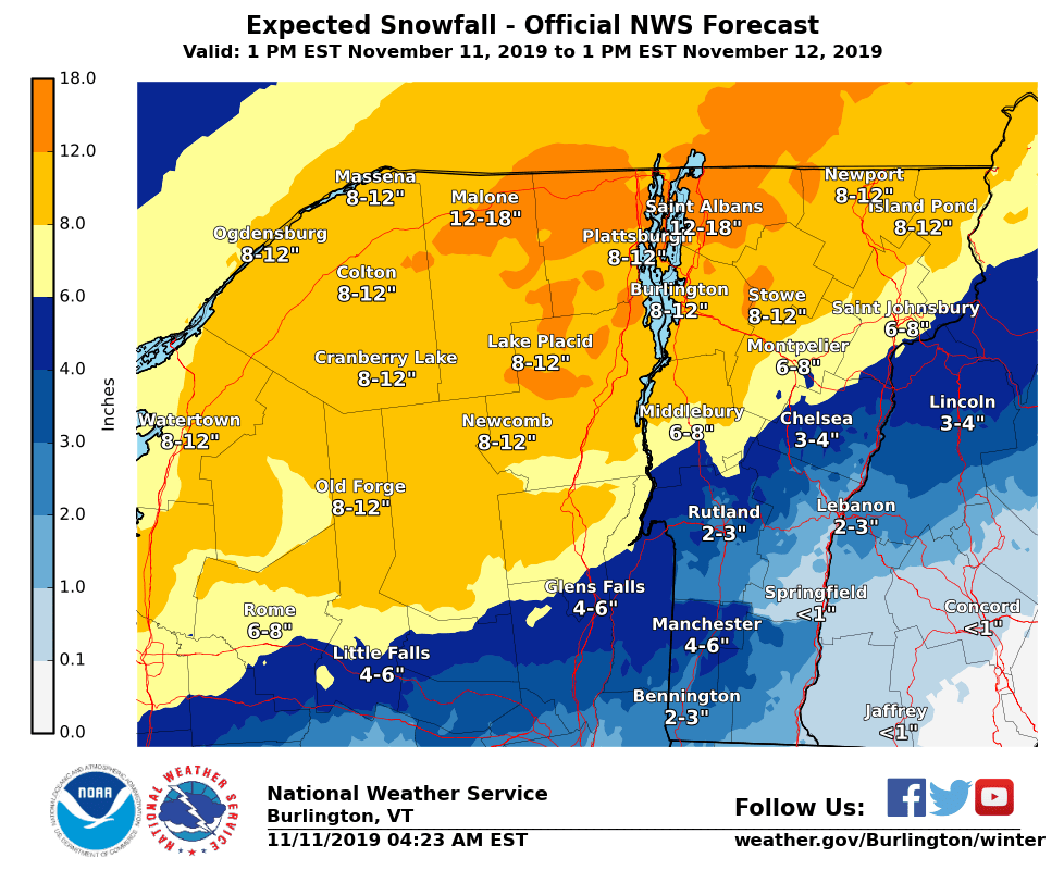
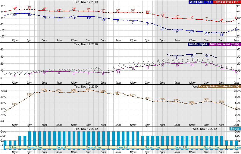
Snow will spread across much of the northeast this afternoon, especially areas of central and northern Vermont, becoming heavy at times tonight into Tuesday morning. Ski areas Jay Peak, Stowe, Smuggler’s Notch, Mad River Glen and maybe Sugarbush could all see in excess of 12″ between now and Wednesday morning.
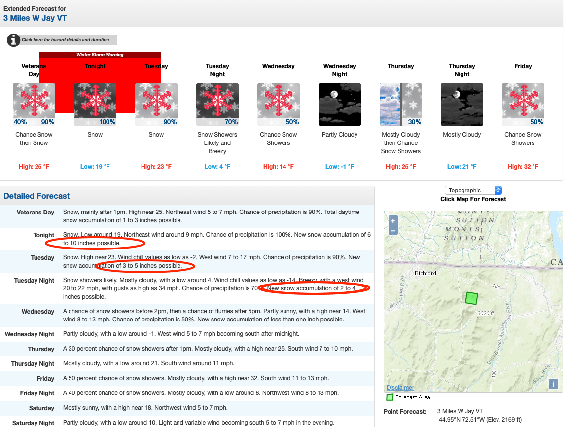
Snow and mixed precipitation are expected across portions of central and southern Vermont during this period. Snowfall will range from 6-12 inches in warning areas and 2-6 inches elsewhere.
...WINTER STORM WARNING REMAINS IN EFFECT FROM 1 PM THIS
AFTERNOON TO 1 PM EST TUESDAY...
* WHAT...Heavy snow expected. Total snow accumulations of 6 to
12 inches.
* WHERE...The Adirondacks of New York and most of central and
northern Vermont.
* WHEN...From 1 PM Monday to 1 PM EST Tuesday.
* IMPACTS...Travel could be very difficult.
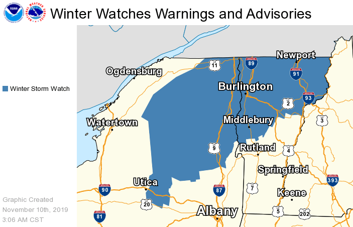
* ADDITIONAL DETAILS...A band of moderate to heavy snow is
expected across the warning area tonight into Tuesday morning.
The Tuesday morning commute will be impacted.
Snow will taper off Tuesday night into Wednesday with near-record cold (up to 20º below normal) expected and the remainder of the week also chilly.
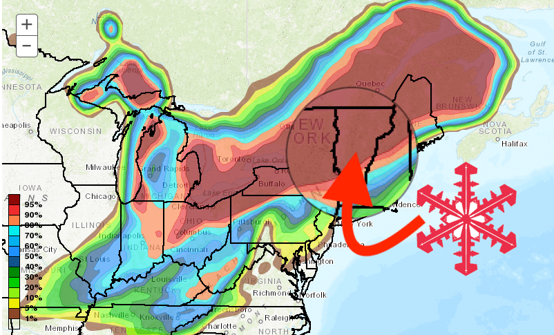
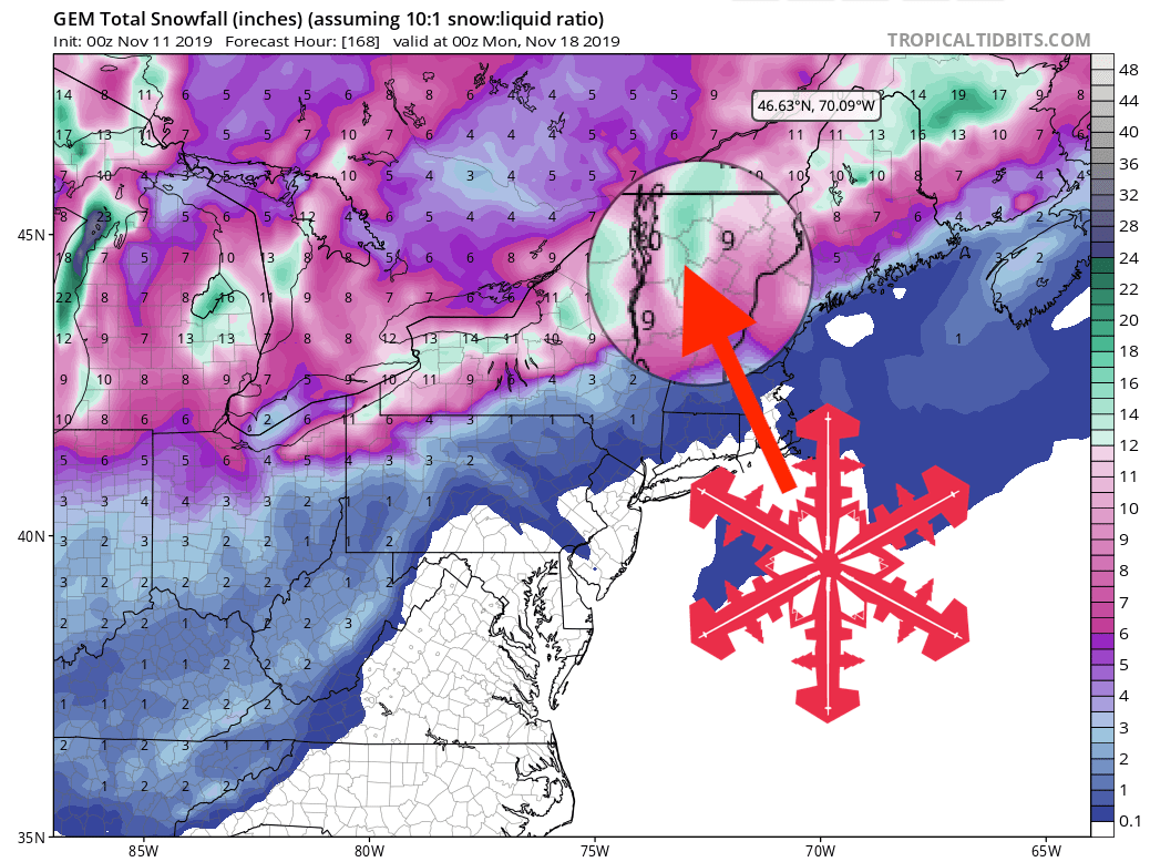
GEM Total Snowfall Forecast Model
Other Info: