“There is high confidence that storms will continue to dodge us [California] to the east leaving us relatively clear, cool and dry with periodic north winds for the next 2-3 weeks.” – Western Weather Group, Inc on 2/4/2020
We read this weather forecast from Weather West Group today and our hearts sank.
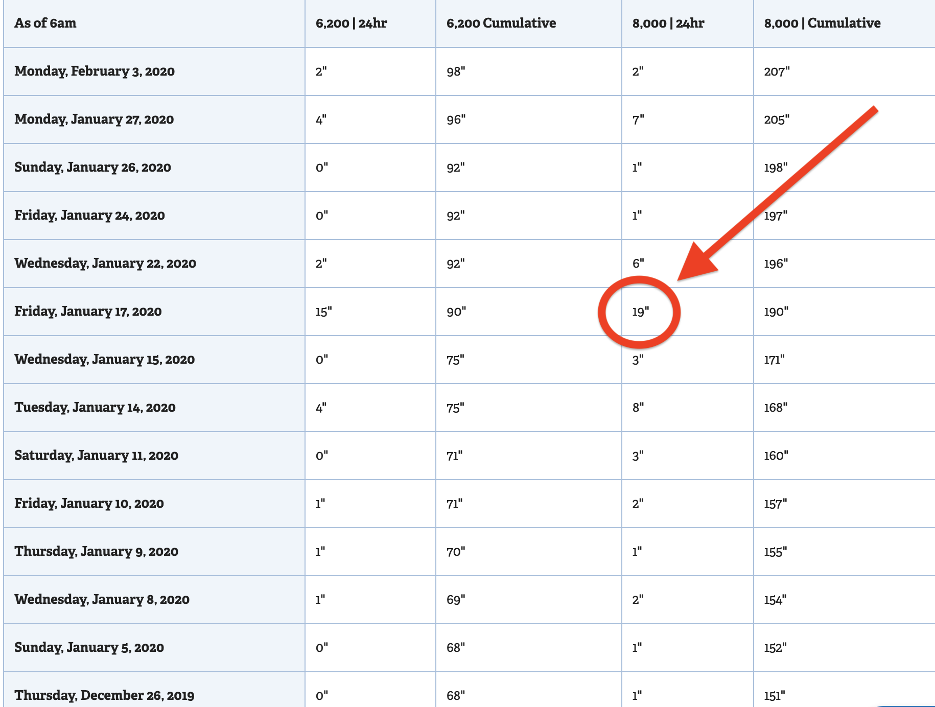
The last time Lake Tahoe saw a significant snowstorm was on January 17th, 2020.
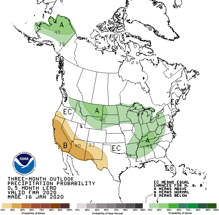
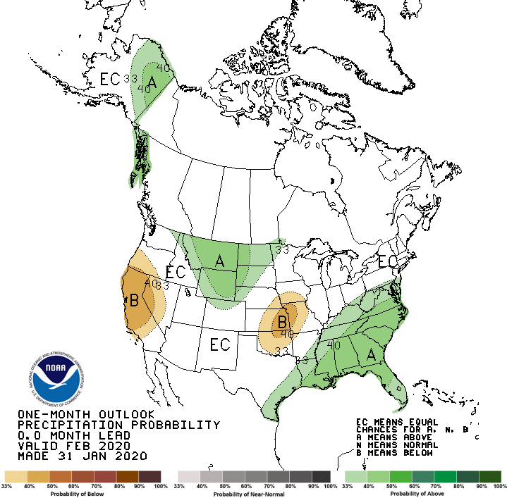
NOAA’s 1-month & 3-month long-range precipitation outlook maps (below) support Western Weather Group’s statement.
Let’s keep our fingers crossed for a Miracle March like back in 2018!
A dry pattern is setting up along the West Coast and it doesn’t appear to go anywhere for a while. There is high confidence that storms will continue to dodge us to the east leaving us relatively clear, cool and dry with periodic north winds for the next 2-3 weeks. Without cloud coverage and precipitation, fairly persistent frosty nights will be possible when winds are calm. In the past, we might get some Tule fog to insulate parts of the Central Valley (like the Sacramento Valley) but with more dry north wind events in the winter, this has become less common.
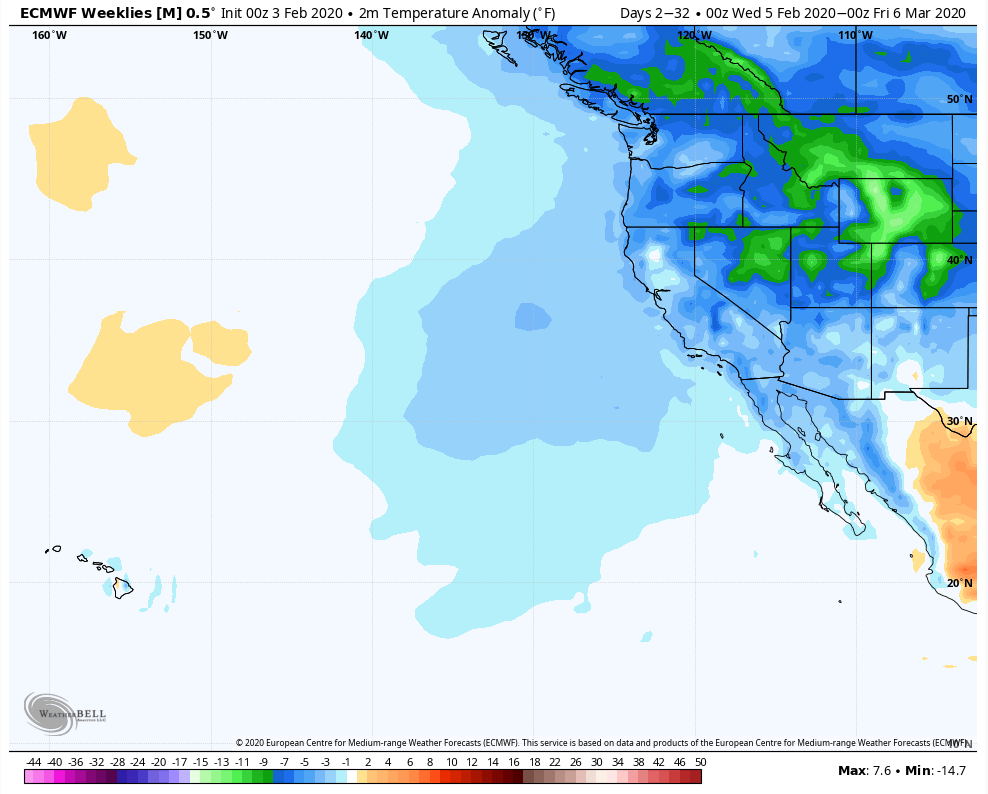
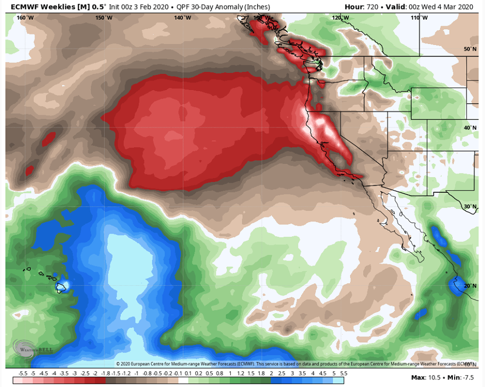
When will it end? Some computer models suggest that this may play out a little like 2 years ago where we had a record dry February accompanied by a prolonged stretch of record cold nights, followed by an unusually wet “Miracle March”. Whether or not this wetter pattern starts during the last week of February or early March is yet to be determined. A few computer models have suggested that a pattern change may occur as early as the 23rd-25th, while others hold off till early March. When looking that far out, everything must be taken with a grain of salt, though. If there is no Miracle March, parts of Northern California may end up with around a 30-40% deficit for seasonal rainfall (if not more in some areas).
– Western Weather Group, Inc on 2/4/2020