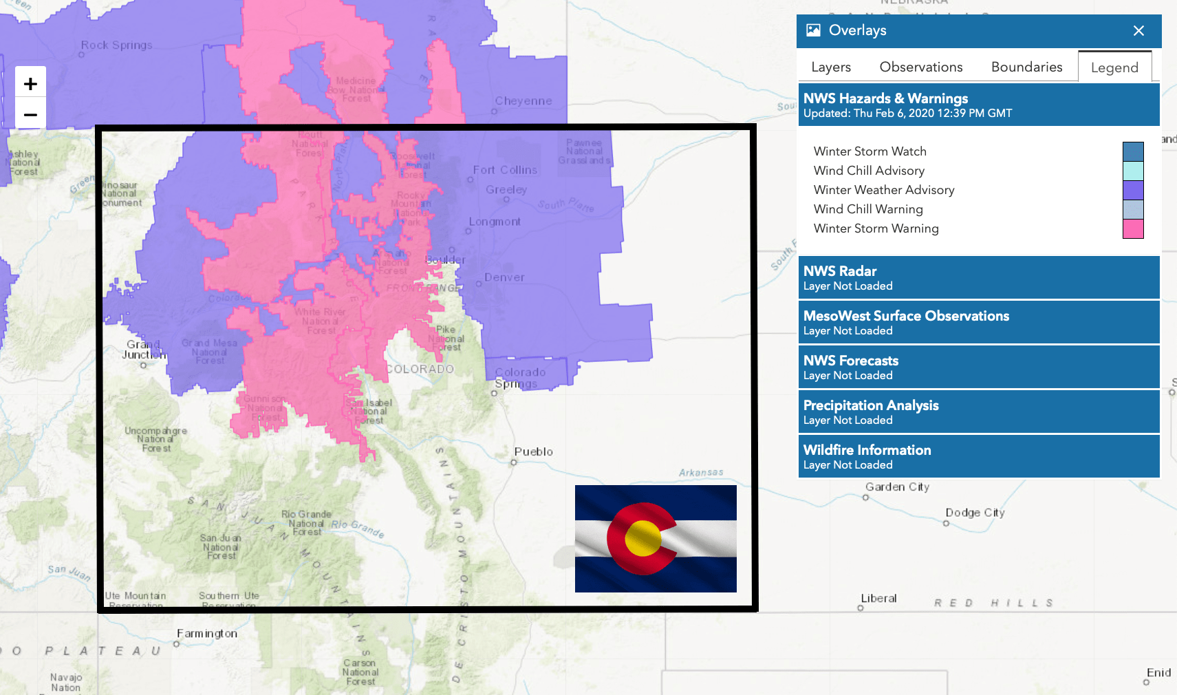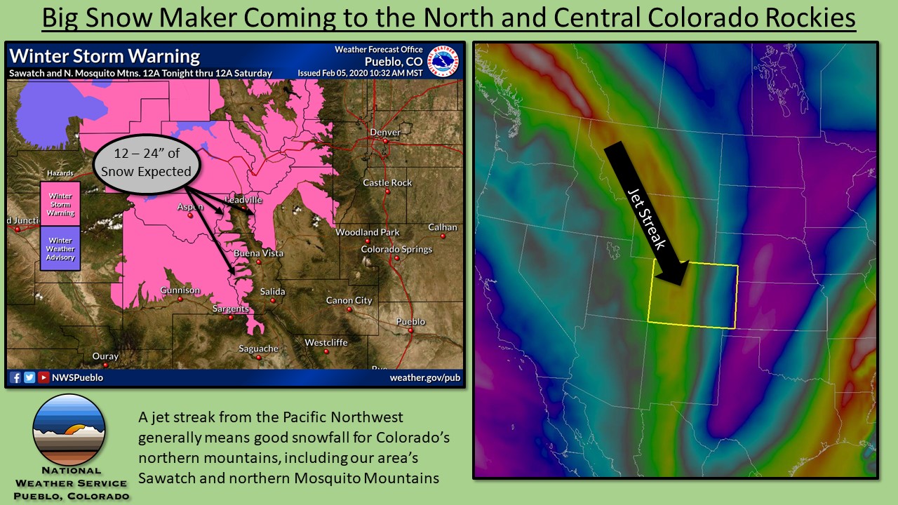
The NOAA has issued a winter storm warning for the mountains of Colorado through Friday night, with the potential for up to 3-FEET of fresh snow for many ski areas going into the weekend.
...WINTER STORM WARNING REMAINS IN EFFECT UNTIL MIDNIGHT MST
FRIDAY NIGHT...

* WHAT...Heavy snow expected. Total snow accumulations of 18 to 36
  inches. Winds gusting as high as 65 mph.

* WHERE...The Mountains of Summit County, the Mosquito Range,
  and the Indian Peaks.

* WHEN...Until midnight MST Friday night.

* IMPACTS...Travel could be very difficult to impossible. Areas
  of blowing snow could significantly reduce visibility. The
  hazardous conditions could impact the morning or evening
  commute. Very strong winds could cause extensive tree damage.
  The cold wind chills as low as 30 below zero could cause
  frostbite on exposed skin in as little as 30 minutes.
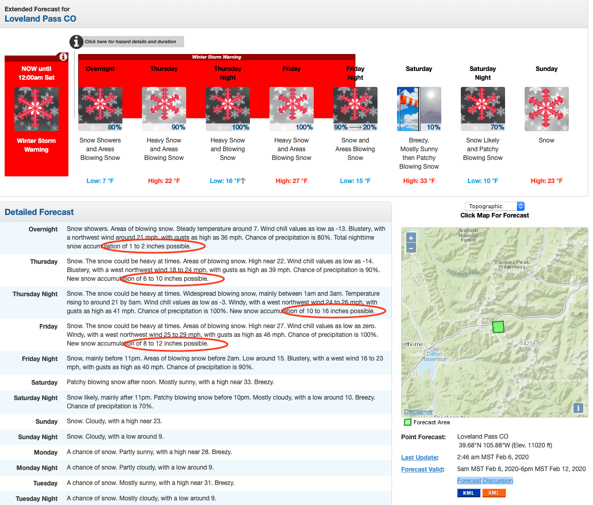
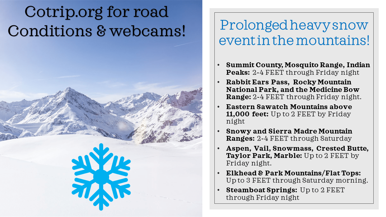
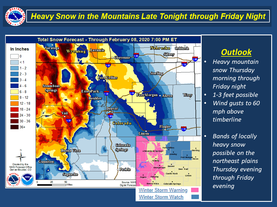
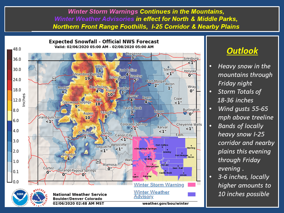
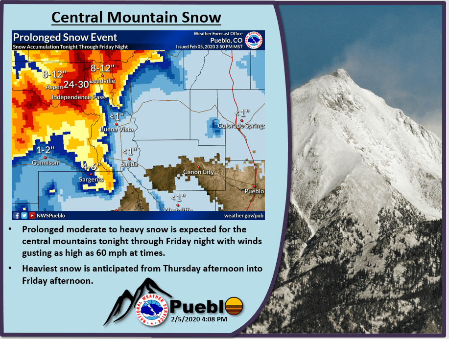
Moderate to heavy snowfall will continue in the mountains through tonight, with the heaviest snowfall along northwest facing slopes. Snow, heavy at times, will continue in the mountains Friday. Total snow amounts for the mountains of 1 to 3 feet are expected. Across the Front Range and eastern plains, areas of snow will develop with bands of heavy snow. Snowfall is expected to greatly vary across the lower elevations due to the bands of heavy snow. A general 3 to 6 inches of snow are expected, locally higher amounts of 8 to 10 inches will be possible.
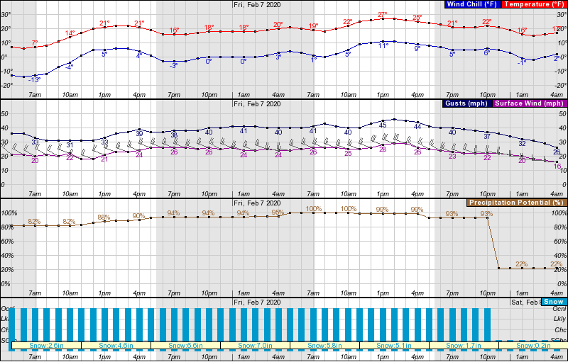
Strong gusty winds up to 60 mph at times will create blowing and drifting snow producing low visibilities so travel could be difficult to impossible. Winds will also cause wind chill temperatures of 25 to 30 degrees below zero. Travelers and outdoor enthusiasts should be prepared and travel with emergency kits.
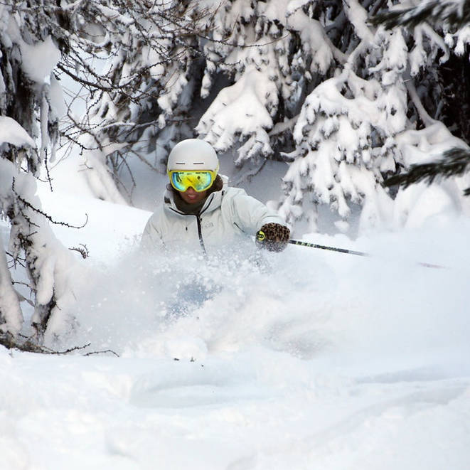
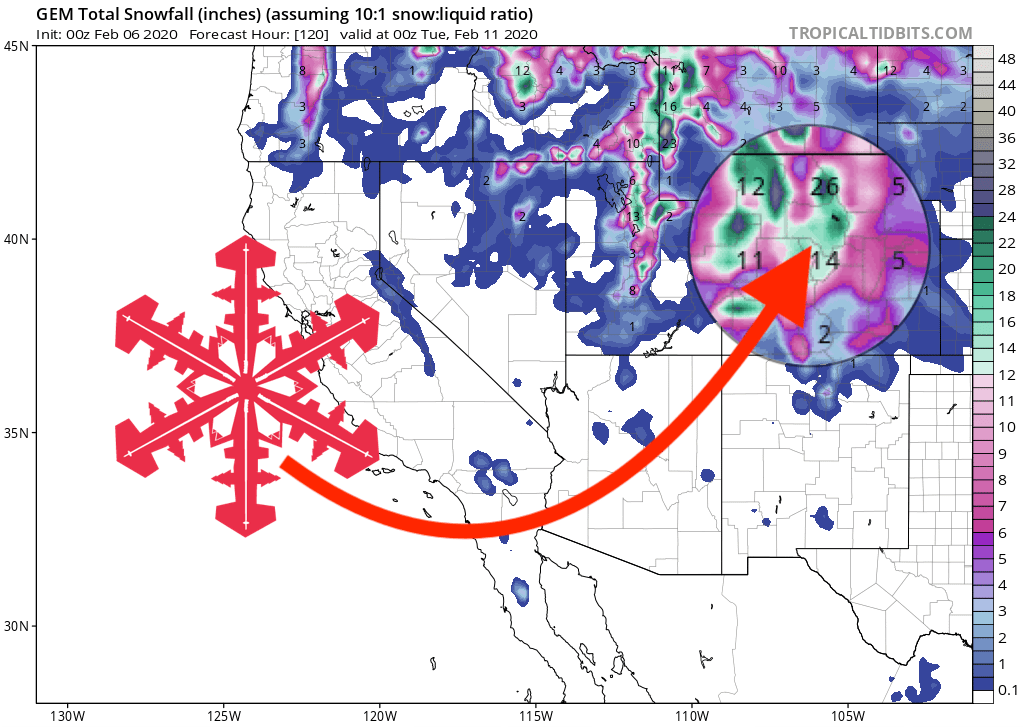
Ski areas across the state will see varying amounts of snow, from move than 3-FEET at Steamboat, Loveland, and Arapahoe Basin, up to 30″ for Breckenridge and Copper, over 2-Feet at Vail, Beaver Creek, and Winter Park and over a foot at Aspen, Monarch, and Crested Butte. Expect free refills all day today, and epic powder conditions tomorrow.
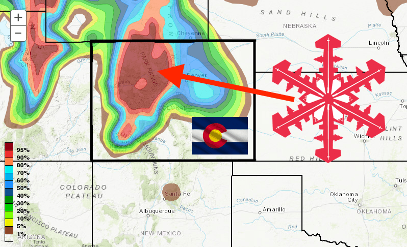
The is also an avalanche watch in effect, with dangerous avalanche conditions expected to develop today, with the danger rating reaching HIGH (Level 4).
* TIMING...Dangerous avalanche conditions are expected to develop
  on Thursday.

* AFFECTED AREA...Park Range...the Flat Top Mountains...Medicine Bow
  Mountains...Never Summer Mountains...and the Front Range.

* AVALANCHE DANGER...The avalanche danger rating is expected to
  reach HIGH (Level 4) on Thursday.

* REASON...Heavy snowfall and strong winds will increase the
  avalanche danger. Large avalanches will become very easy to
  trigger. During periods of heavy snowfall avalanches will release
  naturally.

* PRECAUTIONARY/PREPAREDNESS ACTIONS...Travel in or under avalanche
  terrain is not recommended on Thursday as heavy snow accumulates.
  Plan ahead for rapidly increasing avalanche danger.
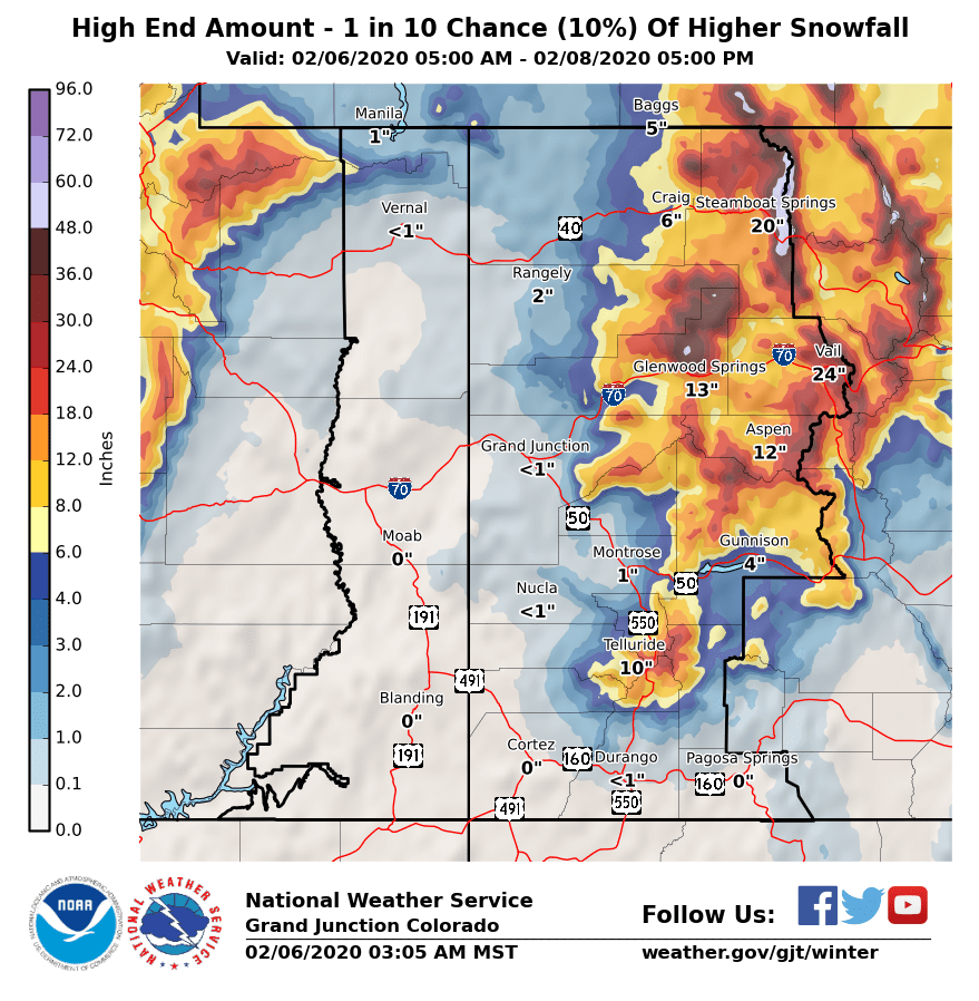
GEM Snowfall Total Forecast:
Other Info: