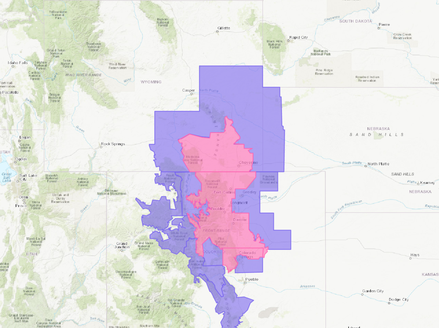
The National Weather Service has issued a Winter Storm Warning for Colorado and Wyoming. It is in effect until noon in Wyoming and 3pm in Colorado. Cold temperatures are expected to persist following this storm.
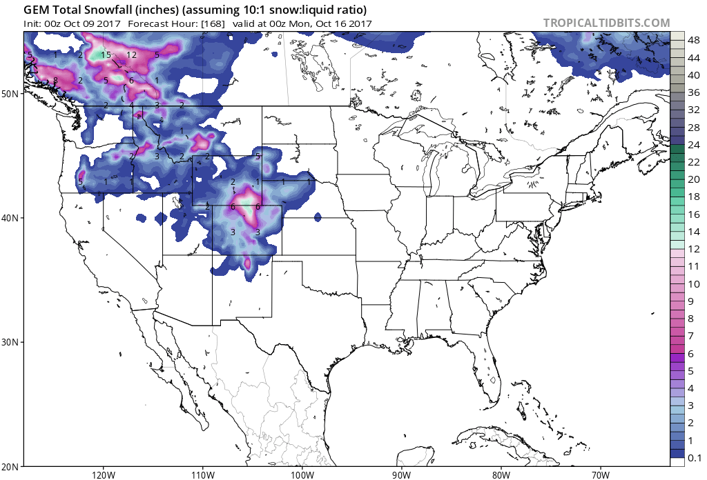
3-7″ of additional snowfall is expected to fall in Colorado Today.
Up To 8″ of additional snowfall is expected to fall in Wyoming Today.
NOAA Has Issued A Winter Storm Warning For:
- Colorado
- Wyoming
NOAA Has Issued A Winter Weather Advisory For:
- Colorado
- Wyoming
A strong cold front is present along with this storm, which will allow for accumulating snow in the valleys.
Additional Storm Info:
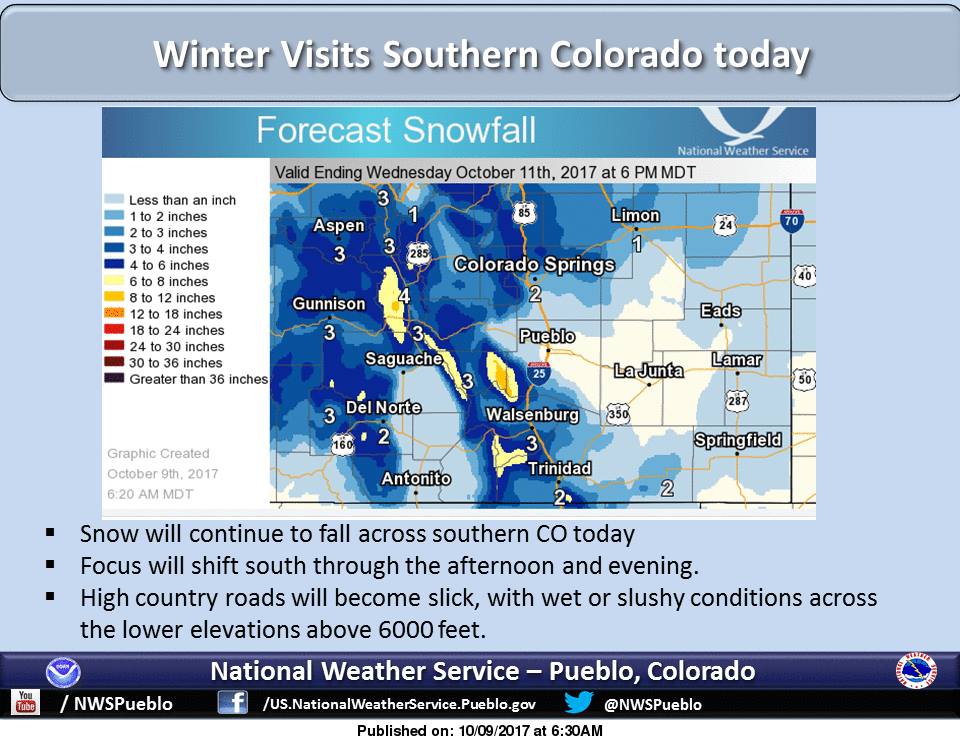
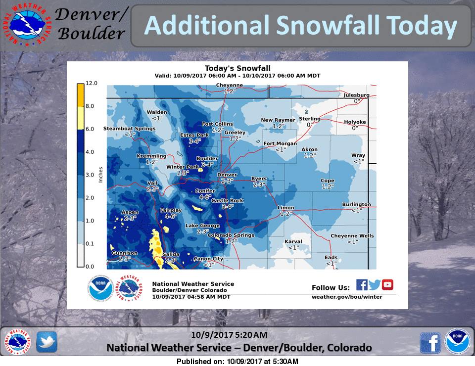
Colorado: 3-7″ of Additional Snow Through This Afternoon
* Additional snow accumulations of 3 to 7 inches are expected.
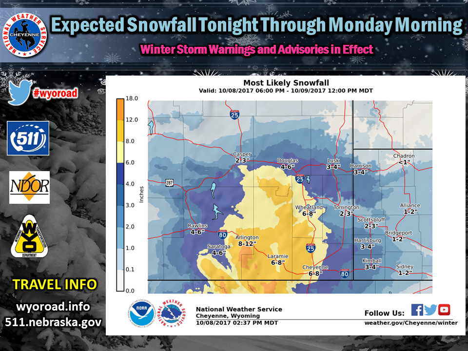
Wyoming: Up To 8″ of Additional Snow Through Today
* Additional snow accumulations of 4 to 6 inches,
with localized amounts up to 8 inches, are expected.


CO Winter Storm Warning:
URGENT - WINTER WEATHER MESSAGE
National Weather Service Denver CO
413 AM MDT Mon Oct 9 2017

...HEAVIEST SNOW WILL FALL THIS MORNING...

.Rain has mixed with and changed to snow over most of the plains
early this morning. Mainly light snow fell overnight, although
intensity will increase this morning. Snow will decrease from
northwest to southeast by afternoon, with improving weather
conditions.

...WINTER STORM WARNING REMAINS IN EFFECT UNTIL 3 PM MDT THIS
AFTERNOON...

* WHAT...Heavy snow occurring. Plan on hazardous and slow travel
 conditions, including during the morning commute. Additional
 snow accumulations of 3 to 7 inches are expected.

* WHERE...Rocky Mountain National Park and the Medicine Bow
 Range, The Mountains of Summit County, the Mosquito Range, and
 the Indian Peaks, The Northern Front Range Foothills and The
 Southern Front Range Foothills.

* WHEN...Until 3 PM today.

* ADDITIONAL DETAILS...Be prepared for significant reductions in
 visibility at times.