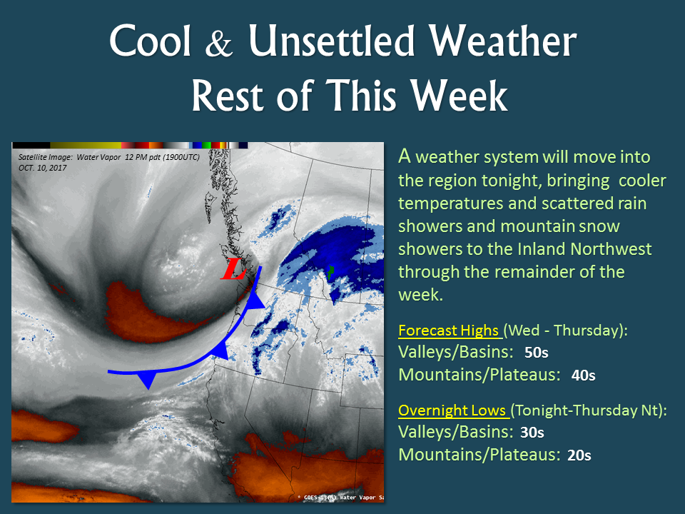
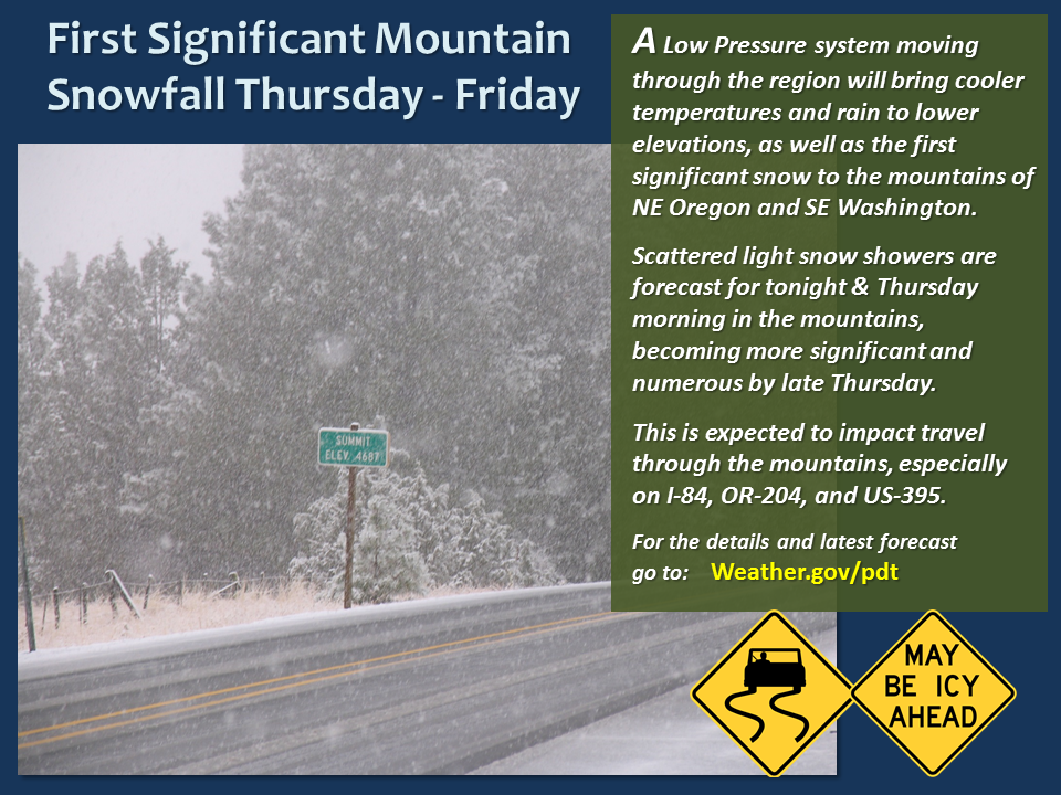
The National Weather Service has issued a Winter Storm Warning for Oregon and Washington. The warning is in effect until 11pm on Friday. A strong cold front is expected to move through, which will produce the first significant snowfall of the season.
6-14″ of snow is expected to fall above 4500ft through Friday Night in Oregon & Washington.
NOAA Has Issued A Winter Storm Warning For:
- Oregon
- Washington

Snow levels started out around 4500ft Thursday Night, but they are expected to drop down to 3000ft by Friday Night.
Additional Storm Info:
Oregon: 6-14″ of Snow Above 4500ft Through Friday Night
* Total snow accumulations of 2 to 7 inches between 3500 and 4500 feet
  and 6 to 14 inches above 4500 feet, are expected.
- NOAA Pendleton, OR
Washington: 6-14″ of Snow Above 4500ft Through Friday Night
* Total snow accumulations of 2 to 7 inches between 3500 and 4500 feet
 and 6 to 14 inches above 4500 feet, are expected.
- NOAA Pendleton, OR


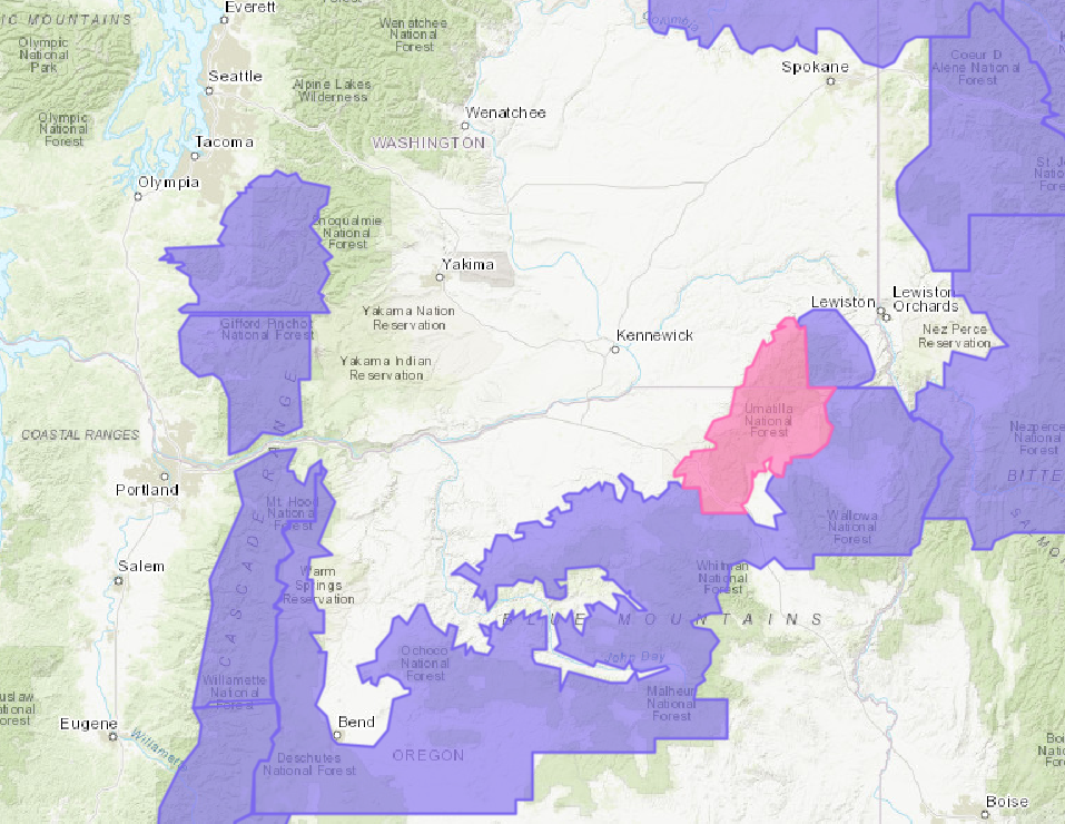
Washington Winter Storm Warning:
URGENT - WINTER WEATHER MESSAGE
National Weather Service Pendleton OR
1142 AM PDT Thu Oct 12 2017

...FIRST SIGNIFICANT MOUNTAIN SNOWFALL OF THE SEASON...

A cold northwest flow with abundant moisture will bring snow
levels down from 4500 feet today to around 3000 feet Friday. This
will produce the first significant snowfall on roads over the
eastern mountains of Oregon which will impact travel.

Northern Blue Mountains of Oregon-Northwest Blue Mountains-
Including the cities of Meacham, Tollgate,
and Ski Bluewood Resort
1142 AM PDT Thu Oct 12 2017

...WINTER STORM WARNING REMAINS IN EFFECT UNTIL 11 PM PDT
FRIDAY...

* WHAT...Heavy snow expected above 3500 feet. Plan on difficult
 travel conditions, including during the evening commute. Total
 snow accumulations of 2 to 7 inches between 3500 and 4500 feet
 and 6 to 14 inches above 4500 feet, are expected.

* WHERE...In Oregon, Northern Blue Mountains of Oregon including
 Meacham, and Tollgate. In Washington, Northwest Blue Mountains
 including Ski Bluewood.

* WHEN...Noon today to 11 PM Friday.

* ADDITIONAL DETAILS...Roads are likely to become snow packed
 especially in the overnight periods. Snow level will be 4500
 feet today lowering to around 3000 feet late Friday. Look for
 significant reductions in visibility at times.