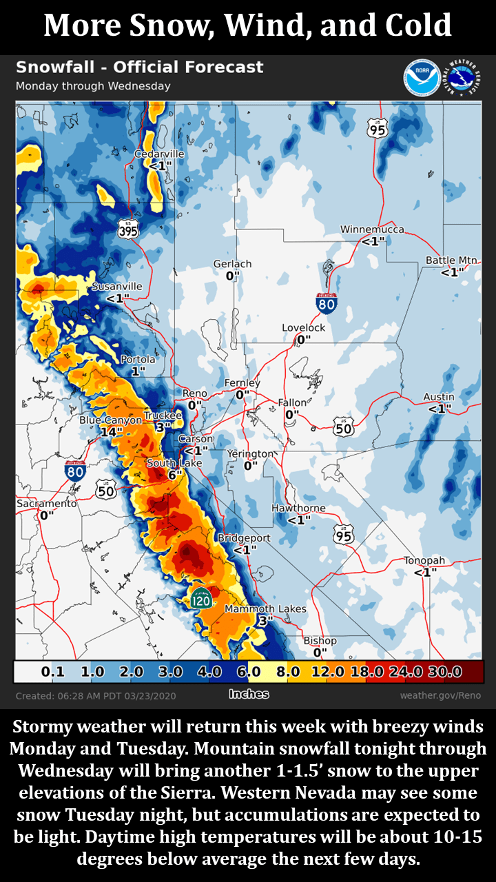
A storm is still on track to impact the Sierra with gusty winds and heavy snow showers. The Tahoe area is expected to see up to 18 inches of fresh snow. A winter weather advisory has been issued from 4 pm tonight until tomorrow morning.
Snow starts today, gradually getting heavier with the biggest totals falling Wednesday. Temperatures will drop to around 20ºF with wind gusts as high as 45 mph.
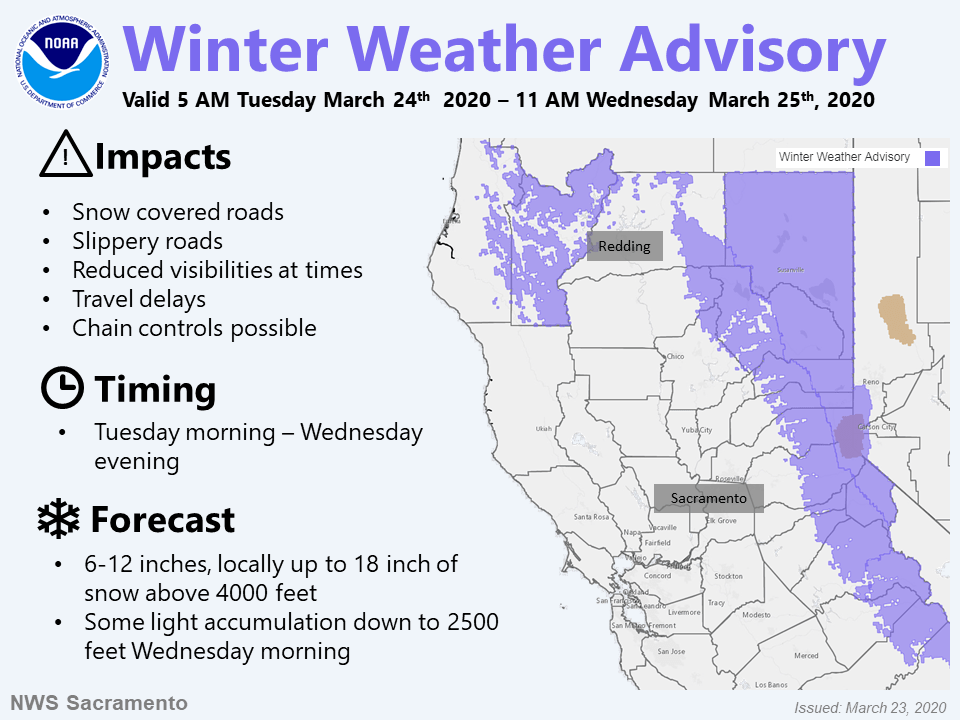
WINTER WEATHER ADVISORY IN EFFECT FROM 4 PM TUESDAY TO 10 AM
PDT WEDNESDAY...

* WHAT...Snow expected. Total snow accumulations of 1 to 4 inches,
  except 5 to 10 inches near and west of Highway 89. Local amounts
  of 10 to 15 inches possible near the crest. Winds gusting as
  high as 40 to 45 mph Tuesday afternoon and evening.

* WHERE...Greater Lake Tahoe Area.

* WHEN...From 4 PM Tuesday to 10 AM PDT Wednesday.

* IMPACTS...Plan on slippery road conditions and much longer
  travel times over Sierra passes.
Sierra snow and valley showers are forecast through Thursday as a storm slowly moves through the region. A period of heavy snow will result in slick roads tonight until Wednesday morning. Expect temperatures to be below average on Wednesday and Thursday before slowly warming towards the end of the week.
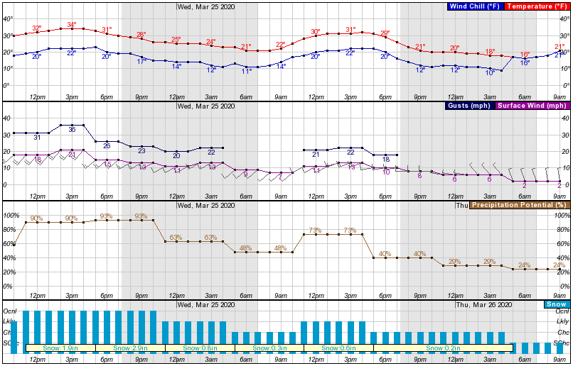
Going forward, the overall trend is toward warmer and drier conditions, however, we could see at least one more storm before the end of March.
This forecast is provided for information only. With ski resorts closed and backcountry areas subject to social distancing measures, skiers are advised to stay home.
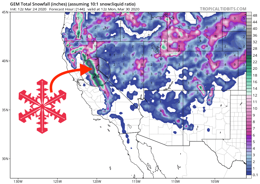
GEM snowfall total forecast
Other info