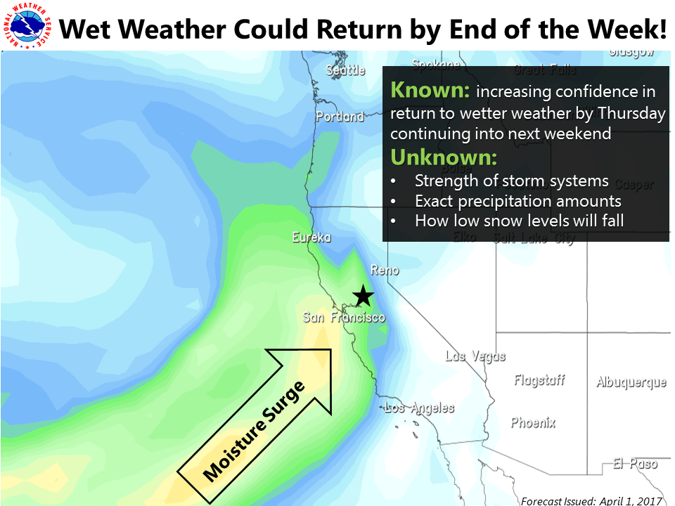
NOAA is calling for a large storm, likely an Atmospheric River, to hit Lake Tahoe, CA/NV this coming Thursday-Sunday.
"At this time, the atmospheric river looks to be of the weak to moderate variety
based on GEFS analysis." - NOAA Reno, NV today

Precipitation is forecast to be heaviest on Friday.
Thursday-Sunday precipitation totals are forecast to be 3-4″ (which would translate to around 30-40+” of snow where it’s all snow).
Snow Levels are forecast to start around 6,500-7,500′ on Friday before dropping to 5,000-6,000′ on Friday night and Saturday and even lower on Sunday.
"For those living in the Sierra, beprepared for the potential for additional
heavy snow." - NOAA Reno, NV today

Our friend, Bryan Allegretto from OpenSnow.com, is calling for 9-47″ of snow (depending on elevation) for Squaw from Thursday-Sunday.

NOAA FORECAST DISCUSSION TODAY:
PRECIPITATION: The initial push of moisture will move into the
region Friday morning with the heaviest precipitation rates likely
to be Friday into Friday night. Precipitation will taper to showers
Saturday and Sunday behind the cold front. Very preliminary liquid
precipitation totals indicate chances for 2-4 inches along the
Sierra crest with 1-2 inches in the Tahoe Basin and eastern Sierra
foothills. 0.5-1 inch is possible along the Sierra Front with lesser
amounts into west central Nevada.

SNOW LEVELS: Most likely scenarios show snow levels in the 6500-7500
foot range with the onset of the precipitation Friday (lowest closer
to the Oregon border). The higher precipitation rates will work in
the favor of keeping snow levels down ahead of the cold front. The
cold front looks to push through Friday night, taking snow levels
down to 5000-6000 feet by Saturday and even lower Sunday under the
cold core of the upper low. While this storm is nothing like the
huge AR events we saw in January and February, it has the
potential to be a significant snow event for the high Sierra,
especially considering it is now April. Travel is likely to be
impacted across all passes much of the weekend.


Good for the Farmers and skiers who don’t drown!