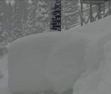
“20” since 4:30pm and 29” in the past 24 hours 😳. Avalanche mitigation in progress.” – Sun Valley, ID today
Sun Valley, ID just got 20″ of snow overnight and 29″ of snow in the past 24 hours.
Sun Valley 5-12″ of snow forecast
As of 9 am PST, all lifts are closed at Sun Valley.
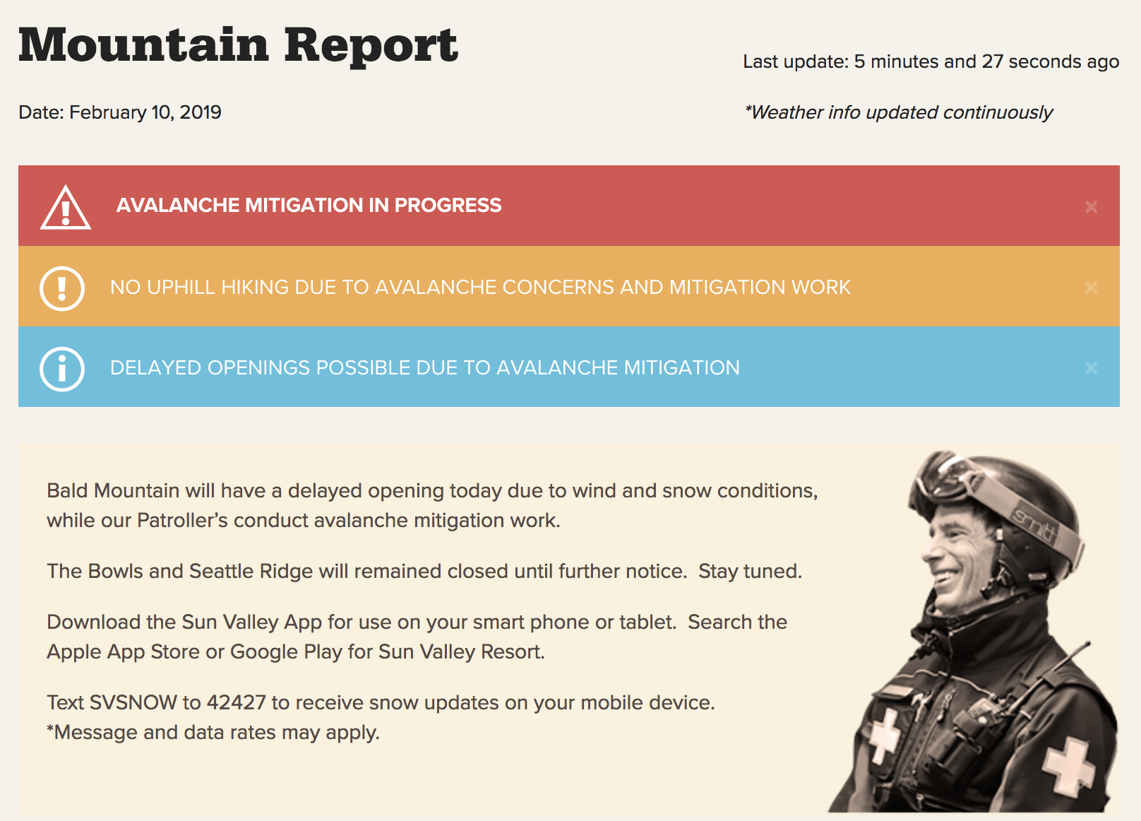
Bald Mountain will have a delayed opening today due to wind and snow conditions, while our Patroller’s conduct avalanche mitigation work.
The Bowls and Seattle Ridge will remained closed until further notice. Stay tuned.
- Sun Valley, ID today
FORECAST:
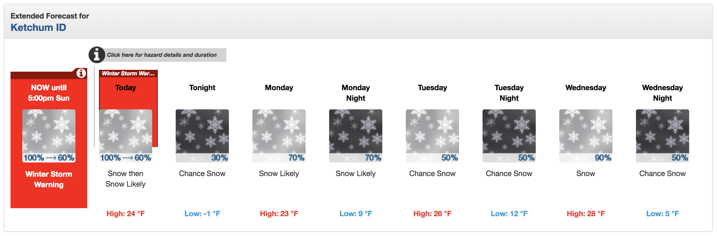
Winter Storm Warning
URGENT - WINTER WEATHER MESSAGE
National Weather Service Pocatello ID
432 AM MST Sun Feb 10 2019

Frank Church Wilderness-Sawtooth/Stanley Basin-Sun Valley Region-
Big Lost Highlands/Copper Basin-Wood River Foothills-
Including the cities of Clayton, Stanley, Ketchum, Sun Valley,
Galena, Hailey, Bellevue, and Picabo
432 AM MST Sun Feb 10 2019

...WINTER STORM WARNING REMAINS IN EFFECT UNTIL 5 PM MST THIS
AFTERNOON...

* WHAT...Moderate to heavy snow will continue. Additional snow
  accumulations of 5 to 9 inches are expected for the Wood River
  Foothills, Wood River Valley, and Big Lost Highlands, with
  localized higher amounts to 12 inches in the mountains above
  pass level. Further north, additional accumulations of 2 to 5
  inches are expected across the Stanley Basin and Frank Church
  Wilderness.

* WHERE...Picabo, Bellevue, Hailey, Sun Valley, Ketchum, Galena
  Summit, Stanley, Banner Summit, and Clayton.

* WHEN...Until 5 PM MST this afternoon. The heaviest snowfall is
  expected this morning.

* IMPACTS...Difficult travel conditions will continue due to snow
  covered roads and significant reductions in visibility. Winds
  gusting as high as 35 MPH will also cause areas of blowing and
  drifting snow, especially over mountain passes.