
A Gulf of Alaska storm has dropped down from Alaska, picked up moisture off the Pacific Ocean, and is headed straight for California today and tomorrow.
This storm is forecast to drop 4″ below 7,000′, 4-8″ of snow above 7,000′, and up to a foot along the crest. Snow levels will be as low as 5,500′ and as high as 7,000′.

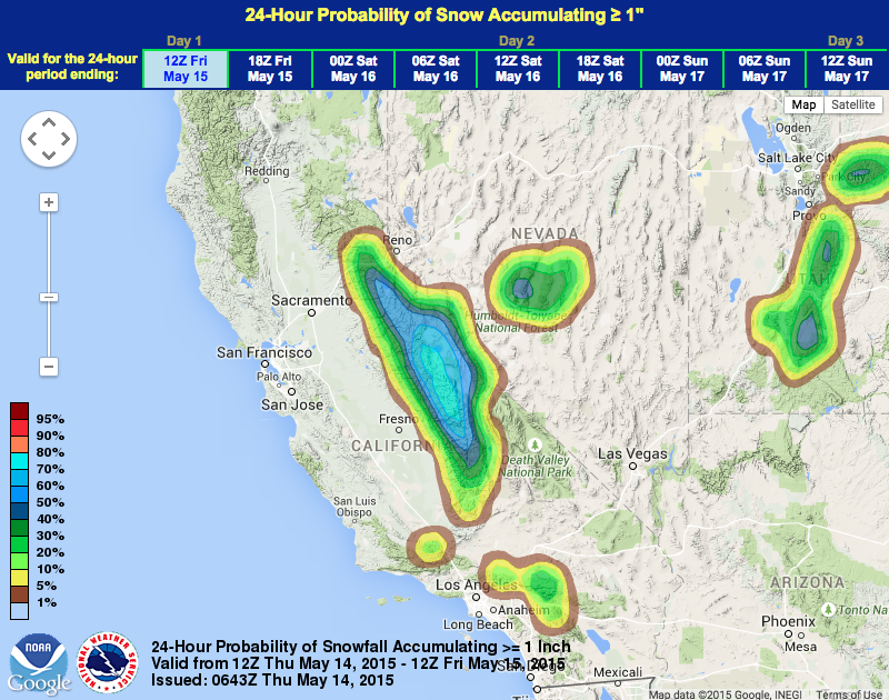
This storm appears to be aimed directly for Mammoth Mountain, CA. Mammoth ski resort is still open and is likely going to experience a powder day or two out of this storm. As of this writing at 8am PST, it’s snowing lightly in Mammoth Lakes, CA.
Just last Saturday, Mammoth got 12-18″ of snow and experience a great powder day.
NOAA has issued both a Winter Storm Warning and a Winter Weather Advisory for California’s Sierra Nevada.
“A low pressure system out of the Gulf of Alaska will move into position off the Norcal coast today then move inland on Friday. This will bring a period of unsettled weather for the next couple of days. Most Norcal areas have the potential for thunderstorms this afternoon. Snow showers are expected at pass level over the Sierra. Showers are expected to continue over the mountains into the weekend as another low pressure system moves in off the coast.” – NOAA Sacramento

NOAA Winter Weather Advisory:
URGENT - WINTER WEATHER MESSAGE
NATIONAL WEATHER SERVICE RENO NV
321 AM PDT THU MAY 14 2015

...LATE SEASON WINTER STORM FOR SIERRA TODAY AND FRIDAY...

...WINTER WEATHER ADVISORY REMAINS IN EFFECT FROM 11 AM THIS
MORNING TO 11 AM PDT FRIDAY...

* TIMING: LIGHT SNOW SHOWERS THURSDAY MORNING WILL INCREASE IN
  INTENSITY IN THE EVENING AND CONTINUE THROUGH FRIDAY MORNING.

* SNOW ACCUMULATIONS: 4 TO 8 INCHES WITH LOCALLY UP TO 12
  INCHES ALONG THE SIERRA CREST. UP TO 4 INCHES OF SNOW WILL
  BE POSSIBLE BELOW 7000 FEET.

* CONFIDENCE: MEDIUM TO HIGH CONFIDENCE FOR SNOW TOTALS ABOVE 7000
  FEET. LOW CONFIDENCE FOR SNOW AMOUNTS BELOW 7000 FEET...ESPECIALLY
  IN THE TAHOE BASIN.

* SNOW LEVELS: AROUND 7000 FEET...BUT MAY BRIEFLY LOWER TO 5500
  FEET IN HEAVIER SHOWERS.