
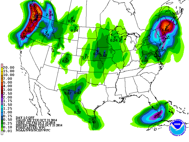
94″ of snow are forecasted for 10,000-foot Mt. Baker in Washington state in the next four days. A series of very wet storms will be marching into the area beginning today.
Snow levels will be around 6,000-feet with these storms meaning that the upper part of Mt. Baker will be buried in snow after these storms pass through.

As per usual, winter kicks off with a Bang in Washington state.
NOAA:
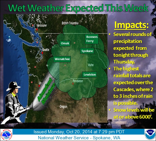
A series of wet storm systems will begin to affect the Inland Northwest tonight, and continue through much of the week. While most areas will receive rainfall, the Cascade crest will see the highest precipitation totals. 2 to 3 inches of rain is expected here, with lesser amounts expected further east. Snow doesn’t look like it will be much of an issue, as the snow levels fall to 6000′.
If that was where folks skied that would be AWESOME.
This link is the actual location of the “Mt. Baker Ski Area”
http://forecast.weather.gov/MapClick.php?site=sew&textField1=48.80&textField2=-121.63&zone=1#.VEfW52ddVic
We have a lot of backcountry skiers who read this site, as well. I have a handful of friends who ski on the real Mt. Baker. But, you’re right, Leon, most people ski the resort, that’s why we made it clear that this forecast is for Mt. Baker proper and not the ski area. thanks