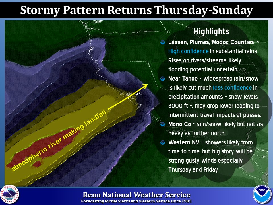
An atmospheric river is forecast to hit Lake Tahoe, CA this week beginning on Thursday. One of the latest weather forecasting models is showing up to 20 inches of rain falling in the Northern Sierra Nevada mountains.
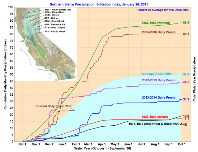
This storm may not be an epic one for skiing, but California is currently experiencing an “Exceptional Drought” and we’ll take every drop of rain we can get.

Snow levels will be high with the storm. Models are currently suggesting an average snow level of 8,000-feet for the storm. That’s not great for skiing as most Lake Tahoe ski resorts top out at around 8,600-feet. The Mount Rose ski resort and backcountry area have bases above 8,000-feet. This storm could be a blessing for the Mt. Rose area. We’ll have to wait and see.
How much snow will Tahoe get out of this storm? Right now, forecasters are calling for less than a foot of snow above 8,000-feet.

NOAA SNOW LEVEL DISCUSSION:
IN GENERAL EXPECT SNOW LEVELS TO BE HIGH WITH THIS STORM AS THE
SIERRA REMAINS ON THE WARM SIDE OF THE JET WITH RIDGE LEVEL
TEMPERATURES THAT WOULD INDICATE SNOW LEVELS ABOVE 8000 FEET.
HOWEVER, SNOW LEVELS CAN BE VERY TRICKY IN THESE CIRCUMSTANCES
WHEN RIDGE TOP TEMPERATURES ARE NEAR FREEZING AND ISOTHERMAL LAYERS
DEVELOP DURING PERIODS OF HEAVY PRECIPITATION. FRIDAY NIGHT IS THE
BIGGEST CONCERN RIGHT NOW AS THERE IS A CHANCE SNOW LEVELS MAY
DROP TO NEAR SIERRA PASS LEVELS WITH THE POTENTIAL TO IMPACT
TRAVEL. SNOW LEVELS WOULD MOST LIKELY RAISE CONSIDERABLY DURING
THE DAY ON SATURDAY AND REMAIN HIGH UNTIL A COLD FRONT ARRIVES
SUNDAY EVENING WITH THE POTENTIAL TO AGAIN IMPACT TRAVEL OVER
SIERRA PASSES. IN THESE SITUATIONS SNOW LEVELS CAN BE DIFFICULT TO
PREDICT 1 OR 2 DAYS, LET ALONE 5. THE BEST ADVICE IS TO BE PREPARED
FOR LOWER SNOW LEVELS IF TRAVELING OVER SIERRA PASSES FRIDAY NIGHT,
EVEN THOUGH IT IS ONLY HAS A SLIGHT CHANCE OF OCCURRENCE.
NOAA PRECIPITATION DISCUSSION:
WHAT I CAN SAY ABOUT PRECIPITATION AT THIS POINT IS THAT CONFIDENCE
IS HIGH THAT THE NORTHERN SIERRA WILL RECEIVE SIGNIFICANT
PRECIPITATION. CONFIDENCE HAS INCREASED THAT THE CENTRAL SIERRA WILL
SEE A DECENT AMOUNT OF PRECIPITATION.  AT THIS POINT I WOULD
EXPECT THE EASTERN SIERRA TO RECEIVE SOME PRECIPITATION BUT
CONFIDENCE REMAINS THE LOWEST WITH HOW FAR SOUTH THE MOISTURE WILL
SPREAD.
Heavenly tops out at 10k.
Mt Rose base is 8240, so they should receive all snow based on your reports, but significant wind.
Sugar Bowl could receive significant rain at a base of 6800 and top of 8300.
Hi, thanks for starting this discussion page. I’ll be out in Tahoe for the first time in about 10 years next weekend.. When you say most Tahoe resorts top out at 8,600 feet, you mean skiable summits, correct? A mountain like Kirkwood is ~9,800, but is the true reachable summit much lower? What’s my outlook like for Thursday-Sunday for skiing? Been planning this trip for almost 1 year.. hoping to get some good runs out of it and will drive where I need to. Staying at Heavenly.
Hey Kevin, thanks for the message. You’re exactly right, the highest you can reach via chairlift. Kirkwood, Heavenly, and Mt. Rose are higher than the average, but the average feels to be around 8,600-feet in Tahoe. Thursday – Sunday looks a bit rough, Kevin. High snow levels are forecasted with some big wind. Hopefully Heavenly gets a bit less wind and is high enough to bring you some snow, not rain this weekend. Have a blast.