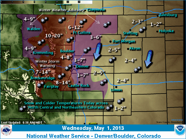
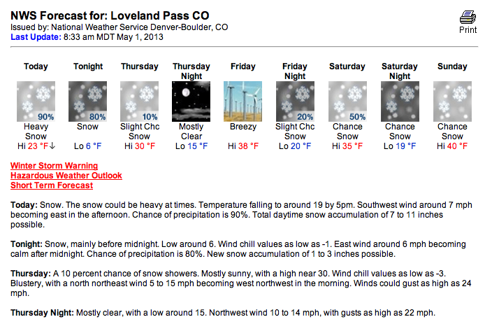
The storm arrived at the Loveland Pass area a bit later than expected but plans to keep cranking. The Winter Storm Warning remains in effect until midnight in the Loveland Pass zone and is expected to drop an additional 7-14 inches of snow. (Cameron Pass, CO got 18” inches of snow overnight according to SNOTEL)

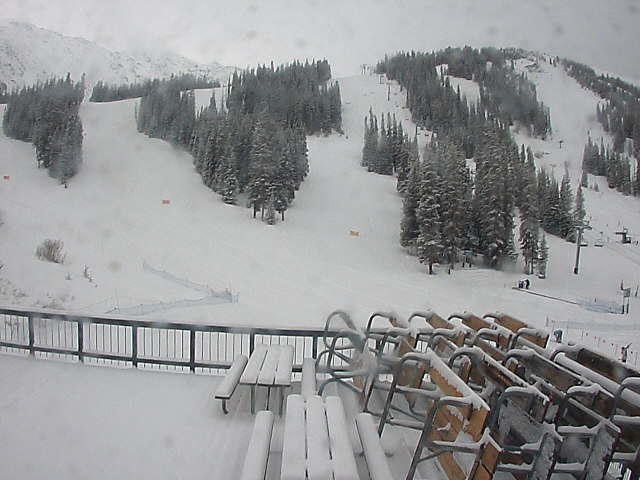
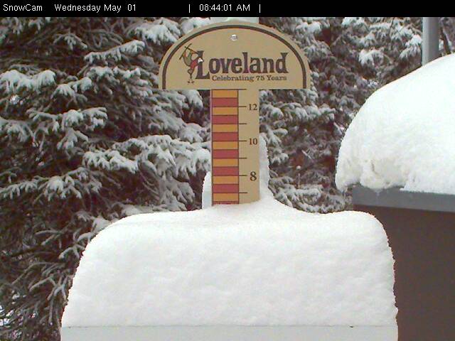
Loveland saw 7” overnight. Arapahoe Basin received 4” overnight. Both ski areas are currently open.
WINTER STORM WARNING:
...WINTER STORM WARNING REMAINS IN EFFECT UNTIL MIDNIGHT MDT
TONIGHT...

* TIMING...SNOW...HEAVY AT TIMES WILL CONTINUE THROUGH THIS
  EVENING THEN DECREASING.

* SNOW ACCUMULATIONS...7 TO 14 INCHES...HEAVIEST ALONG THE
  HIGHER EAST FACING SLOPES.

* VISIBILITY...BANDED SNOW WILL BE ABLE TO PRODUCE 1 TO 2 INCHES
  OF SNOW PER HOUR AT TIMES IN RELATIVELY SMALL AREAS...REDUCING
  VISIBILITIES TO LESS THAN ONE QUARTER OF A MILE.
COLORADO SNOW FORECAST:
18″ at Cameron pass
Cutting school tomorrow.