We wish every National Park had an terrain atlas like this. This atlas is unreal. Anything you need to know about any zone in Glacier National Park, on the Candian side, is professionally displayed for any skier or rider to study.
The best part is, you can save this terrain atlas to your computer. Perfect.
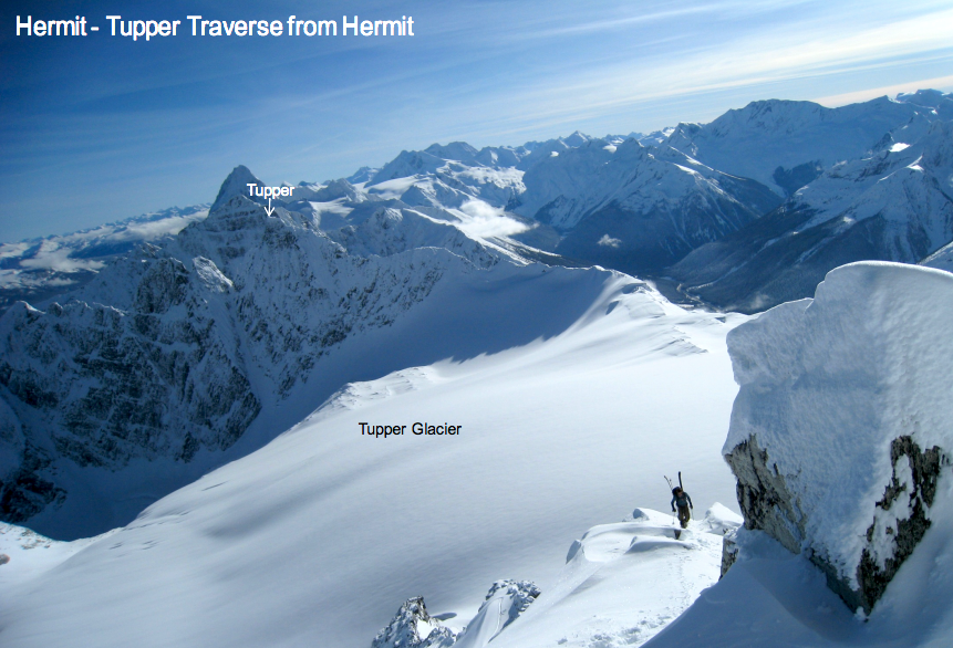
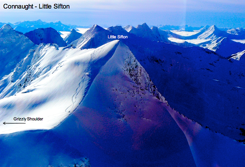
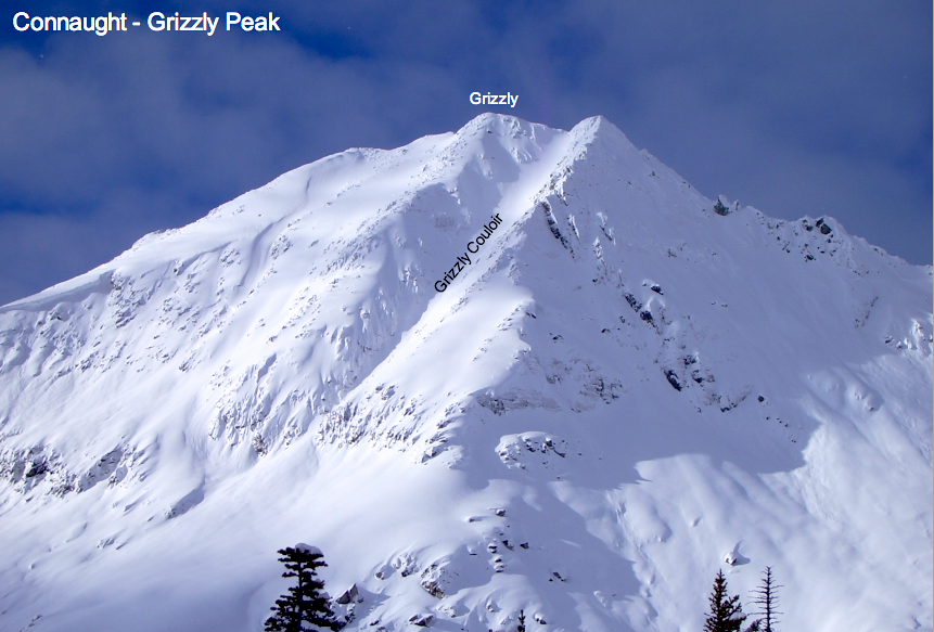
The Winter Terrain Atlas provides valuable visual terrain information to backcountry users of Mount Revelstoke and Glacier national parks. It is designed to provide a common language for place and run names and to assist with trip planning and rescue situations. The Winter Terrain Atlas also helps backcountry users identify Winter Permit Area boundaries.
It is important to check today’s Avalanche Bulletin and the Winter Restricted Area Statusto ensure your destination areas are open before heading into backcountry terrain. You will also need a daily or annual winter permit.
The Winter Terrain Atlas is available for download. At 190 pages, it is a comprehensive document, so we have provided several download options.
-
Download the full terrain atlas:
-
Low Resolution Version (For web and mobile viewing, PDF, 15 MB)
-
High Resolution Version (For printing, PDF, 73 MB) Note: To save this large file to your computer, right-click on the link (control-click on a mac) and select the “Save Target As…” option.

Glacier National Park
-
Just so no one is confused, this isn’t the same Glacier Park that’s on the Canadian side of Glacier Park in Montana. This Glacier National Park is between Revelstoke and Golden BC and is home to some of the best backcountry touring in the world at Rogers Pass.