
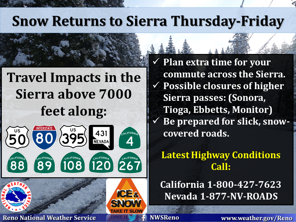
A Gulf of Alaska storm will be careening into California Thursday and Friday bringing with it up to a foot of snow on the Pacific Crest from Tahoe to Mammoth. Snow levels will be down to 5,500-feet.
Tahoe and Mammoth Forecasted Snow Totals:
Above 5,000′ = 2″
Above 6,000′ = 2-6″
Above 7,000′ = 12″
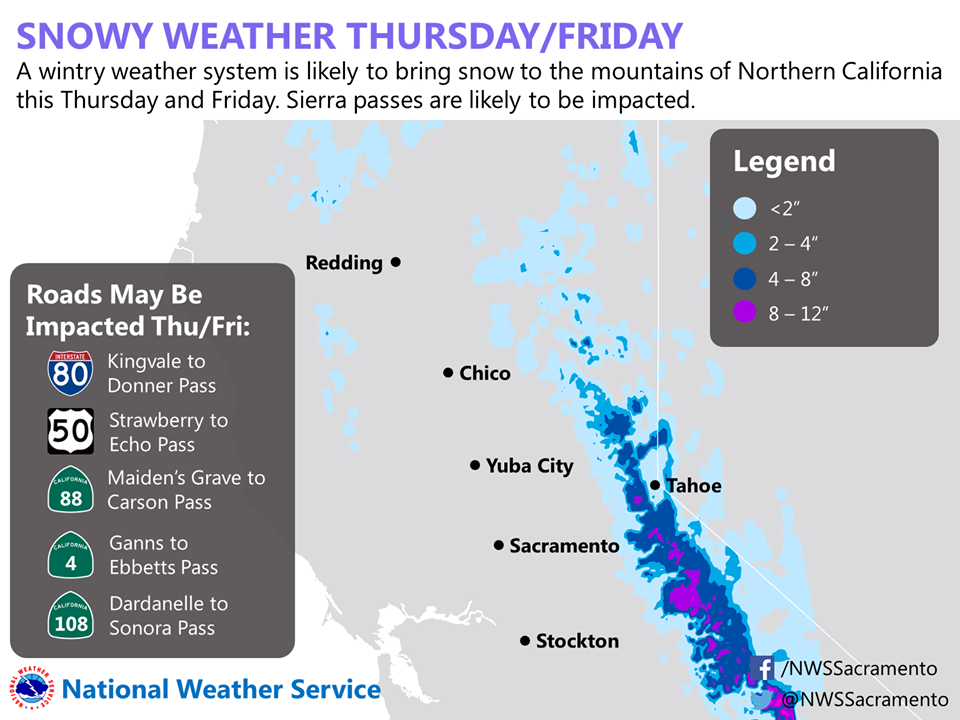
It’s very likely that all of the mountain passes in the area will close for this storm including: Tioga (hwy 120), Sonora (hwy 108), Ebbetts (hwy 4), Monitor (hwy 89). Chain controls will likely exist on passes that stay open: Donner (hwy 80), Echo (hwy 50), Carson Spur (hwy 88).
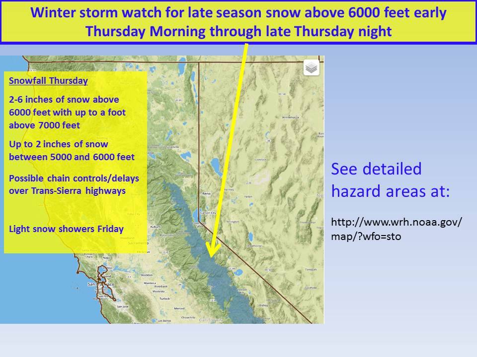
“Another late season storm from the Gulf of Alaska will move into California Thursday into Friday. This storm will bring rain and snow showers along with the possibility of thunderstorms. Thunderstorms will bring dangerous lightning and possibly heavy rain and small hail along with gusty winds. Snow levels are expected to be around 5500 ft. This will bring snow to the Sierra passes with up to a foot possible over the highest elevations. Chain requirements and travel delays are possible over the Sierra Passes. Temperatures will cool to around 10 to 20 degrees below normal for mid May, with high temperatures around the mid 60s to low 70s in the Valley and low 30s to low 50s in the mountains.” – NOAA Sacramento
NOAA Special Weather Statement:
SPECIAL WEATHER STATEMENT
NATIONAL WEATHER SERVICE RENO NV
354 AM PDT WED MAY 13 2015

...SNOW LIKELY IN THE SIERRA THURSDAY AND THURSDAY NIGHT...

LOW PRESSURE WILL MOVE INLAND ON THURSDAY AND PRODUCE A PERIOD OF
SNOW IN THE SIERRA. SNOW MAY BE HEAVY AT TIMES THURSDAY AFTERNOON
AND THURSDAY NIGHT, LEADING TO LOW VISIBILITY AND RAPID ACCUMULATIONS
ABOVE 8000 FEET. SEVERAL INCHES OF SNOW ARE LIKELY ABOVE 7000
FEET, WITH HIGH END TOTALS UP TO 12 INCHES POSSIBLE ALONG THE
SIERRA CREST IN ALPINE AND MONO COUNTIES.
Miracle May?