Report from August 18, 2023
75ish degrees and partly cloudy is the perfect hike-to-swim weather here at high elevation.
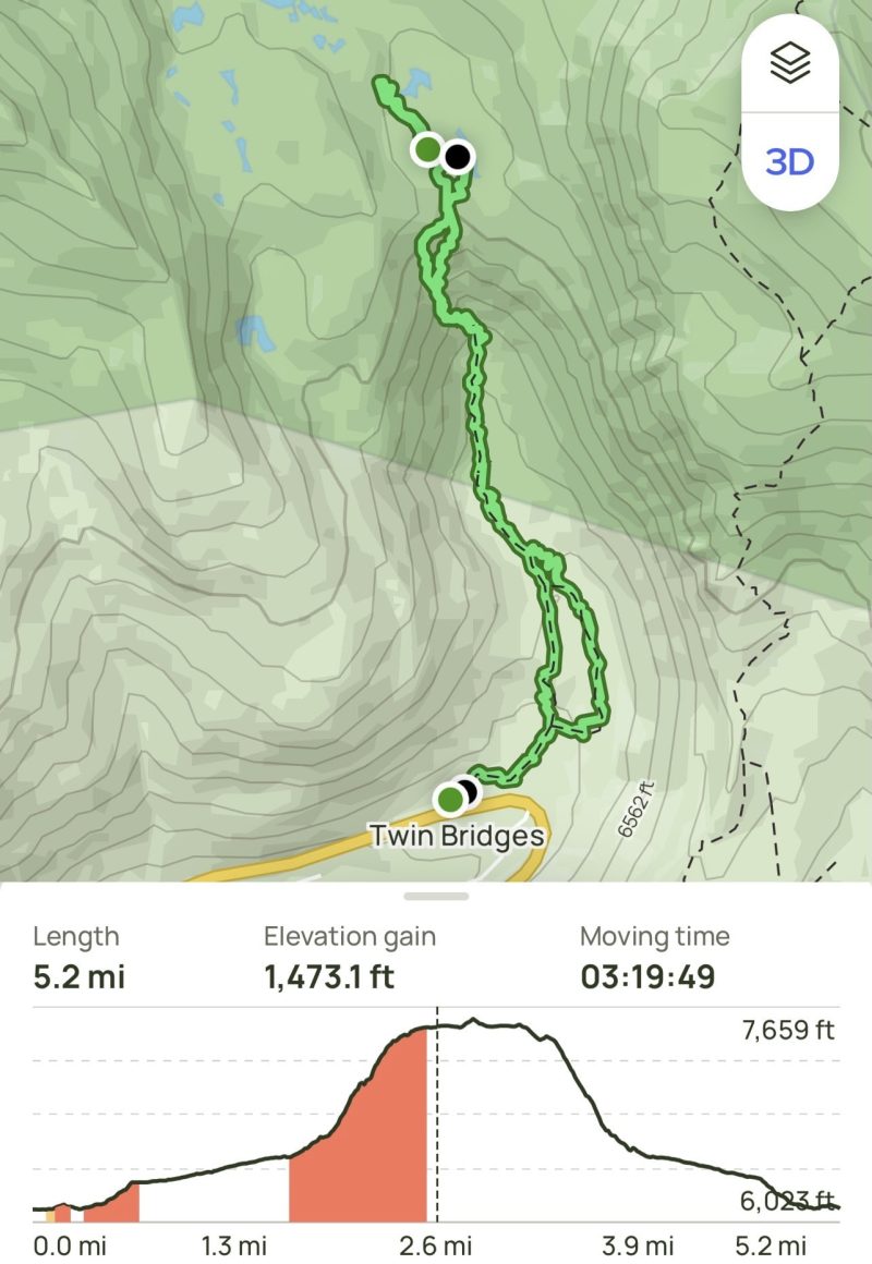
We decided a 4+ mile out-and-back hike to Horsetail Falls, CA, would be a great way to spend our day off of work.
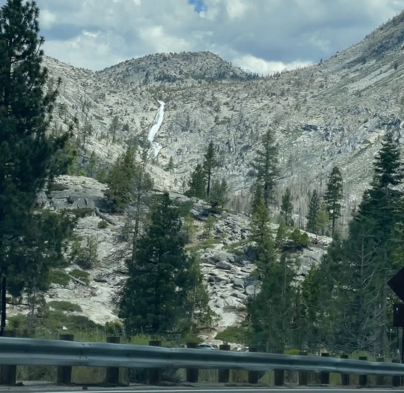
After a short, 30 minute drive from South Lake Tahoe to just past Sierra at Tahoe Ski Resort, we curved around Lovers Leap, and had the first visuals on our objective: the top of the falls.
We arrived at the nearly empty trailhead parking lot, tucked right off of Highway 50, as a small train of cars raced east towards the basin for the weekend.
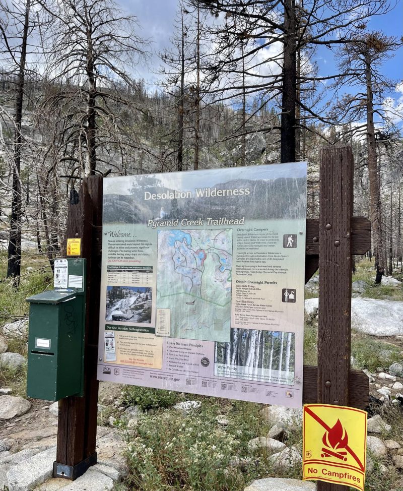
Parking requires a quick and easy $10, self-pay slip, located right near the restrooms and trailhead.
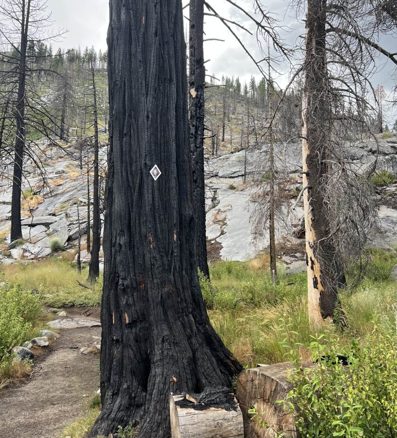
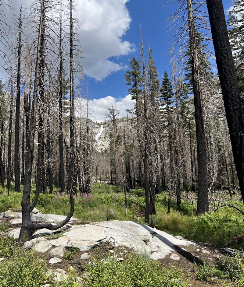
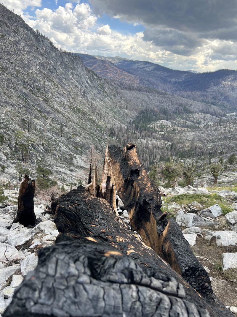
Once we were off and moving, the devastating signs of the Caldor Fire were immediate.
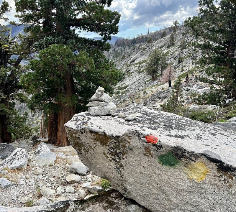
Brand new trail markers on scorched trees directed us right to a small little waterfall in the first minutes of our hike.
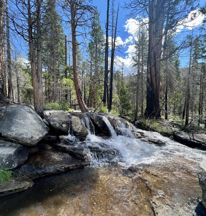
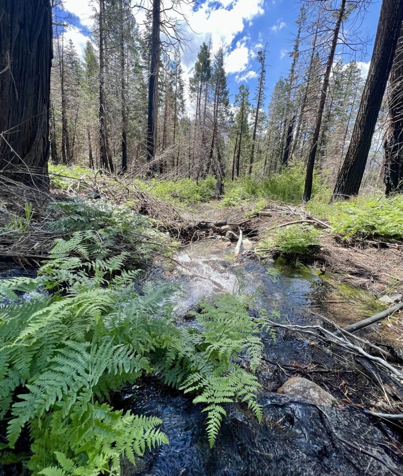
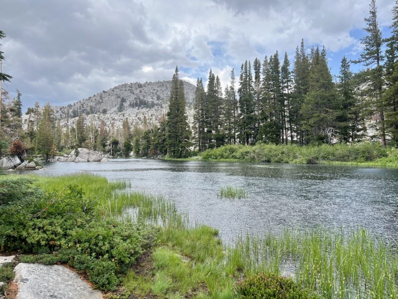
We followed the trail closest to the creek on the ascent, keeping us right on the bank to 40 feet away from the rushing waters.
The sounds of the rocks and sticks crunching beneath our feet and the creek echoing to our right was meditative between conversation.
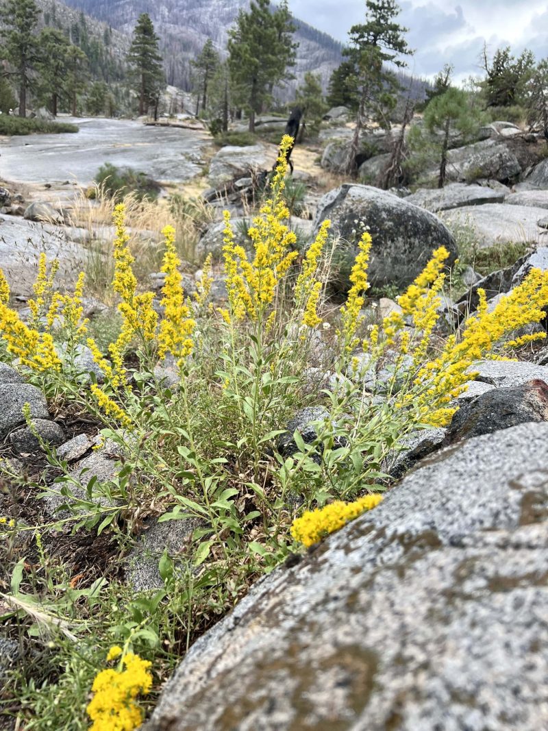
Lush, bright green ferns were scattered everywhere throughout the white, pink, yellow, and purple wildflowers.
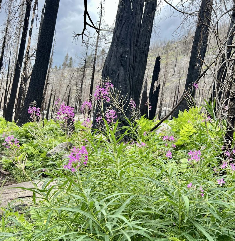
We meandered between the contrasting burnt trees, resulting from the Caldor Fire in 2021, and the blossoming vegetation, thanks to the record breaking winter of 2022-23.
Along the way, we filled out a free Desolation Wilderness Day Use pass required for anyone venturing into this incredible, remote location.
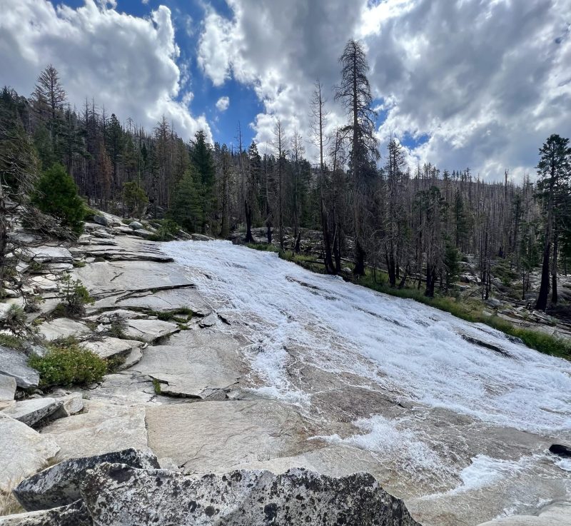
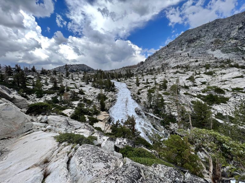
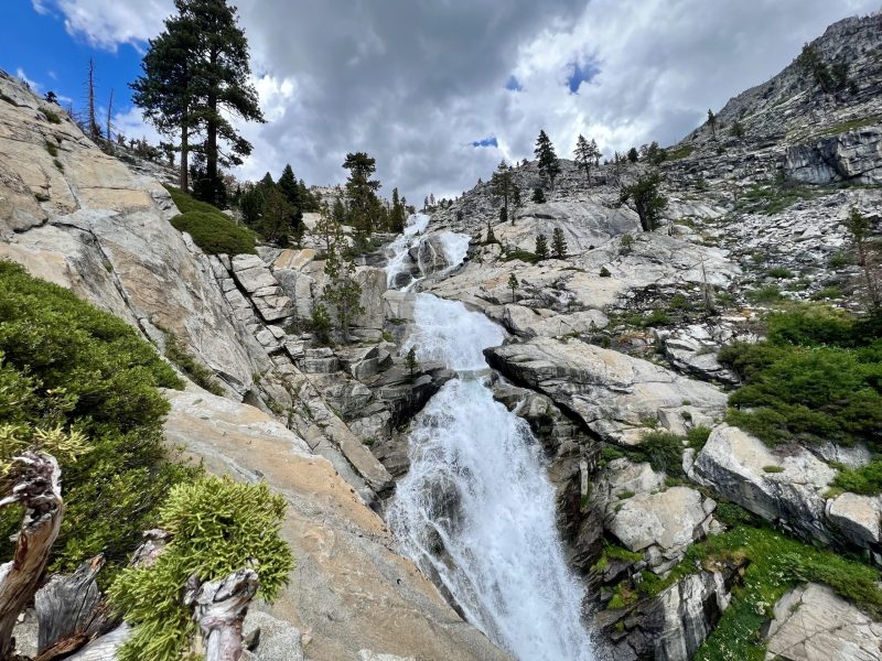
1.5 miles of easy-to-moderate hiking and about 400 feet of elevation gain across the dirt, gravel, and endless granite lead us to the base of the main falls.
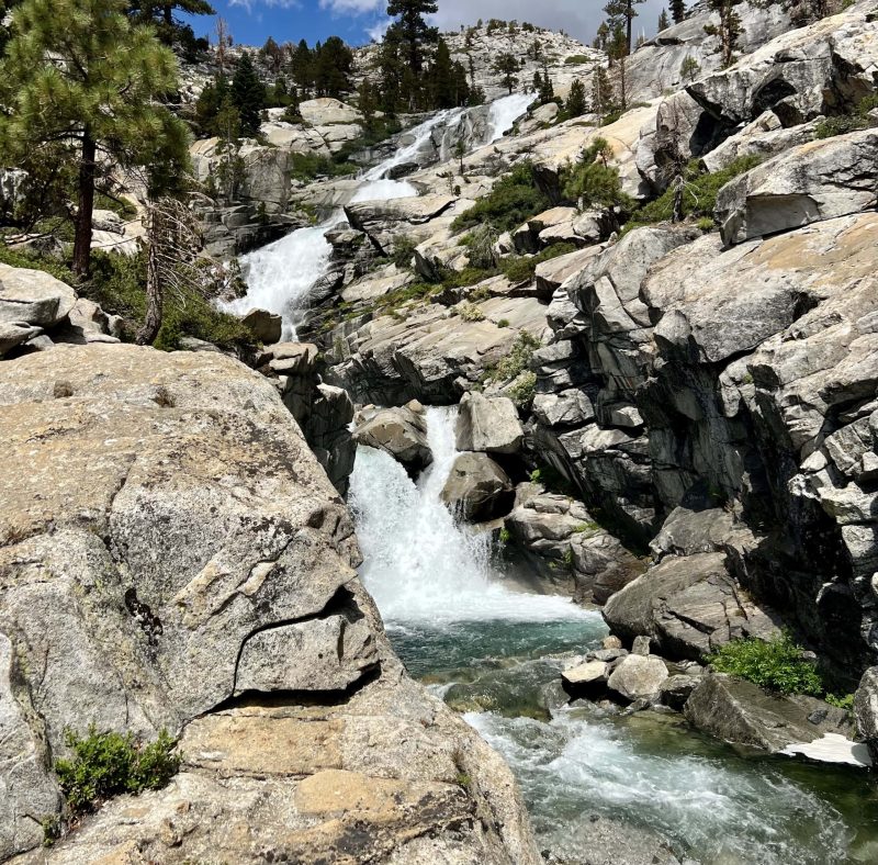
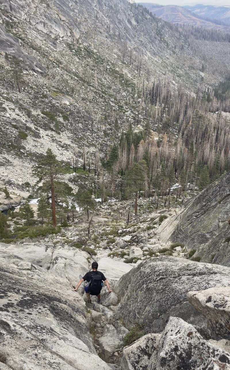
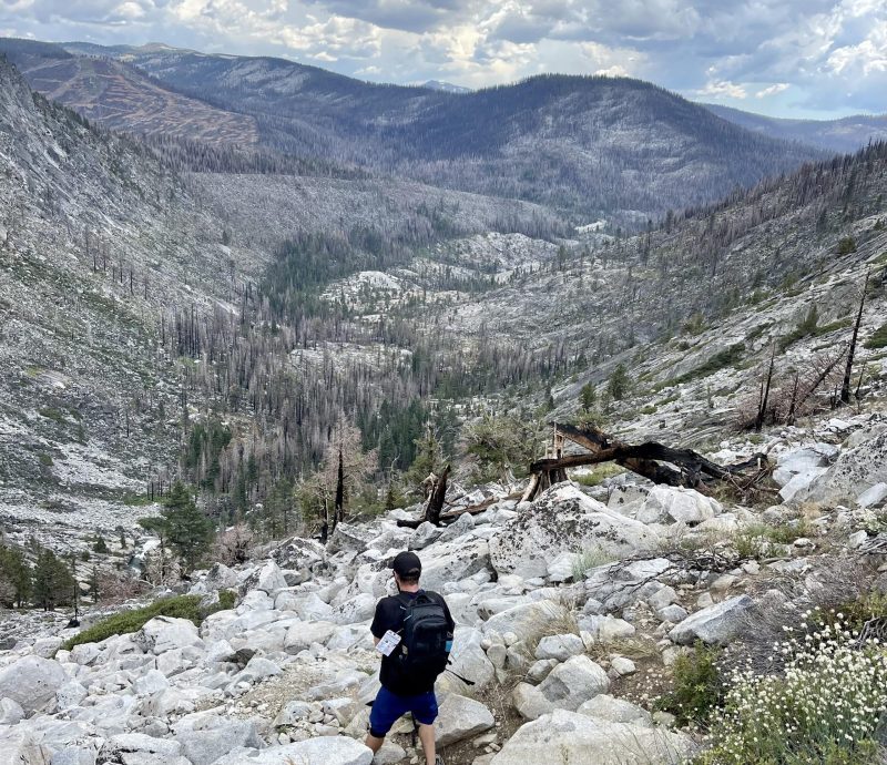
The next mile of the hike consisted of rock scrambling up a not very well marked “trail” to the top of the falls.
According to AllTrails, a few areas during this part of the climb reached a 75% grade.
The clouds were moving in quickly, as potential afternoon thunderstorms developed to the south.
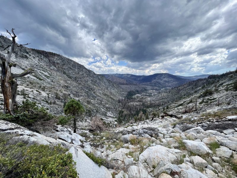
We gained 1,000 feet of elevation in less than a mile, as we carefully maneuvered around and over the giant boulder fields to the top of Horsetail Falls.
At this point, the partial cloudiness morphed into a deep sea of dark gray storm clouds, and thunder roared in the distance as it started to sprinkle.
But, we had completed our goal and made it to Avalanche Lake, the top of Horsetail Falls.
After briefly relaxing and taking in the scenery, it was time to start our descent.
Thankfully, the rain mellowed out and peaks of sunshine slipped between the ominous clouds as we worked our way down.
As I was walking in the lead, I spotted a large snake moving less than eight feet away from me, and instantly recognized it’s distinctive pattern.
“Rattlesnake!” I shouted, as I hopped back and clearly saw the white rattler as it slithered into the burnt manzanitas.
A little added excitement, fear, and adrenaline to help push us on the down-climb.
There was another couple with a dog (not recommended due to the steepness and scrambling of rocks) and a few other hikers heading down as the weather became more threatening.
We took in the incredible and boundless, yet somber views of the extensive damage from the terrible Caldor Fire.
Much to our surprise and relief, rock cairns and painted dots used as trail markers were conveniently placed, helping guide us down.
Continuing back down near the pools of the falls, there were a dozen or so other day-hikers admiring the huge waterfall from below.
The temperature was dropping and the clouds were engulfing us and the mountains.
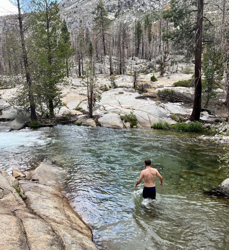
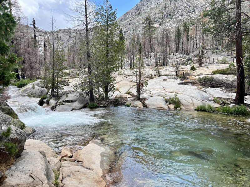
However, as we approached a beautiful, secluded emerald pool, it was far too enticing to not get in.
The water was pretty cold, but so refreshing and rejuvenating on our bodies after a strenuous day.
As we inched closer to the trailhead, the rain picked back up, and big, steady drops were now coming down hard.
I lost my footing on some slippery dirt and granite and took a small spill, maybe ten minutes away from the car.
Moments later, an older gentleman went down hard, tailbone or hip and elbow straight to the granite.
Overall, this fairly difficult hike (with lots of rock scrambling) was incredibly rewarding and repaid us with fantastic views, a terrific work-out, and an amazing late summer day.
*Remember: Pack it in, pack it out. Leave no Trace.*

Map
Photos