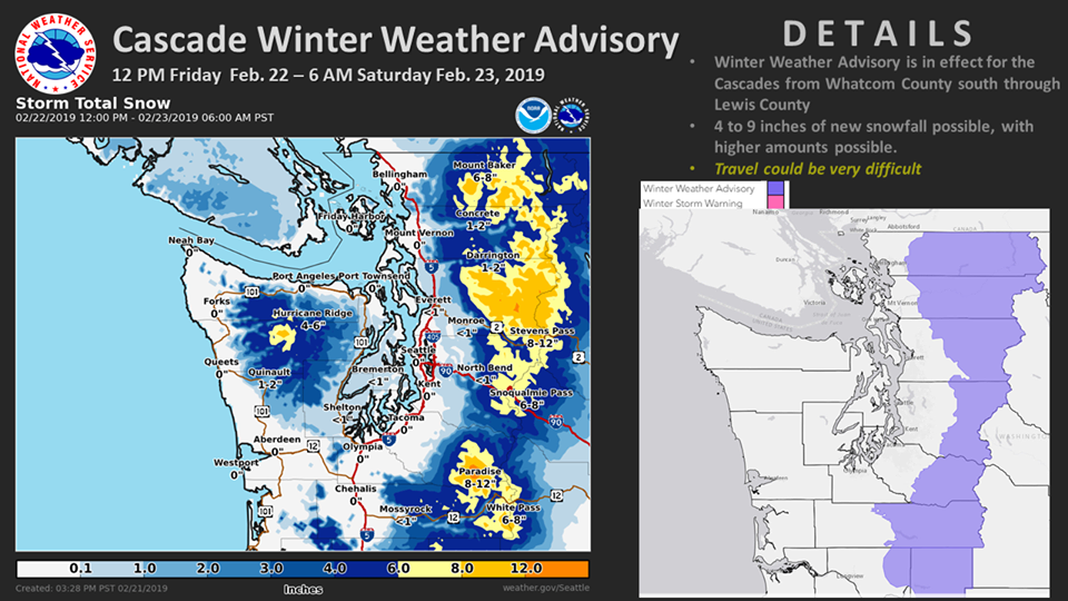
The National Weather Service has issued a Winter Weather Advisory for Washington. It’s in effect from 12:00pm Today – 6:00am Saturday morning. Snow is expected to impact the area throughout that time.
Washington:
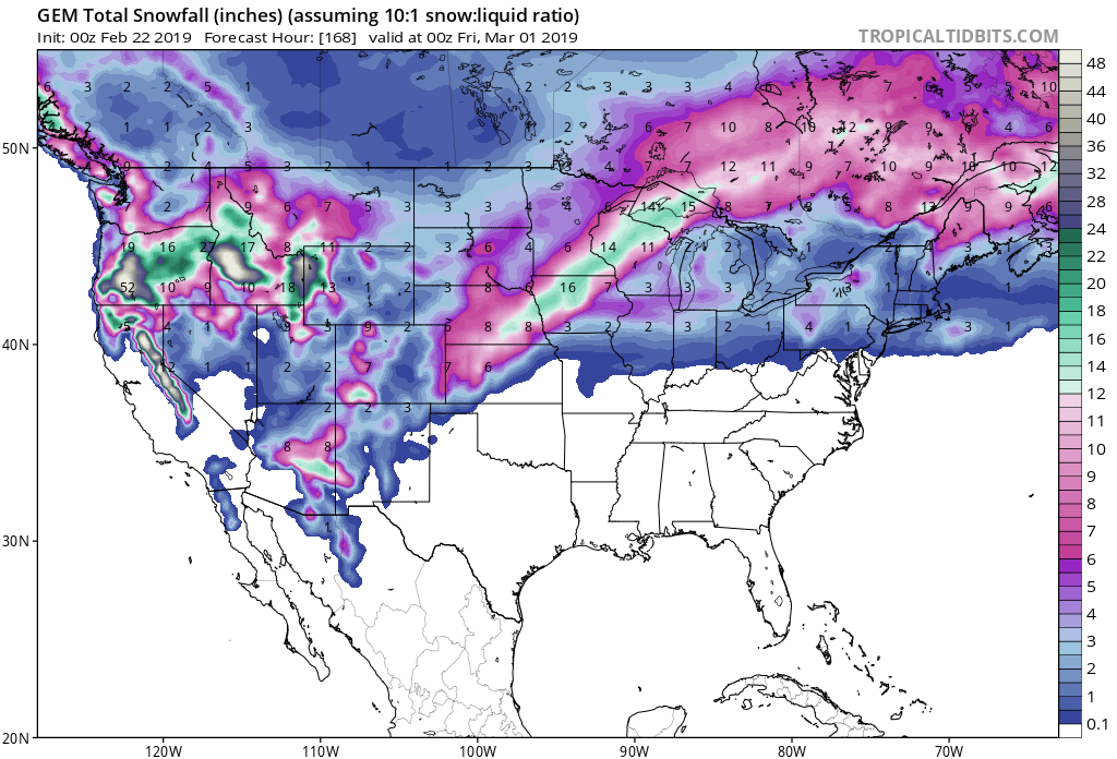
- 4-11″ of Snow Today – Saturday Morning
“A Winter Weather Advisory has been issued for the Cascades (Noon Friday thru 6 AM Saturday) for the potential of 4 to 9 inches of new snow accumulation. Higher amounts will be possible. Travel may become hazardous across the Passes. The next weather system will move into the area tomorrow, bringing more snow to the mountains and rain to the lowlands.”
– NOAA Seattle, WA
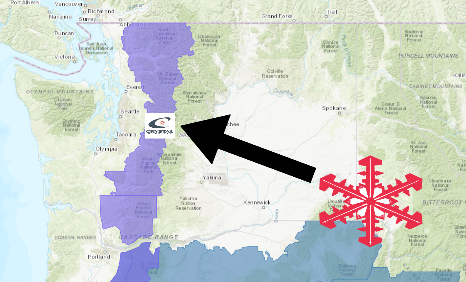
Crystal Mountain Resort, WA is in good shape with this system, plus they received over 7 FEET of snow in 7 days last week.
Snow levels are forecasted to hover just above 1,000ft with this system.
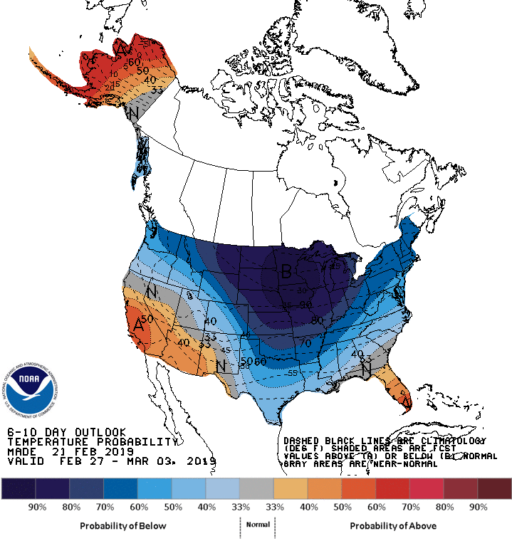
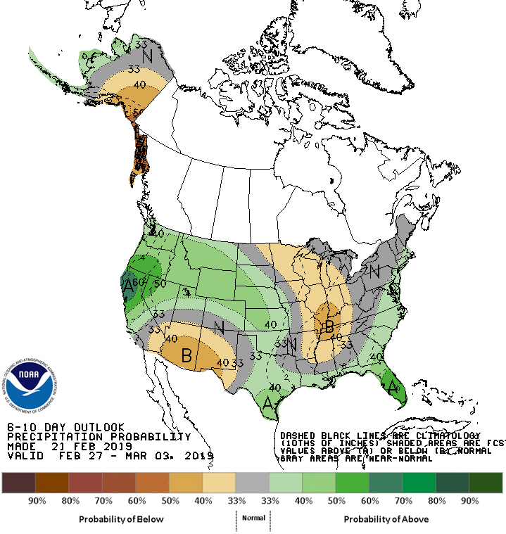
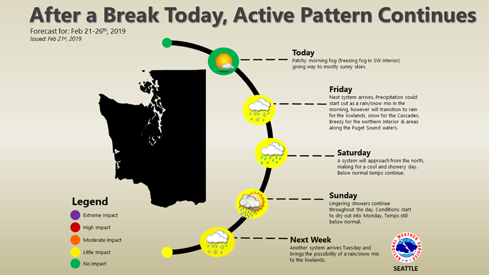
The 6-10 day outlook is calling for below average temperatures and above average precipitation in Washington.
Additional Storm Info:
Washington: 4-11″ of Snow Today – Saturday Morning
* Snow expected. Snow accumulations of 4 to 11 inches
  expected through early Saturday morning.
- NOAA Seattle, WA
Winter Weather Advisory:
URGENT - WINTER WEATHER MESSAGE
National Weather Service Seattle WA
402 AM PST Fri Feb 22 2019

Cascades of Whatcom and Skagit Counties-
Cascades of Snohomish and King Counties-
Cascades of Pierce and Lewis Counties-
including Concrete, Hamilton, Lyman, Maple Falls, Deming,
Newhalem, Darrington, Baring, Stevens Pass, Skykomish,
Snoqualmie Pass, Morton, Ashford, Packwood, Randle, Paradise,
and Longmire

...WINTER WEATHER ADVISORY REMAINS IN EFFECT FROM NOON TODAY TO
6 AM PST SATURDAY...

* WHAT...Snow expected. Snow accumulations of 4 to 11 inches
  expected through early Saturday morning.

* WHERE...Cascade mountains and valleys of Whatcom, Skagit,
  Snohomish, King, Pierce and Lewis counties. This includes the
  Mount Baker Ski Area, Stevens Pass, Snoqualmie Pass, Paradise
  on Mount Rainier and White Pass.

* WHEN...From noon today to 6 AM PST Saturday.

* ADDITIONAL DETAILS...Plan on slippery road conditions.