onX is the first digital navigation app in the United States to include the ATES classification system, expanding its offering of avalanche safety tools
onX Backcountry, a navigation and discovery app for outdoor enthusiasts, today launched a new mapping tool called the Avalanche Terrain Exposure Scale (ATES). ATES classifies terrain based on exposure to avalanches, helping snow enthusiasts–primarily backcountry skiers and snowboarders, as well as fat bikers, nordic skiers, and snowshoers–make more informed decisions regarding avalanche safety in the mountains.
According to Snowsports Industries of America’s 2022-23 participation report, close to 5 million backcountry skiers and boarders are heading into the mountains–a two-fold increase compared to pre-pandemic years. Participation in fat biking, nordic skiing, and snowshoeing have also hit record levels. Access to snow safety information for new entrants and seasoned adventurers is crucial to help keep powder seekers safe. To access this information, they turn to daily avalanche forecasts issued by the professional avalanche community to understand the day’s avalanche hazard and how to minimize their risk.
“The daily avalanche forecast considers numerous important variables, such as temperature, snowfall, slope aspect, and elevation. Some of these variables change daily or even by the hour. But there is one variable that will likely remain the same throughout the season: terrain. That is where ATES comes in–helping a skier or snowboarder understand whether the terrain where they plan to ski or board could expose them to an avalanche, regardless if tinter enthusiasts,” said Utah Avalanche Center’s director of forecasting, Mark Staples. “Taken together with the daily avalanche forecast, ATES can help the public–whether they’re a beginner or a professional–better understand how to reduce their overall risk, have an incredible time in the mountains, and get home to their friends and family at the end of the day.”
– onX Backcountry Product Manager Charlie Avis
“onX Backcountry’s introduction of ATES, and its additional Avalanche Runout and Avalanche Potential Release Area layers, have the potential to greatly improve users’ risk management and backcountry navigation. It’s clear that onX is committed to providing innovation and improvement within the avalanche industry, cementing themselves as a leader within the digital mapping space.”
– American Avalanche Association executive director, Jayne Nolan
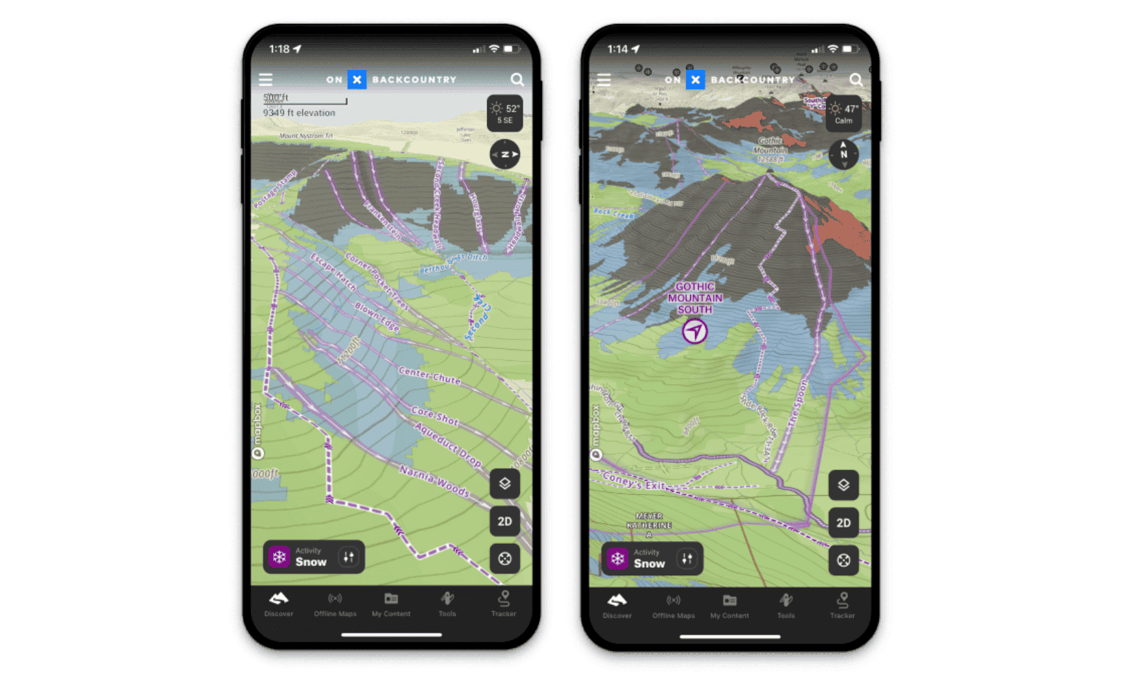
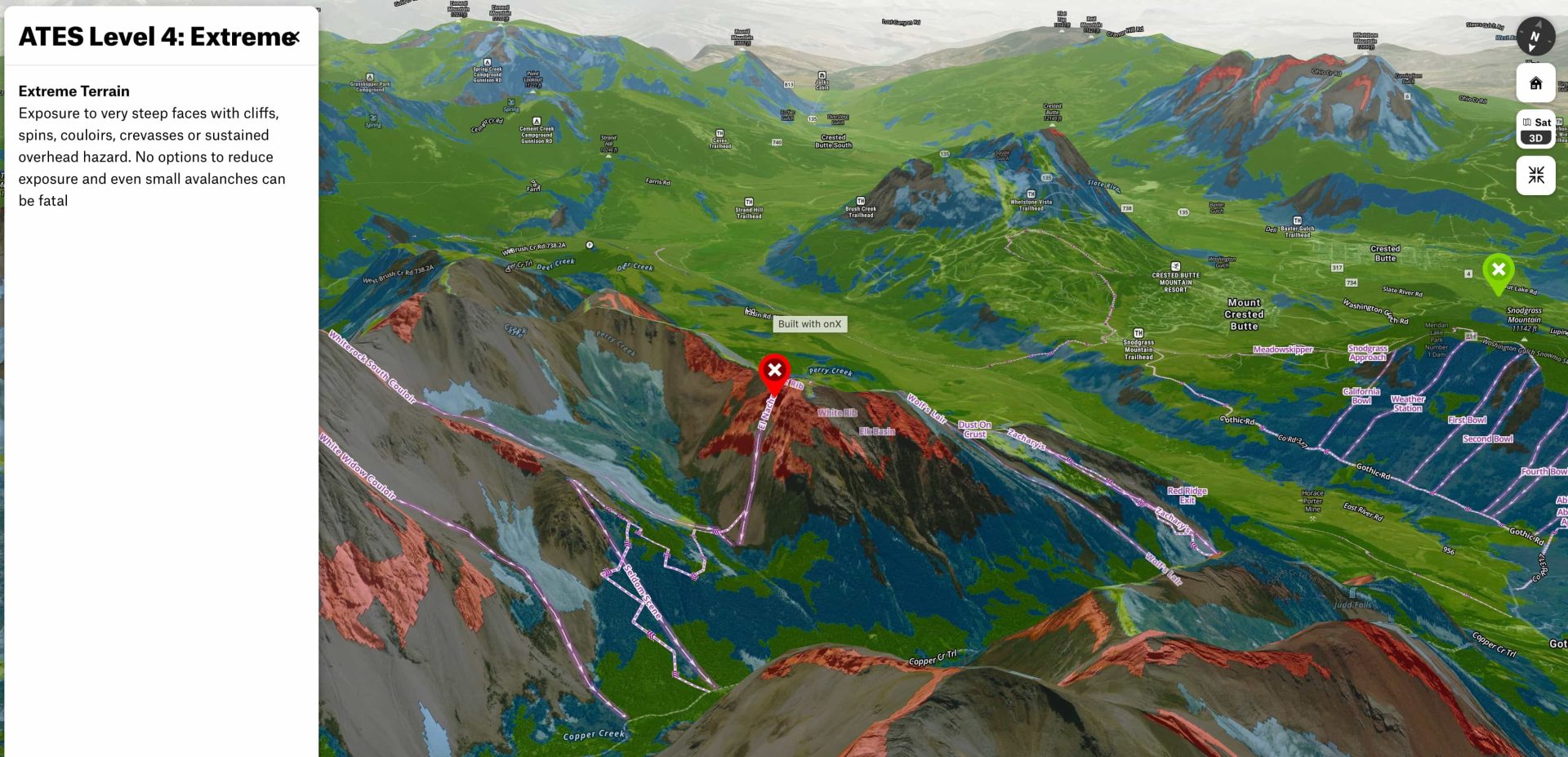
ATES is a layer in onX Backcountry’s robust Snow Mode that users can toggle on or off. It shows four different colors for four different ratings. Those ratings are: simple (green), challenging (blue), complex (black), and extreme (red). With this tool, users can connect the terrain to the daily avalanche forecast and confidently plan their adventure.
Because ATES is the result of 11 different inputs, some enthusiasts may enjoy seeing a few of those individually. To aid this understanding, onX has added an Avalanche Run Out layer and Avalanche Potential Release Area layer to Snow Mode for further exploration. App users can also toggle on other layers like the Daily Avalanche Forecast, Slope Aspect, and Slope Angle and access the weather forecast and SNOTEL data to expand their understanding of snow safety.
Current ATES coverage areas in the onX Backcountry app include zones in Colorado, Montana, and Utah. Coverage in additional regions will be added later this season, including Washington, California, Wyoming, and Alaska, as well as expanded regions in Colorado and Montana
“ATES doesn’t tell you where to go. Winter outdoor enthusiasts still need to do the work to connect the forecast with the terrain and take critical avalanche safety education courses. But we are giving users the tools to apply this education right on the map.”
– Beacon Guidebook founder and onX Backcountry senior content manager, Andy Sovick
To learn more about ATES, and to purchase an onX Backcountry subscription, visit https://www.onxmaps.com/backcountry/app/features/avalanche-terrain-exposure-scale.