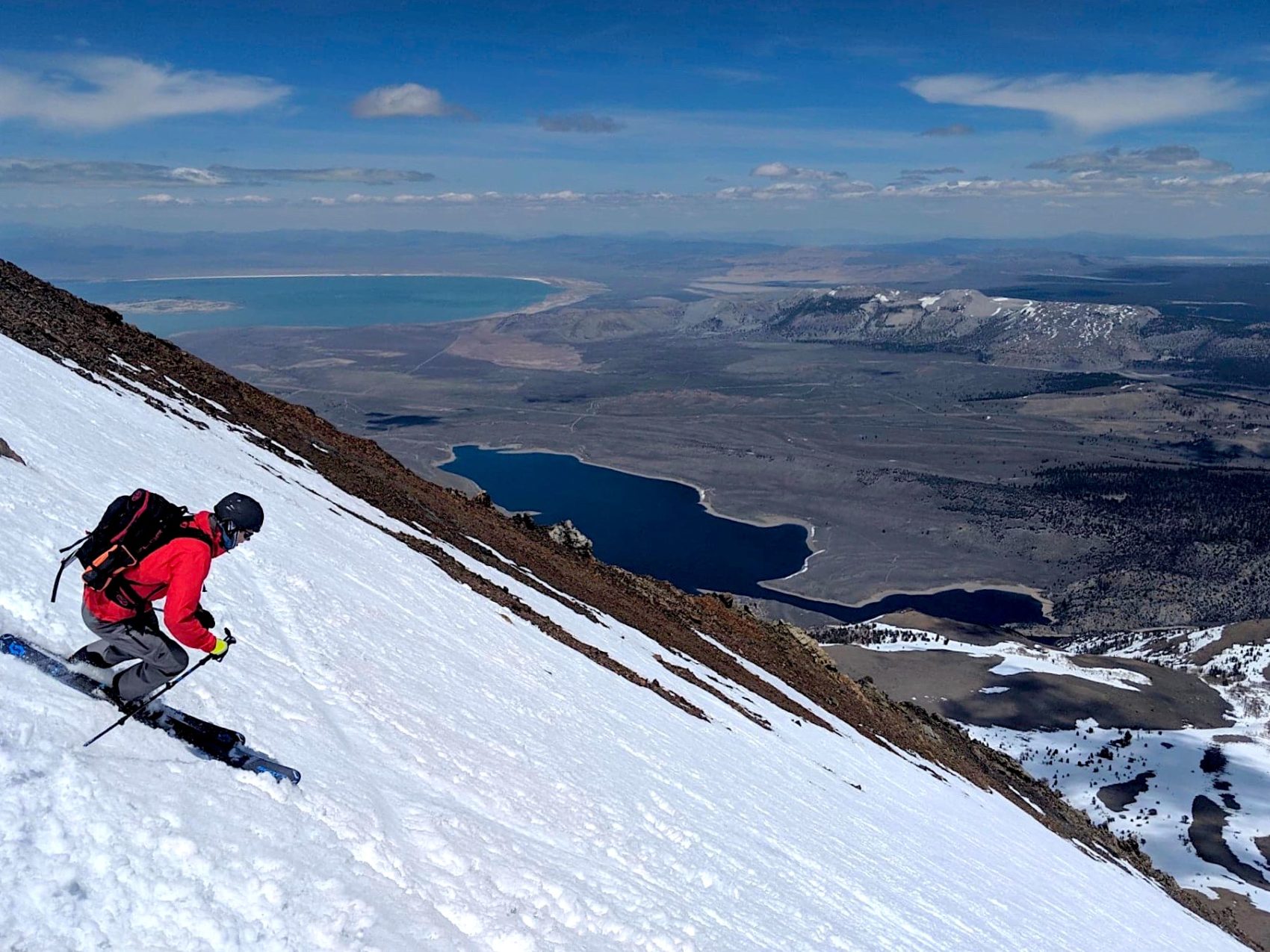
One of the best places in the world to backcountry ski may be the Eastern Sierra of California. The region has a deep snowpack, sunny skies, and stunning high-elevation peaks. Great terrain and easy access add to the allure.
Nate Greenburg grew up in these mountains, backpacking and skiing throughout the area, and is the co-author of the book Backcountry Skiing California’s Eastern Sierra. The book is a guide to every major peak and canyon in the range, covering approximately 300 descents with options for all ability levels.
Greenburg is also committed to helping the region’s adventure opportunities expand. In 2005, along with the help of a group of dedicated individuals, Nate helped form the Eastern Sierra Avalanche Center, providing backcountry users the information they need to stay safe in avalanche terrain.
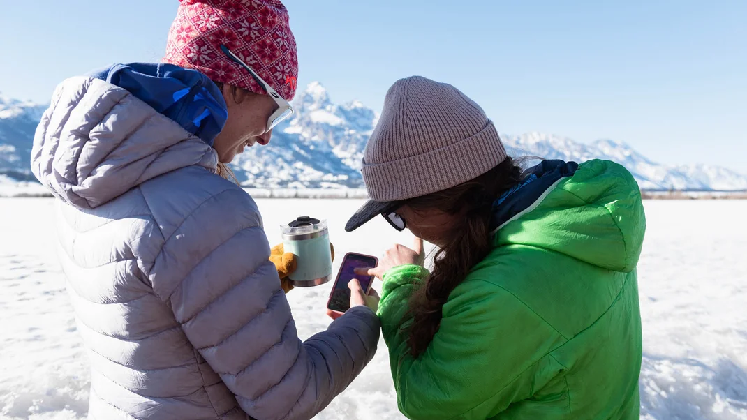
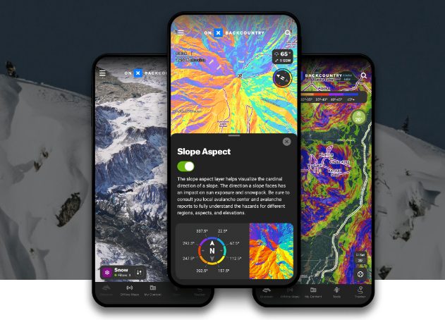
Now in a recent partnership with onX Backcountry, Greenburg is making backcountry lines more public and readily available to everyone, no matter what their experience level is in the backcountry. The partnership uses GPS integration to allow users to follow the backcountry routes on their phones, significantly improving access to the routes in the guidebook.
In case you are unfamiliar, onX Backcountry is a respected app with all the information you need to plan your epic missions. 3D maps enable you to visualize your outdoor pursuit in stunning detail. The app has numerous features that allow backcountry skiers to visualize, plan, and execute their objectives.
The news of the partnership was met with mixed opinions on social media, including many from professional skiers.
Primarily, the critics commented that this would create an influx of inexperienced riders into the area who could get into dangerous situations by not having formal training. This could lead to injuries, deaths, and putting others at risk. Others worried that it would make the mountains crowded, pointing to something similar happening to sacred surfing spots. Additionally, some purists complained that the journey and thrill of adventure of researching your mission goes out the window and “taking a wrong turn every once in a while” was part of that journey. Gone is the authentic experience of discovery and connection with nature.
Local pro Zak Mills had one of the most engaging comments when he said this:
“This is disappointing to see Nate. From what I’ve heard from others along with my own experience, backcountry skiing is about adventure not following lines on your phone. Your guidebooks have done more than enough to get people started skiing here, there is no need for more information. It’s ironic to me that the users of this sort of technology are shortchanging themselves out of a beautiful authentic experience of discovery and connection with nature. All the while paying you to have that compromised experience. Who wins from something like this? I can’t imagine your personal profit is worth the impact this will have on our Range. I hope you’ll re-consider if this is good for the Eastern Sierra and our community or if this is just good for you and folks that want to skip steps and take short cuts to check boxes. I would encourage folks that feel like they need this sort of technology to put the time in, seek mentorship, & discover yourself along with the mountains on your own terms. I promise it will be a more profound and fulfilling experience. Remember, the simpler you make things the richer the experience. This is not simple.”
Professional skier Michelle Parker offered some similar insight:
“I think it comes down to safety for me. I share beta and love having these discussions. I’ve also guided many groups this year around Tahoe. Clearly, I’m not for this particular app as I’ve had personal experiences with them mentioned previously. Many of these digital devices are great navigation tools, but when being guided into the backcountry by an app, the degree of slope is almost always off by a few and lots of the routes are off. When heading out with minimal beta, you learn, gain experience have a beautiful opportunity for exploration. I actually very much see both sides and agree with aspects of both. It’s a super interesting discussion IMHO. I don’t know what the “right” answer is and I certainly don’t intend to gatekeep…I just don’t want us to lose that experience of figuring it out for ourselves, putting in the work and having an epic adventure. I also love escaping technology in the mountains and in recent experience in these mountains am honestly concerned for individuals’ safety.”
Proponents of the project offered congratulatory remarks and gratitude for the hard work put in and pointed out how much of the same information can be found in the guidebook. Also, anyone using the app to get in the backcountry will probably find a way to do it anyway. Having more decision-making tools and information is good, and this kind of data is safer than community-oriented public route information.
Joel Ryan, another adventurer in the area, offered this insight:
“Bummer that everyone is being so hard on Nate and not looking at the reality of the demographics of a growing sport. There will always be lifetimes worth of exploration. Making information accessible doesn’t bring the mountain any closer to someone’s doorstep. The Eastern Sierra don’t have the resources for people to get injured while we gatekeep ‘adventure.’ People will make good and bad decisions as they always do… trying to support decision making with tools and information is worth respect, not criticism.”
Professional skier Cody Townsend (who also has a partnership with onX) made his voice heard as well:
“I’ll throw my hat in the ring. A gargantuan amount of digital routes are available in apps already and coming to all apps and every mountain range soon. We just live in a time of transition, one that is impossible to stop. But this route, is far safer and community oriented than the public route submissions that is and will dominate Strava / Fat Map integration. We cannot fight GPX files from proliferation on apps, but we can have them written by knowledgeable, community oriented, avy forecasters like Nate. A massive amount of information is already at all of our fingertips, will only continue to grow, the only decision is if it’s dished out by people like Nate, or the masses. Eventually once all this info is out, then it’s back to square one where anonymity and space is found in the crowd. Anyways, that’s my 2¢.”
There are pros and cons to both sides of this. Do features like this lower the barrier to entry too much for backcountry skiers, making it more dangerous, or does having this data readily available at your fingertips improve safety? Depending on where you stand in your backcountry journey, it will certainly determine which side you are on.
To view all the comments and join the conversation, see the original post below or comment at the bottom of this page.
Boy I guess it’s a good thing you can’t just Google most of these routes already.
Oh, wait…
What a great marketing trick by onX! Backcountry tracks have been around for years with apps like FatMap and Strava’s heat map. The real scandal is that you’re facing into the trap of a savvy marketing department with lots of dollars.