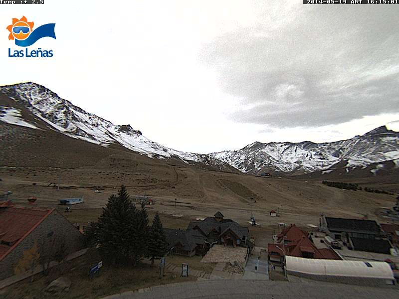
The first outlook for South America by weatherbrains didn’t go so well. The ridge decided to retrograde to the west just far enough to create a cut-off coastal slider pattern. The ensembles were showing an upper latitude blocking pattern in the Bellingshaussen Sea, instead we were left with a mid latitude block that managed to cut off a couple upper level disturbances from the main storm track.
Once we’re dealing with a cut-off low scenario all reliability in the models go out the window. The first two storms got torn apart by the ridge trying to nose its way into the coast of Chile. The storms fell apart as they tried to cross the Andes and all of the energy stayed south of Las Lenas.

So there is one more cut-off low before the ridge builds back in for a few days. Its exact track will be critical to try to determine a sensible forecast for Las Lenas for the next couple of days. Definitely frustrating not being able to nail down a forecast 24-48 hours out. The models are holding on to the storm a little bit better now and pushing it farther north down the coast. There are still signs that the low may stay too far west to amount to anything more then clouds and a dusting. Best case scenario right now looks like 1″-3″, then the ridge builds back into the coast.
Medium Range Forecast
Looks like the ridge is building back into Las Lenas from the 22nd through the 26th. A series of strong storms looks to be approaching the southern cone making land fall on the 27th, flattening the ridge and retrograding it well to the west of Chile initially centering around 35S and 110W. Las Lenas sits at 35S and 70W. That should be plenty far enough to allow the storm track to push far enough north to reach Las Lenas. So there is a possibility that the tail end of the first storm on the 27th hits Las Lenas or stays just to the south. Patagonia should get hit pretty hard. Keep in mind that this is just beyond a week out and the models have been performing poorly this last ten days or so. The Climate Forecasting System (CFS) was showing storms the end of May and the first week of June about 4 weeks ago on multiple runs and it has been performing unusually well in both hemispheres lately.
Long Range Forecast
The newest model run of the (18Z GFS) Global Forecasting System that just came in, is showing the storm on the 27th staying south of Las Lenas now. Another system appears to hit Las Lenas on the 30th. Unfortunately the GFS is the only model that goes beyond 7 days in South America. Otherwise you have to rely on the ensembles and the only ones that go beyond 7 days are the Canadian and the Global Forecasting System. So not a lot to go on down there and those of you with experience know that it is hard to get a reliable long range forecast in South America. The GFS ensemble between the 27th of May to the 4th of June keep the storm track right at or just south of Las Lenas. The Canadian has some of the energy stretching farther to the north during the same time frame. Overall the models and there ensembles lack continuity so the forecast confidence is low at this time.

One decent snowstorm hit Las Lenas about a week later, meanwhile it snowed the entire month of August down in Patagonia last year. The 2013 season in Las Lenas ended with a massive rain storm early September which is not typical for them. In fact talking to a prominent business owner of Hemisphere Sports and Clothing about the rain storm that hit. He said he had never seen it rain that hard for that long in the numerous years he had spent living there. It eventually turned to snow on the upper mountain resulting in gigantic wet slides.