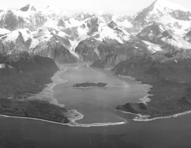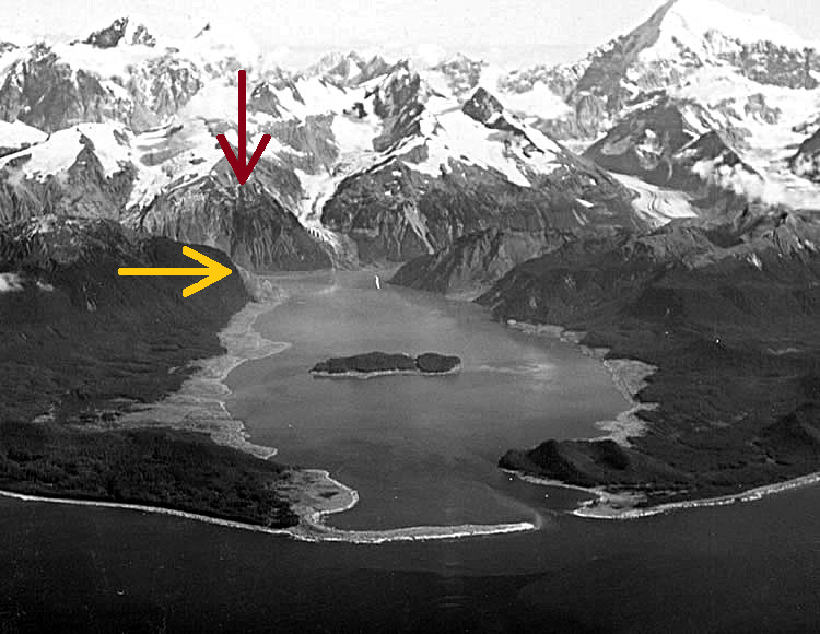
At 10:15 pm on July 10, 1958, the ground shook violently as an M7.8 earthquake occurred along the Fairweather Fault in Southeast Alaska. The strong shaking set loose an enormous rockfall, in which 40 million cubic yards of material (9 Superdomes!) tumbled down a steep slope into the narrow inlet of Lituya Bay. The impact was heard 50 miles (80 km) away and the displaced water traveled outward as a landslide tsunami, stripping away trees and soil up to an elevation of 1720 feet (524 meters): the tallest known tsunami.
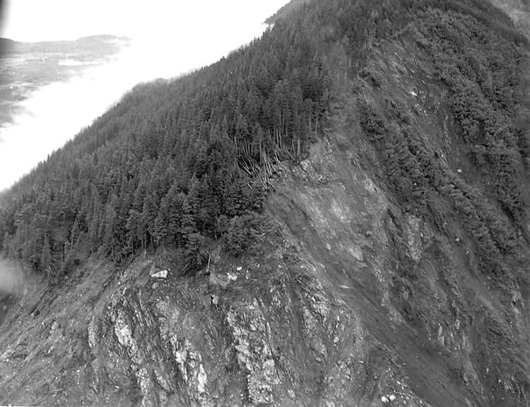
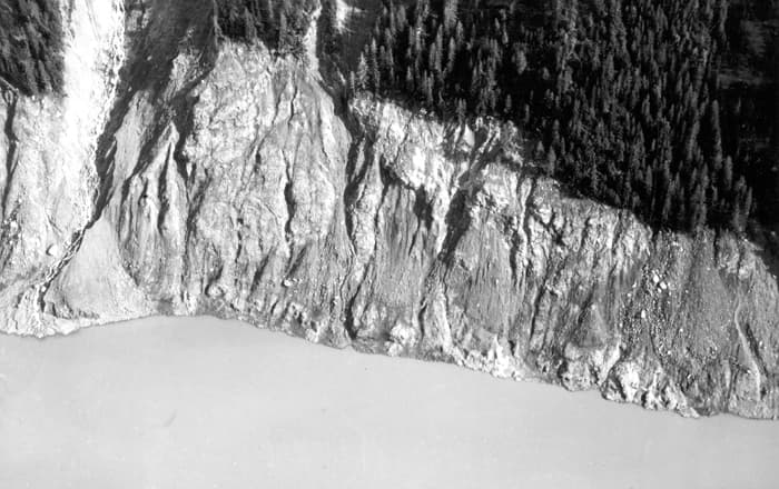
The areas of destroyed forest along the shorelines are clearly recognizable in photos as light-colored areas rimming the bay. Three lives were lost as a fishing boat anchored in the cove at lower left was carried over the spit in the foreground; a boat underway near the entrance was sunk; and a third boat, anchored near the lower right, rode out the wave. This was the largest and most significant megatsunami of modern times; it forced a re-evaluation of large-wave events and the recognition of impact events, rockfalls, and landslides as causes of very large waves.
A 2010 model examined the amount of infill on the floor of the bay, which was many times larger than that of the rockfall alone, and also the energy and height of the waves. Scientists concluded that there had been a “dual slide” involving a rockfall which also triggered a release of 5 to 10 times its volume of sediment trapped by the adjacent Lituya Glacier, a ratio comparable with other events where this “dual slide” effect is known to have happened. Lituya Bay has a history of megatsunami events, but the 1958 event was the first for which sufficient data was captured at the time.
Landslide tsunamis can happen very quickly, and even in the absence of earthquake shaking. If you spend time in steep coastal areas, make sure to know natural warning signs of a tsunami: strong coastal shaking, a loud roar from the ocean or coastal cliffs, appearance of a wall of water, or sudden retreat of water past normal low tide. If something seems “off,” don’t wait for an official warning: immediately go to high ground or inland, and check for more information once you are somewhere safe.