Two waves of storm energy will push into Colorado late this week and weekend, bringing a much needed leap towards the start of the ski season.
The first wave will last from Thursday morning until Thursday evening and primarily affect northwest Colorado. Most resorts north of Aspen – including Summit County resorts and Steamboat – will see a dusting of snow or maybe up to an inch. While it will bring 2-5″ to the Flat Tops range, this first wave will be fairly insignificant for resorts.
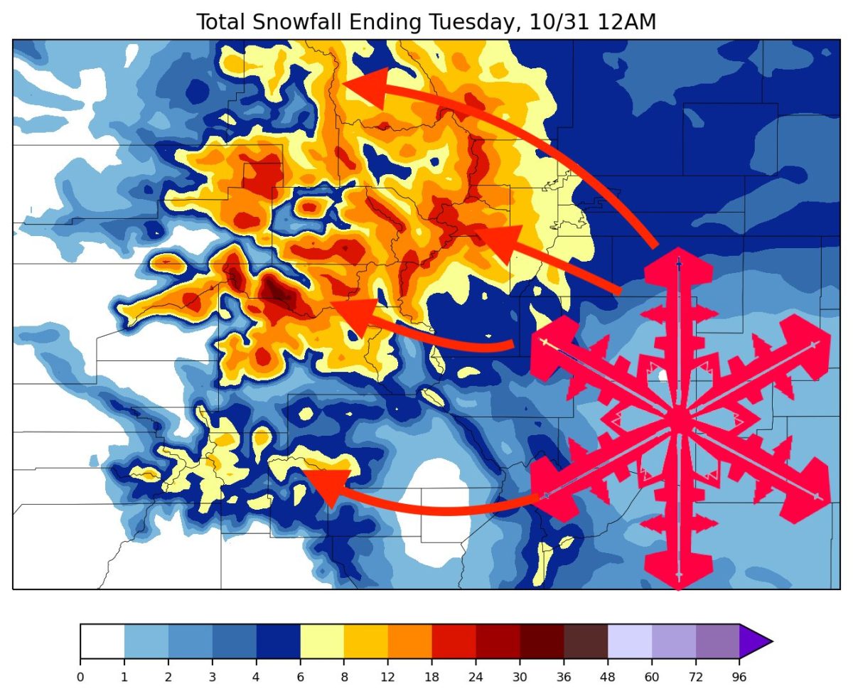
The second and primary wave begins on Friday night. This wave will primarily affect the north and central mountains, although respectable snowfall will move south into the San Juans on Saturday night.
Most of the precipitation will be wrapped up by Sunday afternoon/evening. In terms of totals, this will be the most thorough and widespread storm of the season so far. We’re looking at widespread totals exceeding 8 inches in the mountains with maximums on higher terrain exceeding 18:”
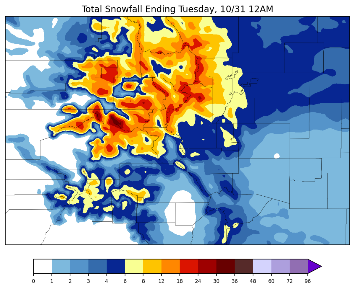
Let’s look through some projected totals by Monday:
- Steamboat: 8-14″
- Winter Park: 10-15″
- A-Basin: 11-16″
- Vail: 12-16″
- Snowmass: 18-24″
- Telluride: 3-6″
- Wolf Creek: 3-6″
This storm will also usher in much colder temperatures behind it, meaning resorts will likely be able to make artificial snow around the clock. Between the new snow that this storm is bringing and the favorable snowmaking conditions behind it, it seems as if the start of Colorado’s ski season is imminent; likely only another week or so before Arapahoe Basin or Keystone begins spinning their lifts!