Forecast written on Tuesday, March 26, 2024, at 9 am PST
A massive pattern is setting up for California this week, bringing two major storms that will drop as much as 3 FEET of snow at resorts around the region.
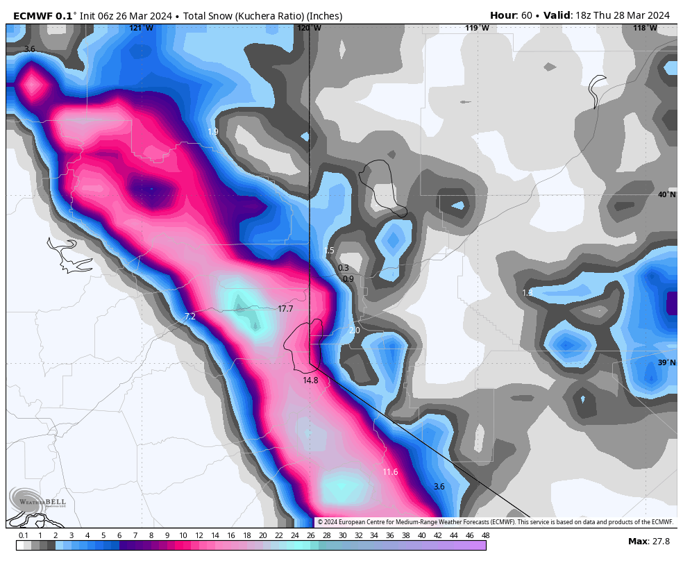
Storm #1 will be fast and heavy-hitting, favoring the Lake Tahoe region. Precipitation rates will ramp up on Wednesday evening, peaking in intensity in the early hours of Thursday morning before significantly falling off once lifts are spinning. Snow levels should start off around 6,500 feet but will drop well below lake level during the peak of the storm, meaning all resorts should see all snow. Temperatures will allow snow ratios to be in the 11-14:1 range. For resorts along the Sierra Crest (Palisades Tahoe, Sugar Bowl, Kirkwood), we’re looking at 12-18″ of fresh snow. For central Lake Tahoe resorts (Northstar, Homewood), overnight totals will be 8-12″. For resorts in the eastern Lake Tahoe basin (Mt. Rose, Heavenly), overnight totals should be in the 5-10″ range. Mammoth will pick up 5-9″ by Thursday morning.
Below: projected ECMWF snowfall by Thursday morning, favoring resorts along the Sierra Crest:
Winds will be borderline during the day on Thursday and may prevent resorts from opening the upper mountains.
Precipitation will linger over the course of Thursday and Thursday night (especially in the central Sierra near Mammoth) before precipitation from storm #2 begins to ramp up on Friday afternoon. This storm is still fairly far out, and there’s still a lot of uncertainty associated with it, so we’ll have to wait for the models to converge a little longer to have full faith in specific projected totals. Between Friday afternoon and Sunday morning, we’re looking at the following storm totals at resorts:
- West Lake Tahoe basin (Sierra Crest): 9-15″
- Central Lake Tahoe basin: 6-12″
- East Lake Tahoe basin: 5-10″
- Mammoth: 16-25″
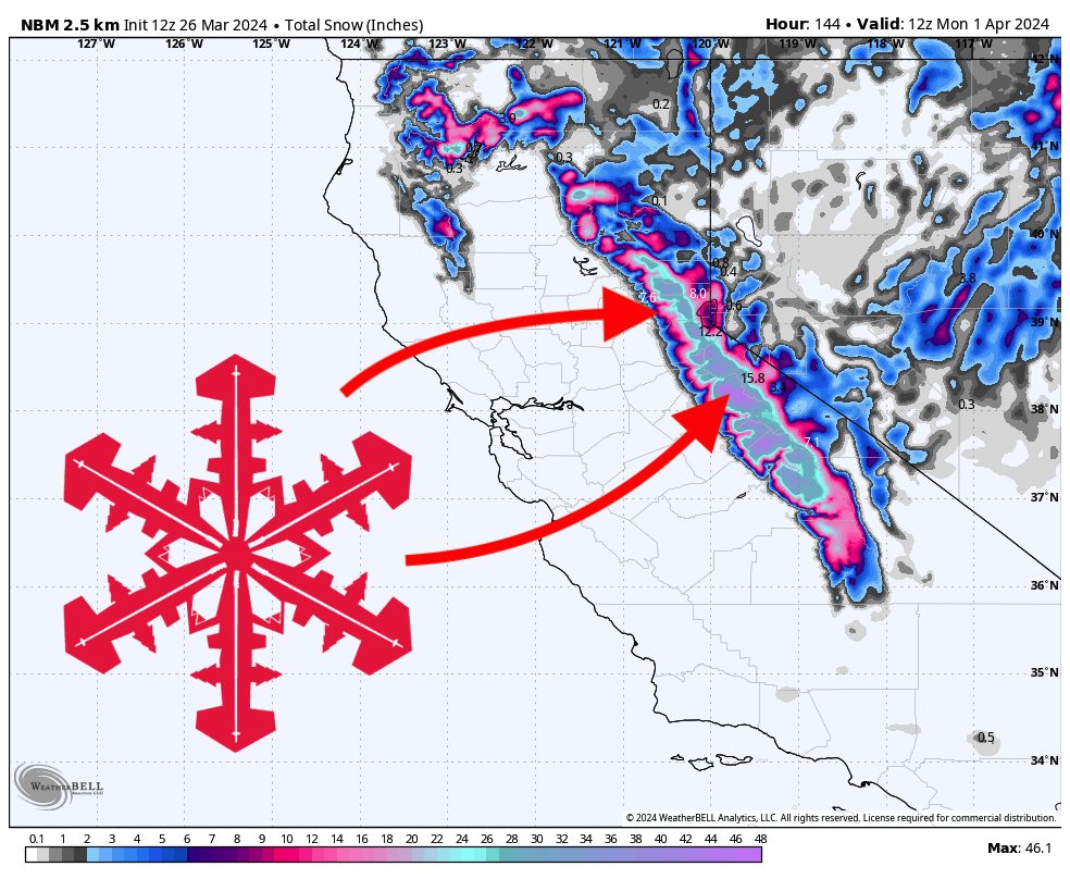
Below: NBM projected total snowfall from both storms:
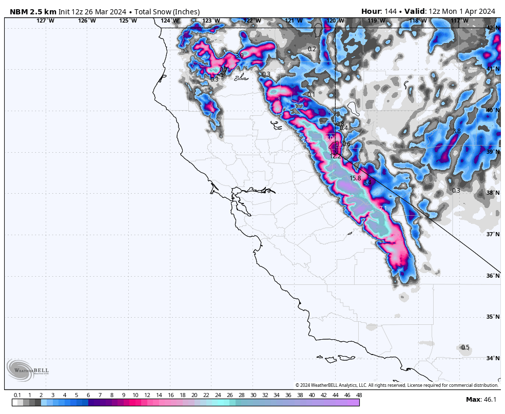
SLRs should be in the 11-13:1 range in Tahoe and near 15:1 at Mammoth due to its higher elevation, meaning the snow quality should be a fair bit better at Mammoth than in Tahoe. Snow will linger over the next few days and bring a few bonus inches on Sunday and Monday.
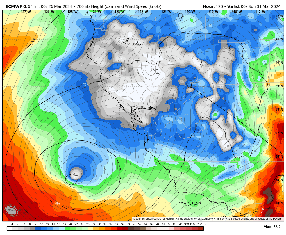
Mammoth should be the clear winner from the second storm and provide great ski conditions this weekend into early next week. Low winds throughout the storm also mean that resorts should be able to operate their upper-elevation terrain, pending avalanche mitigation. Below are lower-atmospheric winds on Saturday, showing surprisingly calm conditions over the region.
Looking ahead, we’re looking at calmer, dry conditions to start the week before a storm-conducive pattern returns next Thursday and lasts well into the following week. Cheers to a hopefully snowy spring ahead!